
Related Manuals for Cobra GPS 500


Summary of Contents for Cobra GPS 500
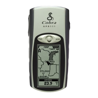
- Page 1 ENGLISH Q u i c k S t a r t G u i d e GPS 500 GLOBAL POSITIONING SYSTEM RECEIVER Instructions to get you on your way! Nothing comes close to a Cobra ®...
- Page 2 GPS Buttons These buttons allow you to access all the features of the GPS 500: The POWER Button • turns the unit on and off when you press and hold for 2 seconds • turns the backlight on and off when you press...
-
Page 3: Basic Operation
Accessories,” in the owner’s manual) can be used with your GPS 500. Getting Started In order to navigate using your GPS 500, you first must acquire a “fix” on your current position. To do this, take your GPS 500 outside making sure you have a clear view of the sky. -
Page 4: Selecting Options
F I V E M A I N PA G E S Everything you need to navigate using your GPS 500 is found on five main pages or screens. Once power is on, you may switch among the five main pages... -
Page 5: New Waypoint
WAY P O I N T S Navigating with Waypoints The Nav Data page gives you access to navigational features. From this page, you can create and store up to 500 waypoints (a specific location that you can mark and recall), view the "GoTo"... -
Page 6: Clearing The Track Log
Clearing the Track Log The GPS 500 has 2000 active track log points available to you. Once the track log is full, no additional tracks can be stored until the log is cleared. - Page 7 N AV I G AT I N G T R A C K S & R O U T E S Navigating a Selected Track To make the map show the navigational path along a selected track: 1. From the Nav Data page, highlight and select TRACKS.
-
Page 8: Stopping Navigation
(feet, miles, meters or kilometers) off course you are currently. Satellite Connection Lost or Off Whenever satellite lock is lost or GPS is turned Off, certain animation icons (below) appear on screen and continue until GPS is On and/or satellite lock is re-acquired. - Page 9 Points of Interest With optional computer software and interface cable, you can connect your GPS 500 to a computer mapping database to access the coordinates for points of interest. Once stored in memory, these points of interest can be used as waypoints for navigation.
- Page 10 JOYSTICK left, right, up or down to highlight an item. 3. Press the ENTER button for detail information on cities/towns, waypoints or POIs. Refer to your GPS 500 User’s Manual for detailed directions on accessing and exiting waypoint, track, route, point of interest, or city data. Panning Mode...
- Page 11 Test your knowledge of GPS 500 basics by taking a walk around the block. 1. Load batteries per instructions and take your GPS 500 outdoors. Be sure you have a clear, unobstructed view of the sky. Turn your unit on by pressing and holding the POWER button for 2 seconds.
-
Page 12: Important Note
The Quick Start Guide is intended only as a handy reference to review the basics of operating your GPS 500. For a full understanding of how to use your GPS 500 properly, please consult the GPS 500 User’s Manual. Read it carefully to become familiar with your unit’s numerous features.