Garmin aera 795 Quick Reference Manual
Hide thumbs
Also See for aera 795:
- Pilot's manual (252 pages) ,
- Quick reference manual (70 pages) ,
- Specifications (2 pages)
Table of Contents
Advertisement
Quick Links
Advertisement
Table of Contents

Related Manuals for Garmin aera 795


Summary of Contents for Garmin aera 795
- Page 1 ™ models: 795 and 796 Quick Reference Guide...
- Page 3 Overview GPS NaviGatiON FliGht PlaNNiNG hazard avOidaNce UtilitieS aPPeNdix iNdex...
- Page 4 Garmin Ltd. or its subsidiaries. aera ® ® ™ a trademark of Garmin Ltd. or its subsidiaries. These trademarks may not be used without the express permission of Garmin. Jeppesen is a registered trademark of Jeppesen, Inc.
- Page 5 WARNING: Do not use outdated database information. Databases used in the aera 795/796 system must be updated regularly in order to ensure that the information remains current. Pilots using any outdated database do so entirely at their own risk.
- Page 6 Although unlikely, it may be possible for erroneous operation to occur without a fault indication shown by the aera 795/796. It is thus the responsibility of the pilot to detect such an occurrence by means of cross-checking with all redundant or correlated information available in the cockpit.
- Page 7 • • Do not disassemble, puncture, or damage the battery. • If using an external battery charger, only use the Garmin accessory approved for your product. • Only replace the battery with the correct replacement battery. Using another battery presents a risk of fire or explosion. To purchase a replacement battery, see your Garmin dealer or the Garmin Web site.
- Page 8 FAA/FCC regulations. NOTE: All visual depictions contained within this document, including screen images of the aera 795/796 panel and displays, are subject to change and may not reflect the most current aera 795/796 system and aviation databases.
-
Page 9: Table Of Contents
3.1 Flight Plan data Fields ....................25 3.2 Flight Plan creation ....................25 3.3 adding Flight Plan waypoints ................26 3.4 Flight Plan Storage ....................27 3.5 Flight Plan activation .....................28 3.6 Flight Plan deletion ....................28 3.7 approaches ......................29 190-01194-01 Rev. A Garmin aera 795/796 Quick Reference Guide... - Page 10 License Agreement and Warranty ..................42 AOPA Airport Directory Notice .................... 43 XM Satellite Radio Service Agreement ................ 44 irius Weather Data Warranty ...................... 44 FCC Compliance......................... 45 Industry Canada Compliance ....................45 Garmin aera 795/796 Quick Reference Guide 190-01194-01 Rev. A...
-
Page 11: Section 1 Overview
The purpose of this document is to provide a resource with which to find operating instructions on the major features of the aera 795/796 more easily. This Quick Reference Guide is not intended to be a comprehensive operating guide. Refer to the aera 795/796 Pilot’s Guide for complete operating procedures and warnings. -
Page 12: Getting Started
3) Insert the battery so that the metal contacts on the battery line-up with the metal contacts inside the battery compartment as shown below. 4) Insert the battery into the battery compartment, and push until it clicks into place. Garmin aera 795/796 Quick Reference Guide 190-01194-01 Rev. A... - Page 13 Overview Power Button Battery Release: Push to remove the battery SD Card Slot Battery Contacts Unit Overview (Back - Battery Out) 190-01194-01 Rev. A Garmin aera 795/796 Quick Reference Guide...
-
Page 14: Charging The Battery
Charging the unit’s battery using the aircraft's power outlet: 1) Mount the aera 795/796 in the aircraft (refer to the aera 795/796 Pilot's Guide), and connect the power cable to the aircraft power outlet (cigarette lighter receptacle). -
Page 15: Operation
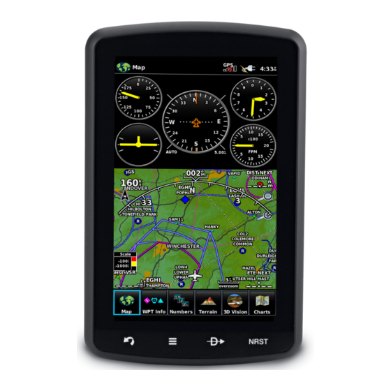
NRST Displays the Nearest Icons. PaGe BUttONS NOTE: The aera 795/796 Page Buttons are User Configurable. Refer to the aera 795/796 Pilot's Guide for more information. Six different configurable Page Buttons are located above the Dedicated Icons. The Page Buttons default to (Map, WPT Info, Weather (aera 796), Terrain, 3D Vision, and Charts). -
Page 16: Main Menu
Doc Viewer Displays the document viewer. Charts Displays the VFR or IFR charts. Weather Displays second-level Weather Icons (aera 796). SiriusXM Displays SiriusXM Radio (aera 796). Tools Displays second-level Tools Icons. Garmin aera 795/796 Quick Reference Guide 190-01194-01 Rev. A... - Page 17 Touch the following second-level Icons to display the weather product: NEXRAD Displays NEXRAD (NEXt-generation RADar). Satellite Displays Satellite Mosaic cloud cover. Echo Tops Displays Echo Tops. Winds Displays Winds Aloft. Lightning Displays Lightning. Storm Cells Displays Storm Cells. 190-01194-01 Rev. A Garmin aera 795/796 Quick Reference Guide...
- Page 18 Displays Vertical Navigation. Profile Displays Aircraft Profiles. E6B Calc Displays the E6B Calculator. Weight/Bal Displays the Weight & Balance. Database Displays database and software version information. Position Displays the aircraft's Present Position. Garmin aera 795/796 Quick Reference Guide 190-01194-01 Rev. A...
- Page 19 Displays date & time settings. Displays Navigation Map settings. Position Displays position settings. Interface Displays interface settings. Alarms Displays alarm settings. SUA Alarms Displays Special Use Airspace alarm settings. Power Displays power settings 190-01194-01 Rev. A Garmin aera 795/796 Quick Reference Guide...
-
Page 20: Basic Touchscreen Operation
Basic Touchscreen Operation SCROLLING AND PANNING Scrolling and panning on the touchscreen: Drag up or down to scroll menus, documents, etc. Drag in any direction to pan maps or charts. Scrolling Panning Garmin aera 795/796 Quick Reference Guide 190-01194-01 Rev. A... -
Page 21: Menus And Data Entry
Pinch fingers together (zoom in), or pull fingers apart (zoom out). Zoom In Zoom Out 1.4 MeNUS aNd data eNtry OPtiON MeNUS The aera 795/796 has a dedicated Icon that displays a context-sensitive list of menu options available. Navigating the option menu: ➊... -
Page 22: Data Entry
➊ When alphanumeric data can be entered, a keypad will appear after touching the desired datafield. ➋ Touch the keypad to enter the desired data. ➌ Touch OK. ➊ ➋ ➌ Garmin aera 795/796 Quick Reference Guide 190-01194-01 Rev. A... -
Page 23: Using Map Displays
Touch the icon to cancel the map pointer map pointer. Panning the map: Touch While viewing a Map Display, touch anywhere on the map and drag. icon to cancel the map pointer 190-01194-01 Rev. A Garmin aera 795/796 Quick Reference Guide... - Page 24 ➌ Touch the Map Feature Button to review information for the Map Feature. ➍ If desired touch the Direct-to Icon to navigate to the map feature. ➌ ➋ ➍ Garmin aera 795/796 Quick Reference Guide 190-01194-01 Rev. A...
-
Page 25: Map Range
Terrain map overlays can be displayed or removed. ➋ ➌ Displaying/removing map overlays: 1) From the Main Menu, touch Map > Menu > Show/Hide. 2) Touch the 'Show/Hide' Data Option Button for the desired overlay. 190-01194-01 Rev. A Garmin aera 795/796 Quick Reference Guide... - Page 26 Overview Blank Page Garmin aera 795/796 Quick Reference Guide 190-01194-01 Rev. A...
-
Page 27: Section 2 Gps Navigation
2) Touch the desired data field to change. The available data fields are displayed. 3) Touch the desired data field. 4) Touch OK. Restoring default numeric flight data: From the Main Menu, touch Numbers > Menu > Restore Default. 190-01194-01 Rev. A Garmin aera 795/796 Quick Reference Guide... -
Page 28: Hsi/Panel
1) From the Main Menu, touch the Map Icon or the Active FPL Icon. 2) Touch the Menu Icon 3) Touch the 'Release Hold' menu option (only available when navigating a Direct To or Flight Plan). Garmin aera 795/796 Quick Reference Guide 190-01194-01 Rev. A... -
Page 29: Vertical Navigation (Vnav)
1) From the Main Menu, touch Tools > VNAV 2) Touch the desired fields ('Profile', 'Altitude', etc) to enter the VNAV profile. 3) Touch and hold the Back Icon to return to the Main Menu. 190-01194-01 Rev. A Garmin aera 795/796 Quick Reference Guide... -
Page 30: Waypoints
4) Touch the desired Runway Button. Selecting additional information for a frequency: 1) From the Main Menu, touch WPT Info > Freq Tab. 2) Touch the frequency denoted with an *. Garmin aera 795/796 Quick Reference Guide 190-01194-01 Rev. A... -
Page 31: Nearest Information
2) Touch Menu > Create Waypoint 3) Enter the desired user waypoint name (up to 10 characters). Refer to the Overview Section on 'Data Entry' for more information. 4) Touch the OK Icon. 190-01194-01 Rev. A Garmin aera 795/796 Quick Reference Guide... -
Page 32: Direct-To Navigation
1) Touch the icon to display the second level Nearest Icons. 2) Touch Airport. 3) Touch the desired nearest airport. 4) Touch the Direct To Icon. 5) Touch the Activate Icon. Garmin aera 795/796 Quick Reference Guide 190-01194-01 Rev. A... -
Page 33: Gps Navigation
3) Touch the Activate Icon. Cancelling a direct-to: 1) Touch the Direct To Icon.. From the Main Menu, touch the Active FPL Icon. 2) Touch the Menu Icon. 3) Touch 'Stop Navigation'. 190-01194-01 Rev. A Garmin aera 795/796 Quick Reference Guide... - Page 34 GPS Navigation Blank Page Garmin aera 795/796 Quick Reference Guide 190-01194-01 Rev. A...
-
Page 35: Section 3 Flight Planning
5) If desired, repeat Steps 2-4 for the remaining Data Field. 3.2 FliGht PlaN creatiON The active flight plan is the flight plan to which the aera 795/796 is currently providing guidance, and is shown on the navigation maps. Stored flight plans are flight plans available for activation (becomes the active flight plan). -
Page 36: Adding Flight Plan Waypoints
1) With an active or saved flight plan displayed, touch the desired point of insertion. The new waypoint will be added in front of the selected waypoint. An option menu will appear. 2) Touch the 'Insert Waypoint' menu option. Garmin aera 795/796 Quick Reference Guide 190-01194-01 Rev. A... -
Page 37: Flight Plan Storage
2) Touch the 'Save Flight Plan' menu option. A confirmation window appears. 3) Touch Yes. A copy of the flight plan is stored in the next available position in the Flight Plan List. 190-01194-01 Rev. A Garmin aera 795/796 Quick Reference Guide... -
Page 38: Flight Plan Activation
With the Flight Plan List displayed, touch the desired flight plan to delete, and touch Delete Flight Plan > Yes. Deleting all stored flight plans: From the Main Menu, touch FPL List > Menu > Delete All > Yes. Garmin aera 795/796 Quick Reference Guide 190-01194-01 Rev. A... -
Page 39: Approaches
Flight Planning 3.7 aPPrOacheS warNiNG: The aera 795/796 is not designed to be independently used for flight into instrument meteorological conditions (IMC) or other conditions in which aircraft control is based solely upon flight instruments. The approaches provided are for monitoring purposes only. Only the final course segment (final approach fix (FAF) to missed approach point (MAP)) of the published approach is available for monitoring. -
Page 40: Flight Planning
Flight Planning 5) Touch 'Yes' or 'No'. The procedure is added to the end of the flight plan. If activating an approach from the Active Flight Plan, the aera 795/796 immediately begins to provide guidance to the first waypoint in the approach. -
Page 41: Section 4 Hazard Avoidance
Touch the Terrain 'Show/Hide' Button to toggle the terrain overlay on/off. a) Touch the 'Set Up Map' menu option. b) Touch the buttons until the 'Map' Category is displayed. c) Touch the Terrain Shading On/Off Button. 190-01194-01 Rev. A Garmin aera 795/796 Quick Reference Guide... -
Page 42: Traffic Information Service (Tis)
2) Touch the Menu Icon. 3) Touch the 'Enable Alerts' or 'Disable Alerts' menu option. 4.3 traFFic iNFOrMatiON Service (tiS) NOTE: Refer to the aera 795/796 Pilot's Guide for information on configuring TIS. Adjusting TIS audio: 1) From the Main Menu, touch Tools > Setup > Sound. -
Page 43: Section 5 Utilities
3) Touch Track Record Mode, Track Interval, or Track Color. 4) Touch the desired setting. Clearing the track log: 1) From the Main Menu, touch Tools > Track Log. 2) Touch the desired track log (if applicable). 190-01194-01 Rev. A Garmin aera 795/796 Quick Reference Guide... -
Page 44: E6B Calculator
For most aircraft, this is the temperature reading on a standard outside air temperature gauge.) The calculated figures for True Airspeed and Density Altitude are shown in the designated fields. Garmin aera 795/796 Quick Reference Guide 190-01194-01 Rev. A... -
Page 45: Aircraft Profile
1) From the Main Menu, touch Tools > Profile 2) Touch the Aircraft Name Button to access a vertical list of saved profiles. 3) Touch the desired profile from the list. 190-01194-01 Rev. A Garmin aera 795/796 Quick Reference Guide... -
Page 46: Weight & Balance
Keep in mind that the “Aircraft” (empty weight/arm) figures must be entered as a reference to calculate a valid moment, weight, and CG. 3) To empty the aircraft, touch Menu > Empty Aircraft. Garmin aera 795/796 Quick Reference Guide 190-01194-01 Rev. A... -
Page 47: Section 6 Appendix
Internal problem with the GXM antenna. Contact Garmin Product Support. Database Error Internal problem with the system. Contact your dealer or Garmin Product Support to have the unit repaired. Fuel Tank A reminder for switching fuel tanks. The reminder message repeats at the specified interval after the beginning of each trip. -
Page 48: Airspace Messages
The projected course takes you inside an airspace Minutes within the next 10 minutes or less. Airspace Near, Within 2 nm Within two nautical miles of an airspace but not projected to enter it. Garmin aera 795/796 Quick Reference Guide 190-01194-01 Rev. A... -
Page 49: Data Field & Numeric Data Options
Ground Speed The velocity that the aircraft is traveling relative to a ground position. Ground Track The direction of aircraft movement relative to a ground position. 190-01194-01 Rev. A Garmin aera 795/796 Quick Reference Guide... - Page 50 The rate of climb or descent (GPS-derived). Vertical Speed Required The vertical speed necessary to decend/climb from a current position and altitude to the previously selected VNAV position and altitude, based upon current groundspeed. Garmin aera 795/796 Quick Reference Guide 190-01194-01 Rev. A...
-
Page 51: Aural Alerts
Refer to Hazard Avoidance Section. lOSS OF GPS POSitiON When the aera 795/796 loses the GPS signal for any reason, the following will occur: • A blinking red question mark will appear over the airplane icon on the map. -
Page 52: License Agreement And Warranty
This Garmin product is warranted to be free from defects in materials or workmanship for one year from the date of purchase. Within this period, Garmin will, at its sole option, repair or replace any components that fail in normal use. Such repairs or replacement will be made at no charge to the customer for parts or labor, provided that the customer shall be responsible for any transportation cost. -
Page 53: Aopa Airport Directory Notice
DAMAGES, SO THE ABOVE LIMITATIONS MAY NOT APPLY TO YOU. Garmin retains the exclusive right to repair or replace the unit or software or offer a full refund of the purchase price at its sole discretion. SUCH REMEDY SHALL BE YOUR SOLE AND EXCLUSIVE REMEDY FOR ANY BREACH OF WARRANTY. -
Page 54: S Irius Xm Satellite Radio Service Agreement
You assume the entire risk related to your use of the Services. Sirius XM and Garmin assume no responsibility for accidents resulting from or associated with use of the Services. Your Radio Service includes traffic and weather information, and you acknowledge that such information is not for “safety for life”, but is merely supplemental and advisory in nature, and therefore cannot be relied upon... -
Page 55: Fcc Compliance
• Consult the dealer or an experienced radio/TV technician for help. This product does not contain any user-serviceable parts. Repairs should only be made by an authorized Garmin service center. Unauthorized repairs or modifications could result in permanent damage to the equipment, and void your warranty and your authority to operate this device under Part 15 regulations. - Page 56 Blank Page Garmin aera 795/796 Quick Reference Guide 190-01194-01 Rev. A...
- Page 57 Numeric Flight Data 17 E6B Calculator 34 Option Menu 11 Overlay Flight Log 33 Terrain 15 Flight Plan Topography 15 Activation 28 Weather 15 Adding Waypoints 26 Overlays Creation 25 Displaying/removing 15 Index-1 190-01194-01 Rev. A Garmin aera 795/796 Quick Reference Guide...
- Page 58 Symbology 32 User Waypoints Creating 21 Vectors-to-Final 30 Vertical Navigation (VNAV) 19 Profile 19 Warranty 42 Waypoints 20 Weather 21 Weight & Balance 36 Weather 31, 33, 34, 35, 36 Index-2 Garmin aera 795/796 Quick Reference Guide 190-01194-01 Rev. A...
- Page 59 Index-3 190-01194-01 Rev. A Garmin aera 795/796 Quick Reference Guide...
- Page 60 Hounsdown Business Park Southampton, SO40 9RB, U.K. Toll free (within U.K.) 0808.2380000 p: 44/0870.8501241 f: 44/0870.8501251 Garmin Corporation No. 68, Jangshu 2nd Road Shijr, Taipei County, Taiwan p: 886/2.2642.9199 f: 886/2.2642.9099 www.garmin.com 190-01194-01 Rev. A © 2011 Garmin Ltd. or its subsidiaries...