Furuno FEA-2107 Manuals
Manuals and User Guides for Furuno FEA-2107. We have 5 Furuno FEA-2107 manuals available for free PDF download: Operator's Manual, Installation Manual, Specifications
Furuno FEA-2107 Operator's Manual (704 pages)
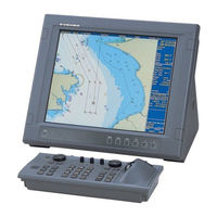
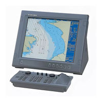
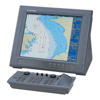
Electronic Chart Display and Information System (ECDIS)
Brand: Furuno
|
Category: Marine Radar
|
Size: 5.56 MB
Table of Contents
-
Foreword
17 -
-
Overview23
-
Positioning25
-
Monitoring26
-
-
-
-
Introduction65
-
S57 Charts65
-
-
Introduction103
-
Permits103
-
Product List103
-
Authentication103
-
-
-
-
Display Base132
-
-
-
ARCS Charts161
-
Chart Menu171
-
-
ARCS Navigator172
-
ARCS Skipper172
-
ARCS Catalogue185
-
-
-
Display Base199
-
-
Route Page202
-
Tracking Page203
-
-
-
-
Introduction207
-
-
11 Chart Alarms
231-
General231
-
Chart Alarms232
-
Route Planning240
-
Route Monitoring243
-
-
-
Introduction251
-
Choosing Datum253
-
-
Parameters260
-
-
WP Table Report268
-
Full WP Report269
-
-
-
Introduction271
-
Route Assistant275
-
-
-
Introduction283
-
Choosing Datum288
-
-
Point Page291
-
Symbol Page292
-
Line Page293
-
Tidal Page294
-
Area Page295
-
-
15.11 Reports303
-
-
16 Pilot Data
307-
Introduction307
-
Pilot Data Modes308
-
-
Using Pilot Data309
-
-
-
Introduction317
-
Copying a File318
-
Renaming a File318
-
Deleting a File319
-
Advertisement
Furuno FEA-2107 Operator's Manual (620 pages)
Electronic Chart Display and Information System (ECDIS)
Brand: Furuno
|
Category: Marine Equipment
|
Size: 17.5 MB
Table of Contents
-
Foreword
17 -
-
Overview25
-
Positioning27
-
Monitoring28
-
-
-
Hot Keys43
-
-
-
Introduction63
-
S57 Charts63
-
-
Introduction101
-
Permits101
-
Product List101
-
Authentication101
-
CD-ROM Service102
-
-
-
-
Display Base131
-
-
-
ARCS Charts159
-
Chart Menu169
-
-
ARCS Navigator170
-
ARCS Skipper170
-
-
-
Display Base194
-
-
-
Introduction203
-
-
11 Chart Alerts
225-
General225
-
Chart Alert225
-
Route Planning232
-
Route Monitoring235
-
-
-
Introduction243
-
-
Parameters252
-
-
WPT Report259
-
Full WPT Report260
-
-
-
Introduction263
-
-
-
Introduction275
-
-
Point Page283
-
Symbol Page284
-
Line Page285
-
Tidal Page286
-
Area Page287
-
-
Reports294
-
Furuno FEA-2107 Operator's Manual (664 pages)
Electronic Chart Display and Information System (ECDIS)
Table of Contents
-
Foreword
17-
Features17
-
-
-
Overview23
-
Positioning25
-
Monitoring26
-
-
-
-
Introduction67
-
S57 Charts67
-
-
Introduction105
-
Permits105
-
Product List105
-
Authentication105
-
-
-
-
Display Base134
-
-
-
ARCS Charts163
-
Chart Menu173
-
-
ARCS Navigator174
-
ARCS Skipper174
-
ARCS Catalogue187
-
-
-
Display Base201
-
-
-
Introduction209
-
-
11 Chart Alarms
233-
General233
-
Chart Alarms234
-
Route Planning242
-
Route Monitoring245
-
-
-
Introduction253
-
Choosing Datum255
-
-
Parameters260
-
-
WP Table Report268
-
Full WP Report269
-
Advertisement

Furuno FEA-2107 Installation Manual (168 pages)
Electronic Chart Display and Information System (ECDIS)
Table of Contents
-
2 Wiring
21 -
Packing Lists
149

Furuno FEA-2107 Specifications (4 pages)
Electronic Chart Display and Information System
Advertisement