Table of Contents
Advertisement
Quick Links
Advertisement
Table of Contents

Related Manuals for Bushnell ONIX 363500


Summary of Contents for Bushnell ONIX 363500
-
Page 1: Gps Receiver
GPS RECEIVER Quick Start Guide Model # 363500 Lit # 98-1246/08-08 English... -
Page 2: Warnings And Notices
You further acknowledge that the structure, organization and code of the Software are valuable trade secrets of Bushnell and that the Software in source code form remains a valuable trade secret of Bushnell. You agree not to decompile, disassemble, modify, reverse assemble, reverse engineer or reduce to human readable form the Software or any part thereof or create any derivative works based on the Software. - Page 3 The Almanac Page and Solunar Edge Technology The Bushnell ONIX 350 features a unique Almanac page, which uses patented Solunar Edge technology developed by Speedtech® Instruments to provide a significantly more accurate predictor of animal and fish activity than standard “sun & moon tables”, utilizing the current environmental pressure and temperature condition data to provide the most reliable activity predictions for your location.
- Page 4 Thank you for purchasing the Bushnell ONIX350 – the most advanced outdoor navigation device available today! The ONIX350 comes preloaded with a base road map of the United States and Canada including a Points of Interest data base. The GPS receiver has the capability to receive satellite signals worldwide.
-
Page 5: Included Parts List
• ONIX 350 GPS Receiver • Lithium Ion Battery Pack • 512MB MicroSD Card • AC Charging Cord battery charging, cleaning & maintenance • The internal Lithium Ion battery pack must be charged before the ONIX can be used for the first time. Make sure... -
Page 6: Battery Level Indicator
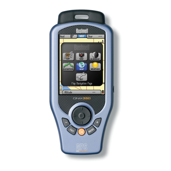
controls and Ports identification Helical Satellite Antenna and Lanyard Attachment 5-Way Button (Key) Pad: Used to navigate on screen, select from menu options, and create waypoints. Press UP/DOWN keys to select items in a menu, RIGHT key to view submenus (if available), LEFT key to exit the menu. - Page 7 (Satellite) - this page allows you to monitor the signal strength of multiple GPS satellites, confirming 1. SAT when you have a “lock”-adequate number and quality of satellites to ensure good reception. 2 . NAV (Navigation) - a basic display of the digital compass. View your current heading and true or magnetic north at any time by switching to this page.
-
Page 8: Power Saving Options
tiPs for maXimiZing battery life in the oniX 350 The ONIX350 uses the latest technology and exclusive features to provide the most efficient combination of battery life and functionality. The rechargeable Lithium Ion battery pack provides an extended capacity of power. -
Page 9: Getting Started
getting started 1. You must charge the battery pack before using the ONIX350. Attach the battery pack (first, verify that the MicroSD card is installed in its slot), referring to the instructions and photos on pg. 5. Plug the AC charger cord into the accessory port (pg. 6), then into an AC outlet (110-120 volt/60 cycle). 2. -
Page 10: The Map Page
The current page you are on is always indicated in the box at the top of the display, just below the “Bushnell” logo. Let’s take a tour of the various pages and the options they provide: The SAT Page As seen earlier in “Getting Started”, The SAT page view... - Page 11 eXPloring the Pages : maP & info boxes MAP Page Layering Options utilizing TruView Technology You may choose to add other items to your view of the MAP page. To select these items, press the HOT button, then press the DOWN key until “Map Detail”...
- Page 12 eXPloring the Pages : maP & info boxes Setting Up and Using the Info Boxes 1. Go to the MAP page if you are not already there (this example will use the MAP Page as a starting point, but Info Boxes are available on other Pages as well).
- Page 13 eXPloring the Pages : naV / set The NAV Page The NAV page provides a standard compass display, with arrows to indicate your last heading and/or current bearing, along with magnetic or true north indication and other optional navigation related data, depending on the display preferences the user has set up.
-
Page 14: Options List
• GPS-press the right button and select GPS satellite reception “ON” to for normal GPS operation, select “OFF” to conserve battery life if you are not going to be navigating, or while you are getting more familiar with your ONIX indoors where GPS reception is not possible. - Page 15 eXPloring the Pages : Weather / almanac The WEATHER Page The Weather Prediction page (Fig. 15) displays the current temperature and barometric pressure at your position (based on the data from internal sensors in the unit). The pressure indication box also displays a rising or falling “trend” arrow (unless the pressure is steady), and pressure data stored in the unit for up to 24 hours is used to generate a forecast based on how significant the increase or decrease in pressure is over time.
- Page 16 eXPloring the Pages : almanac / eleVation • Press the HOT button to open a ToolBox with three options (Fig. 18) : Fishing Chart-highlight this and press OK (a checkmark will appear) if you want the animal activity level chart to be relevant for fish. Hunting Chart-select and check this if you prefer the activity graph to indicated mammal activity levels.
- Page 17 eXPloring the Pages : eleVation With “History” highlighted at the top of the screen, press OK to see a list of your stored Trails (Fig. 21) . Select a Trail from the list and press OK to replace “History” on the page- you now see the elevation history for that trail, showing the changes in altitude as you originally walked/created the trail.
-
Page 18: Setting Waypoints
Map Area is outlined on the next page. More information about utilizing Waypoint Fig 28. the “My Map Areas” features can be found at: http://www.bushnell.com/gps/ “Edit Icon” by clicking the Product Support link. Let’s take a look at the basics of setting up and using your Map Areas... - Page 19 : map areas/fence Posts How to Define a New Map Area (Using “Fence Posts”): • Click the HOT button to get the HOT menu, then press “+” to switch to the “My Stuff” menu. • Highlight “My Map Areas” and press OK-you will see “Create New Map Area”, already selected.
- Page 20 When you are on the MAP or NAV page, all basic navigation actions are easily Fence Post controlled by Bushnell’s exclusive “HOT button”. The HOT button is also used to select the view options for the current display Page. Let’s take a look-from the MAP page, click the HOT button to view the “Hot Menu”, then use the DOWN or UP...
- Page 21 : the hot button 7) My Map Areas-pick from list of your previously created custom map areas 8) My Photos (or Topos)-after you pick a photo or topo from the list (arrow down to it) and press OK to confirm you wish to navigate towards that area, the ONIX will begin to point you towards that area.
- Page 22 SafeTrack™ Battery Conservation Mode SafeTrack is a Bushnell exclusive feature that extends and conserves battery power, without the wait to re-establish GPS satellite contact after a full power down. When you are in SafeTrack mode, the display screen will shut off, and the status LED will blink green.
- Page 23 : name & icon editing You will see the SafeTrack screen (Fig. 43), with a count down delay (time can be adjusted in the Set Page Menu) before the unit enters SafeTrack mode. If you accidentally hold the HOT button down, select “Cancel”...
- Page 24 Downloading, Uploading and Storing Satellite (Aerial) Photos and Topo Maps Now that you are familiar with your Bushnell ONIX series GPS, you are ready to take advantage of many of the easy to use exclusive Bushnell features. In conjunction with your Bushnell GPS unit, you have two additional tools that make your ONIX the most functional GPS for your next outdoor excursion–...
-
Page 25: Troubleshooting
“Software Updates” in the left frame. Component PC System Requirements (to use the “PC Companion” software with Bushnell ONIX GPS products) 500 megahertz (MHz), Pentium III processor or higher 64 megabyte (MB) RAM or higher... - Page 26 The ONIX does not contain any user-serviceable parts. Repairs should only be made by an Authorized Bushnell repair center. Unauthorized repairs or modifications could result in permanent damage to the equipment, and will void your warranty and your authority to operate this device under Part 15 regulations.
- Page 27 ONE YEAR LIMITED WARRANTY Your Bushnell GPS receiver is warranted to be free of defects in materials and workmanship for one year after ® the date of purchase. In the event of a defect under this warranty, we will, at our option, repair or replace the product, provided that you return the product with return postage prepaid.
- Page 28 For further questions or additional information please contact: Bushnell Outdoor Products 9200 Cody, Overland Park, Kansas 66214 Customer Service (800) 423-3537 • www.bushnell.com ©2008 Bushnell Outdoor Products...
Need help?
Do you have a question about the ONIX 363500 and is the answer not in the manual?
Questions and answers