Table of Contents
Advertisement
Advertisement
Table of Contents

Related Manuals for Lowrance LCX-15 MT


Summary of Contents for Lowrance LCX-15 MT
- Page 1 LCX-15 INSTALLATION AND OPERATION INSTRUCTIONS WWW.LOWRANCE.COM...
- Page 2 Copyright © 2001 Lowrance Electronics, Inc. All rights reserved. LCX-15MT is a trademark of Lowrance Electronics, Inc. ® Lowrance is a registered trademark of Lowrance Electronics, Inc. USE THIS UNIT ONLY AS AN AID TO NAVIGATION. A CAREFUL NAVI- GATOR NEVER RELIES ON ONLY ONE METHOD TO OBTAIN POSI- TION INFORMATION.
- Page 3 This device complies with Part 15 of the FCC Rules. Operation is subject to the following two conditions: (1) this device may not cause harmful interference, and (2) this device must accept any interference received, including interference that may cause undesired operation. Note: This equipment has been tested and found to comply with the limits for a Class B digital device, pursuant to Part 15 of the FCC Rules.
-
Page 4: Table Of Contents
INTRODUCTION ... 1 ACCESSORIES ... 1 TRANSDUCERS ... 1 INSTALLATION ... 2 Mounting ... 2 Power Connections ... 3 NMEA/DGPS Wiring ... 4 Accessory Connections ... 5 Speed/Temperature Sensor ... 5 MMC ... 7 KEYBOARD ... 8 SONAR OPERATION ... 9 Pages ... -
Page 5: Introduction
We hope that you enjoy using it as much as we have. The LCX-15MT is sold with many different accessories. Some are packed with a GPS receiver, MMC, and mapping CD-ROM. Others are sold only with a transducer. Many may come with different combinations of acces- sories. -
Page 6: Installation
Transducers (cont.) Model Part # 200 kHz “Pod” Transducer ... PD-WDX ... 106-27 w/o temp for shoot-thru hull 50/200 kHz Dual Freq..HS-50/200-DX ... 106-23 “Skimmer” High Speed Transom mount with temp sensor 50/200 kHz Dual Freq..THST-50/200-DX ... 106-29 Bronze thru-hull mount w/temp and speed sensor INSTALLATION... -
Page 7: Power Connections
Power Connections This unit operates from a 12-volt battery system. For the best results, connect the power cable to the in-line fuse holder and attach it directly to the battery. The power cable can be attached to an accessory or power buss, however there could be problems with electrical interference using this method. -
Page 8: Nmea/Dgps Wiring
DGPS system relies on a grid of ground-based transmitters that send correction signals to DGPS receivers. These in turn, connect to the GPS receiver (such as the LCX-15MT with the LGC-12S GPS module). This gives more accurate positions than is otherwise possible. -
Page 9: Accessory Connections
COM-1 SHIELD (GROUND) LCX-15MT The LCX-15MT can accept position information from any GPS receiver that transmits NMEA 0183 data. Use the wiring diagram shown above for NMEA input to the LCX-15MT. See page 25 and 26 for NMEA and DGPS com port setup instructions. - Page 10 Temperature and Speed/Temperature Installation Examples X-15 X-15 Sonar Connector Sonar Connector “Y” Adapter Cable (Packed with Speed/Temp Sensor) Transducer Transducer Temperature Sensor Speed/Temp Sensor Additional Additional Temp. Temp. or Sensors Speed (if needed) Sensors (if needed)
-
Page 11: Mmc
This unit can use up to two MMC (MultiMediaCard) cartridges. They store the maps, waypoint and route information, sonar data, and more. To install a MMC cartridge, twist the drawer retainer counter-clockwise and pull. The drawer will come out of the unit. Place the MMC cartridge FACE DOWN. -
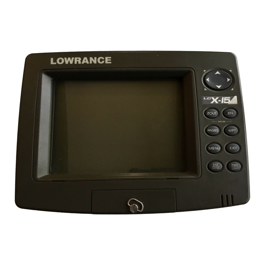
Page 12: Keyboard
KEYBOARD The keyboard has keys arranged in two vertical columns beneath the arrow keys. The menu key near the bottom left corner of the keyboard activates the first menu page. The other keys are used to zoom the dis- play, change modes, and other functions. ZOUT/ZIN - These keys “zoom”... -
Page 13: Sonar Operation
SONAR OPERATION PAGES Turn the unit on by pressing the PWR/LIGHT key. If the sonar screen is not showing, press the PAGES key. A menu similar to the one at right appears. Press the left or right arrow key to highlight the Sonar label. -
Page 14: Digital/Chart
Split Zoom Sonar Chart A split chart shows the underwa- ter world from the surface to the bottom on the right side of the screen. The left side shows an enlarged version of the right side. The zoom range shows at the bottom left corner of the screen. -
Page 15: Customizing The Digital/Chart Screen
Customizing the Digital/Chart Screen The Digital/Chart screen can be customized to show different digi- tal data than the defaults shown on the screen at the bottom of page 8. To customize this screen, press the MENU key while the Digital/Chart screen is showing. Scroll down to the bottom of this menu to the Customize label and select it. -
Page 16: Sonar Options
SONAR OPTIONS Sensitivity The sensitivity controls the ability of the unit to pick up echoes. A low sensitivity level excludes much of the bottom information, fish signals, and other target information. High sensitivity levels let you see this detail, but it can also clutter the screen with many undesired signals. Typically, the best sensitivity level shows a good solid bottom signal with Grayline and some surface clutter. -
Page 17: Grayline
select “Auto Sensitivity” and press the ENT key. To turn it off, repeat the above steps. Press the EXIT key to erase the menu. ® GRAYLINE GRAYLINE lets you distinguish between strong and weak echoes. It “paints” gray on targets that are stronger than a preset value. This allows you to tell the difference between a hard and soft bottom. -
Page 18: Manual
range that’s highlighted. The range numbers that are gray cannot be se- lected. When you’re finished, press the EXIT key to erase the menu. RANGE - Manual You have complete control over the range when the unit is in the manual mode. -
Page 19: Zoom
tom can be shown, which enlarges targets to best suit your fishing needs and water conditions. ZOOM “Zooming” the display is a com- mon method used to enlarge small detail, fish signals, and the bottom with its asscociated struc- ture. This unit lets you zoom the display quickly and easily by pressing the ZIN key. -
Page 20: Chart Data
The cursor can be moved to any location on the screen, letting you pinpoint the depth of a target. To show the depth cursor, press the MENU key, then select “Depth Cursor”. Press the ENT key. The cursor appears at the top of the screen. -
Page 21: Transducer Frequency
Transducer Frequency This unit operates from both 200 kHz and 50 kHz. The default frequency is 200 kHz. It’s best for use in shallow water. The 50 kHz frequency is best for deep water, especially saltwater. Use the arrow keys to highlight the desired frequency, then press the ENT key to select it. -
Page 22: Fish Symbols/Fish Depths
SONAR FEATURES (cont.) Fish Symbols The Fish Symbols feature identi- fies targets that meet certain con- ditions as fish. The microcom- puter analyses all echoes and eliminates surface clutter, ther- moclines, and other signals that are undesirable. In most in- stances, remaining targets are fish. -
Page 23: Log Sonar Chart Data
LOG SONAR CHART DATA If you have a MMC installed in the unit, the sonar data shown on the screen can be saved to the MMC. This can be played back at any time. To save the chart data, press the MENU key, then select “Log So- nar Chart Data”. -
Page 24: Audio
AUDIO The various sounds that the unit makes can be customized to your own taste. Press the MENU key twice , then select “Sounds” from the main menu. The screen at right appears. The volume control on the right side of the menu adjusts the au- dio level for all sounds. -
Page 25: Depth Alarms
DEPTH ALARMS The depth alarms sound a tone when the bottom signal goes shallower than the shallow alarm’s setting or deeper than the deep alarm’s setting. For example, if you set the shallow alarm to ten feet, the alarm will sound a tone if the bottom signal is less than ten feet. -
Page 26: Fish Alarm
highlight the “Enabled” box in the Zone Alarm box, then press the ENT key. To adjust the zone alarm, highlight the “Adjust Zone” label, then press the ENT key. A screen similar to the one at right appears. The zone alarm bar shows on the screen to the right of the zoom bar. -
Page 27: Keel Offset
Keel Offset Normally, this unit measures water depth from the face of the transducer. Since the transducer is below the surface of the water, this distance is not the exact water depth. If the transducer is one foot below the surface, and the screen shows the water depth as 30 feet, then the depth is actually 31 feet. -
Page 28: Sonar Simulator
speed sensor input - not the GPS. This distance (called Water Distance) can be reset to zero using the “Reset Water Distance” label on the “Sonar Setup” menu. Simply highlight “Reset Water Distance” and press the ENT key. The menus automatically erase and the water distance display is reset to 0.00. -
Page 29: Set Local Time
To change the units, select “Units of Measure” from the “System Setup” menu. Highlight the de- sired label with the arrow keys, then press the ENT key to change it. Press the EXIT key when you’re finished. Set Local Time The GPS requires the local time and date for its initialization and the time and date are saved when... -
Page 30: Configure Dgps
If you have any other Magnavox or Starlink compatible DGPS receiver connected to this unit, (including a Lowrance DGPS receiver) you may need to change the settings. To do this, select “Configure DGPS” Configure DGPS This unit will recognize Starlink® and Magnavox®... -
Page 31: Popup Help
Hide GPS features If there is no GPS receiver attached to this unit, then the GPS menus and features can be hidden from view by selecting “Hide GPS Features” on the System Setup menu. The default is on. To turn them on again, select “Show GPS Features”... -
Page 32: Gps Operation
Press the EXIT key to erase this screen. GPS OPERATION NOTE: A LGC-12S GPS module or an external GPS receiver with NMEA output must be attached to this unit in order to use the position and navi- gation features. - Page 33 “wandering” of the data shown on the display. If you want better performance, many manufacturers (including Lowrance) sell a DGPS receiver that attaches to your GPS receiver. The DGPS sys- tem transmits correction signals that increase the accuracy to about 10 meters.
-
Page 34: Finding Your Position
FINDING YOUR POSITION Auto Search To lock onto the satellites, the GPS receiver needs to know it’s current position, UTC time, and date. (Elevation (altitude) is also used in the equa- tion, but it’s rarely required to determine a position.) It needs this data so that it can calculate which satellites should be in view. -
Page 35: Position Acquisition
Using this manual initialization method loads a position that’s close to yours into the GPS receiver. It should now have position, time, and date, thereby giving it the data it needs to determine which satellites are in view. Once the satellites are known, the receiver searches for only those satellites, making a lock faster than an auto search method. -
Page 36: Require Dgps
tude is flashing, simply ignore the altitude display until it quits flashing.) REMEMBER, DO NOT NAVIGATE WITH THIS UNIT UNTIL THE NUM- BERS STOP FLASHING! Require DGPS Normally, the unit will flash the position and navigation data when it loses the satellite fix, but it does not flash the data when it loses the DGPS fix. -
Page 37: Customizing The Status Screen
The GPS receiver is tracking satellites that are in bold type. The receiver hasn’t locked onto a satellite if the number is grayed out, therefore it isn’t being used to solve the position. Beneath the circular graph are the bar graphs, one for each satellite in view. -
Page 38: Customizing The Navigation Screen
When navigating to a waypoint, the Navigation screen looks like the one at right. Your ground speed, track, distance and bear- ing to waypoint, and course are all shown digitally on this screen. Closing speed is also known as velocity made good. It’s the speed that you’re making towards the waypoint. -
Page 39: Full Map
(Note: Maps must be downloaded from a MapCreate™ CD-ROM onto a MMC. The MMC must be installed into the unit before maps will show on the screen. If your unit came with a MMC, MMC Interface, and CD-ROM, then follow the instructions in the separate booklet. If these items were not included with your unit, then you will need to purchase the accessory pack that includes these items.) The maps on the CD have the majority of their detail in far southern... -
Page 40: Two Position Formats
“Two Position Formats” is similar to “Digital Data”, except it adds two present position boxes, one showing latitude/longitude and the other shows the present po- sition in UTM. “Two Maps” shows two maps side-by-side. You can customized each map with different settings. For example, the map on the left can have a zoom range of .5 miles, while the one on the right... -
Page 41: Cursor Distance
To turn the cursor on, simply press the arrow key in the direc- tion you want the cursor to move. This lets you view areas on the plotter that are away from your present position. The zoom-in and zoom-out keys work from the cursor’s position when it’s active - not the present position. - Page 42 as the initial bearing to the waypoint. A “N” shows to help you see which direction is north when either the track-up or course-up mode is on. In the north-up view shown at right, we’re travelling southeast. In this view, the present position indicator appears to move to- wards the lower right side of the screen.
-
Page 43: Auto Zoom
Auto Zoom This receiver has an autozoom feature that eliminates much of the button pushing that competitive units force you to make. It works in conjunction with the navigation features. First, recall a waypoint. (See the waypoint section for more information on navigating to a waypoint.) Then, with the autozoom mode on, the unit zooms out until the entire course shows, from the present position to the destination waypoint (recalled waypoint). -
Page 44: Map Categories Drawn
Map Categories Drawn This menu determines which of the mapping features are shown on the screen. This includes, waypoints, trails, icons, cities, highways, etc. You can selectively turn on or off any of these items, customizing the map to your needs. -
Page 45: Plot Trail
appears with the icon placed at the cursor crosshairs. Press the EXIT key to erase the cursor. Icons can be erased from the plotter individually, all of a spe- cific type, or all at once. To make changes to the icons, press the MENU key, then select “Delete My Icons”. -
Page 46: Edit Trail
The list of saved trails shows on this screen. The check mark next to the trail’s name means that this trail is displayed on the map. An arrow on the right side of the screen points to the trail that’s currently in use, next to the num- ber of points in the trail. - Page 47 You can change this to the distance and bearing from one point to the next (leg), travel time to each point, or arrival time for each point. To change this data, select “Display Data”, then press the ENT key. Select the de- sired data from the list and press the EXIT key.
-
Page 48: Trail Options
Trail Options This menu lets you change the way the trail updates occur. The options are automatic, time, or distance. When it’s in the auto- matic mode, the unit doesn’t up- date the plot trail while you’re trav- elling in a straight line. Once you deviate from a straight line, the unit “drops”... -
Page 49: Waypoints
WAYPOINTS This GPS receiver gives you the ability to create your own database of locations, called “waypoints”. You can save your present position, cursor position, or enter a coordinate and save it as a waypoint. For example, you may wish to store the location of your boat dock as a waypoint before starting on a trip. -
Page 50: Saving A New Position
Saving a New Position To save a position other than the cursor’s or the present position as a waypoint, first press the WPT key. The “Find Waypoint” menu appears. “My Waypoints” is high- lighted. Press the right arrow key to move to the Subcategory sec- tion. -
Page 51: Average Position
Average Position This feature averages your posi- tion. This helps to eliminate errors in the position due to atmospheric effects and other conditions. When the “Average Position” menu item is selected, a screen similar to the one at right appears. The small plotter screen shows your present position. -
Page 52: Waypoint Navigation
“Edit Waypoint” returns the unit to the “Edit Waypoint” menu described on page 46. “Delete Waypoint” removes the waypoint from the list. WAYPOINT NAVIGATION This unit makes it easy to navigate to any waypoint. All you have to do is press the WPT key, select the waypoint, then select “Go To Waypoint”... -
Page 53: Man Overboard
The box with the “S” in it was your starting location when the waypoint was recalled. The dotted line is called a course line and is the shortest path from the starting location to the destination. The “D” is the cursor destination, when the cursor position is used as a destination. -
Page 54: Cancel Navigation
The Man Overboard symbol is also placed on the map screen in the appropriate location. You can use the map screen to navi- gate to the Man Overboard loca- tion, if you so desire. To stop the unit from showing navigation to the man overboard position, see the Cancel Naviga- tion section below. -
Page 55: Create A Route
Create a Route To create a route, first press the MENU key twice , highlight the “Route Planning” label, and press the ENT key. The screen shown at right appears. This unit can store up to 100 routes. To create a route, highlight “New Route”... - Page 56 so “Saved” was chosen. A new menu appears, letting you choose from the list of names or from the nearest waypoint to your present position. In this example, “Name” was chosen. The screen at right appears. Select the first waypoint for the route from the list and press the ENT key.
-
Page 57: Follow A Route
Follow a Route To navigate a route, press the MENU key twice, then select “Route Planning”. Using the ar- row keys, highlight “Saved Routes” and press the ENT key. Select the desired route from the list. The “Edit Route” screen ap- pears next. -
Page 58: Gps Setup
and speed in the boxes provided on simulator screen. The altitude is also adjustable. To use the GPS simulator, press the MENU key twice, than select “GPS Setup”, then “GPS Simulator”. The screen at the bottom of the previous page appears. Make the desired settings, then turn the simulator on by highlighting the “Simulator On”... -
Page 59: Map Fix
tems, you must be in the respective country. This unit will pick the match- ing datum for you when you select the grid. See the Datums section for more information. The military grid reference system (MGRS) uses two grid lettering schemes, which are referred to as standard and alternate MGRS on this unit. -
Page 60: Datum
measure up four inches and to the left a half-inch from the reference point on the map to find your location. To use this format, you need to follow these steps in order. First, take your map of the area and determine a reference latitude/longitude. (Note: in order for this system to work, the latitude/longitude lines must be parallel with the edge of the map. -
Page 61: Position Pinning
A list of the datums used by this unit is in the back of this manual. Position Pinning When using a GPS receiver at extremely low speeds, it can have trouble determining your course over ground, or direction you’re travelling. -
Page 62: Gps Alarms
ALARMS This unit has several GPS alarms. (Sonar alarms are covered in the sonar section of this manual.) You can set an arrival alarm to flash a warn- ing message and sound a tone when you cross a preset distance from a waypoint. -
Page 63: Sonar Troubleshooting
SONAR TROUBLESHOOTING If your unit is not working, or if you need technical help, please use the following troubleshooting section before contacting the factory customer service department. It may save you the trouble of returning your unit. Unit won’t turn on: 1. - Page 64 3. The water may be deeper than the sonar’s ability to find the bottom. If the sonar can’t find the bottom signal while it’s in the automatic mode, the digital will flash continuously. It may change the range to limits far greater than the water you are in.
- Page 65 NOISE A major cause of sonar problems is electrical noise. This usually appears on the sonar’s display as random patterns of dots or lines. In severe cases, it can completely cover the screen with black dots, or cause the unit oper- ate erratically, or not at all.
-
Page 66: Warranty Information
LOWRANCE ELECTRONICS, INC FULL ONE-YEAR WARRANTY “We”, “our”, or “us” refers to LOWRANCE ELECTRONICS, INC, the manufacturer of this product. “You” or “your” refers to the first person who purchases this product as a con- sumer item for personal, family, or household use. We warrant this product against defects or malfunctions in materials and workmanship, and against failure to conform to this product’s written specifications, all for one year (1) from the date of original purchase by you. -
Page 67: Datum List
DATUMS WGS 1984 Default Adindan Mean for Ethiopia, Sudan Adindan Burkina Faso Adindan Cameroon Adindan Ethiopia Adindan Mali Adindan Senegal Adindan Sudan Afgooye Somalia Ain el Abd 1970 Bahrain Ain el Abd 1970 Saudi Arabia Anna 1 Astro 1965 Cocos Islands Antigua Island Astro 1943 Antigua (Leeward Islands) Arc 1950... - Page 68 DATUMS Luzon Philipines (Excluding Mindanao) Luzon Philipines (Mindanao) Mahe 1971 Mahe Island Massawa Ethiopia (Eritrea) Merchich Morocco Midway Astro 1961 Midway Islands Minna Cameroon Minna Nigeria Montserrat Island Astro 1958 Montserrat (Leeward Islands) M’Poraloko Gabon Nahrwan Oman (Masirah Island) Nahrwan Saudi Arabia Nahrwan United Arab Emirates...
- Page 69 DATUMS South American 1969 Ecuador (Baltra, Galapagos) South American 1969 Guyana South American 1969 Paraguay South American 1969 Peru South American 1969 Trinidad & Tobago South American 1969 Venezuela South Asia Singapore Tananarive Observatory 1925 Madagascar Timbalai 1948 Brunei, East Malaysia (Sabah, Sarawak) Tokyo Mean for Japan, Korea, Okinawa...
-
Page 70: Database License Agreement
LOWRANCE DATABASES LICENSE AGREEMENT THIS IS A LEGAL AGREEMENT BETWEEN THE END-USER WHO FIRST PURCHASES THIS PRODUCT AS A CONSUMER ITEM FOR PERSONAL, FAMILY, OR HOUSEHOLD USE (“YOU”) AND LOW- RANCE ELECTRONICS, INC., THE MANUFACTURER OF THIS PRODUCT. (“WE”, “OUR”, OR “US”). USING THE PRODUCT ACCOM- PANIED BY THIS LICENSE AGREEMENT CONSTITUTES ACCEP- TANCE OF THESE TERMS AND CONDITIONS. -
Page 71: Database Limited Warranty
DATABASES LIMITED WARRANTY “We”, “our”, or “us” refers to Lowrance Electronics, Inc., the manufacturer of this product. “You” or “your” refers to the first person who purchases the product as a consumer item for personal, family, or household use. The Databases Limited Warranty applies to the one or more databases that your product may contain. -
Page 72: Saving And Replaying A Sonar Record
Saving and Replaying a Sonar Record To save a sonar chart: 1.Press the MENU key. 2.Select “Sonar Chart Logging”. The screen at right appears. 3.To save the chart as “Chart 1”, select “Start Logging” and press the ENT key. If you want to use a different file name, select “File Name”... -
Page 73: Transferring Gps Data To/From A Mmc
Transferring GPS Data to/from a MMC To transfer waypoints, routes, icons, and plot trails from this unit to a MMC, press the MENU key twice, then select “System Setup”. Next, select “Transfer My Data”. The screen at right ap- pears. All data with check marks next to their labels will be transferred to the MMC. -
Page 75: How To Obtain Service
How to Obtain Service (Canadian Customers Only) We back your investment in quality products with quick, expert service and genuine Lowrance replacement parts. If you need service or repairs, contact the Lowrance Factory Customer Service Department at the toll-free number listed below. A techni- cian may be able to solve the problem and save you the inconvenience of returning your unit. - Page 76 How to Obtain Service We back your investment in quality products with quick, expert service and genuine Lowrance and you have questions, please contact the Factory Customer Service Department using our toll-free number listed below. You must send the unit to the factory for warranty service or repair. Please call the factory before sending the unit.