Table of Contents
Advertisement
Advertisement
Table of Contents

Related Manuals for Lowrance GlobalMap 1600


Summary of Contents for Lowrance GlobalMap 1600
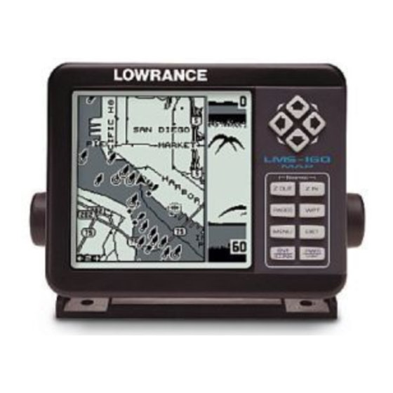
- Page 1 LMS-160 GlobalMap 1600 INSTALLATION AND OPERATION INSTRUCTIONS...
- Page 2 Copyright © 1998 Lowrance Electronics, Inc. All rights reserved. ™ GlobalMap 1600 and LMS-160 are trademarks of Lowrance Electron- ics, Inc. ® Lowrance is a registered trademark of Lowrance Electronics, Inc. WARNING! USE THIS UNIT ONLY AS AN AID TO NAVIGATION. A CAREFUL NAVI- GATOR NEVER RELIES ON ONLY ONE METHOD TO OBTAIN POSI- TION INFORMATION.
- Page 3 This device complies with Part 15 of the FCC Rules. Operation is subject to the following two conditions: (1) this device may not cause harmful interference, and (2) this device must accept any interference received, including interference that may cause undesired operation. Note: This equipment has been tested and found to comply with the limits for a Class B digital device, pursuant to Part 15 of the FCC Rules.
-
Page 4: Table Of Contents
INSTALLATION ... 1 Mounting ... 1 Power Connections ... 2 Cable Connections ... 3 GlobalMap 1600 ... 3 LMS-160 ... 4 Antenna ... 5 Transducer ... 6 INTRODUCTION TO GPS ... 10 OPERATION ... 12 Satellite Status Screen ... 13 Finding Your Position ... - Page 5 SONAR OPERATION ... 59 Sonar Modes ... 59 Full Chart ... 59 Split Chart ... 59 Digital/Chart ... 59 Automatic ... 60 Sonar Options ... 60 Sensitivity ... 60 Grayline ... 61 Adjust Surface Clarity (SCC) ... 61 ASP (Advanced Signal Processing) ... 62 Range - Automatic ...
- Page 6 Notes:...
-
Page 7: Installation
We hope that you'll en- joy this product for years. This manual covers both the Lowrance LMS-160 and GlobalMap 1600. Both have 12-channel GPS receivers, however, the LMS-160 also has a sonar built into the unit. The installation of these two products vary due to this difference, otherwise the operation of the two units (except for sonar) is virtually identical. -
Page 8: Power Connections
Power Connections - All Units This unit works from a twelve-volt battery system. For the best results, attach the power cable directly to the battery. You can attach the power cable to an accessory or power buss, however you may have problems with electrical interference. -
Page 9: Cable Connections
You may need to route the sonar unit’s power cable directly to the battery to isolate it from other wiring on the boat. CABLE CONNECTIONS - GlobalMap 1600 Only ANTENNA LOWRANCE... -
Page 10: Lms-160
CABLE CONNECTIONS - LMS-160 Only POWER/ TRANSDUCER CABLE +12 VDC TRANSDUCER Notes 1. If the NMEA wires are not used, then the NMEA adapter cable is not required. The speed/temperature sensor's cable can be attached directly to the LMS-160. LOWRANCE See Note 1 BLACK (GROUND) -
Page 11: Antenna
Now attach the antenna to the mounting surface, using 4mm screws and the supplied lock washers. Route the cable to the GPS receiver and the antenna in- stallation is finished. -
Page 12: Transducer
LMS-160 and plug it into the connector on the NMEA/DGPS cable. The speed/temp sensor plugs into the optional SAM sonar module on the GlobalMap 1600. TRANSDUCER INSTALLATION - LMS-160 ONLY (Note: A transducer is not included with all units. You may need to pur- chase the transducer separately.) - Page 13 Read this section carefully before attempting the installation. Determine which of the mounting positions is right for your boat. Remember, the transducer location is the most critical part of a sonar installation. Location - General 1. The transducer must be placed in a location that has a smooth flow of water at all times.
- Page 14 Transducer Assembly and Mounting The best way to install this transducer is to loosely assemble all of the parts first, then place the transducer’s bracket against the transom and see if you can move the transducer so that it’s parallel with the ground. 1.
- Page 15 3. Once you determine the correct position for the ratchets, assemble the transducer as shown below. Don’t tighten the lock nut at this time. RUBBER WASHERS 4. Hold the transducer and bracket assembly against the transom. The transducer should be roughly parallel to the ground. The bottom of the transducer bracket should be in line with the bottom of the hull.
-
Page 16: Introduction To Gps
The signals can be blocked easily by trees, buildings, even your body. Never use this GPS receiver while operating a vehicle! Like most GPS receivers, this unit doesn’t have a compass or any other navigation aid built inside. It relies solely on the signals from the satellites... - Page 17 SA. The United States government intentionally degrades the satellite’s signal for civilian users. They introduce small errors into the signals that makes the GPS receiver less accurate. These errors are called selective availability, or SA. How bad is it? They guarantee that the posi- tion reported by a GPS receiver that meets their specifications is within 100 meters horizontally and 150 meters vertically 95% of the time.
-
Page 18: Operation
GPS OPERATION There are 12 keys on the keyboard. You can navigate through the menus, adjust the chart’s cursor, and enter data using the arrow keys. The five major modes of operation are accessed using the PAGES key. Press the MENU key to select or adjust a feature from a list. -
Page 19: Satellite Status Screen
The GPS receiver is tracking satellites that are surrounded by a black box. The receiver hasn't locked onto a satellite if it's number isn't sur- rounded by a box, therefore it isn’t being used to solve the position. -
Page 20: Finding Your Position
FINDING YOUR POSITION Auto Search To lock onto the satellites, the GPS receiver needs to know it’s current position, UTC time, and date. (Elevation (altitude) is also used in the equa- tion, but it’s rarely required to determine a position.) It needs this data so that it can calculate which satellites should be in view. -
Page 21: Position Acquisition
MODES The LMS-160 has five modes: status, navigation, sonar, map, and win- dow groups. The GlobalMap 1600 has four - no sonar mode. Use the PAGES and arrow keys to switch between the different screens. The four GPS screens that show by default are shown at the top of the next page. -
Page 22: Navigation Screens
STATUS NAVIGATION SONAR (GLOBALMAP 1600 ONLY) MAPPING WINDOW GROUPS Navigation There are two different navigation screens. Nav screen number one shows a graphical view of your trip, Nav screen number 2 shows all navigation details in large digital numbers. You can also customize both navigation screens to show data other than the default. - Page 23 pointing up towards the compass, above the present position arrow. Distance from the present position to the waypoint (DIS) shows beneath the compass on the lower left side of the screen. Next to the distance box is estimated time enroute (ETE).
-
Page 24: Course Deviation Indicator (Cdi)
Course Deviation Indicator (CDI) Once navigation to a waypoint is established, the CDI shows your dis- tance to the left or right of the desired course. The vertical line in the box shows both the direction you must steer to get back on course and the distance to the course line. -
Page 25: Cursor
position. It points in the direction you’re travelling. The solid line extending from the arrow is your plot trail, or path you’ve taken. The plotter’s range shows in the lower left corner of the screen. In this example, the plotter’s range is four miles from the left edge of the map to the right. -
Page 26: Map Setup
from your present position. The zoom-in and zoom-out keys work from the cursor’s position when it’s active - not the present position. You can zoom in on any detail, anywhere. The cursor can also place icons and waypoints. When the cursor is used with map-1, it’s posi- tion, bearing, and distance from your present position show at the top of the screen. -
Page 27: Map Options
Map Options The following map options are listed under the “Map Options” menu: Map Orientation, Auto Zoom, Range Rings, and Latitude/Longitude Grids. Map Orientation By default, this receiver shows the map with north always at the top of the screen. This is the way most maps and charts are printed on paper. This is fine if you’re always travelling due north. -
Page 28: Range Rings/Grid Lines
Range Rings/Grid Lines The map screen can be customized with rings that are 1/4 of the range and/or grids that divide the plotter into equal segments of latitude and longitude. To do this, press the MENU key, select “Map 1 Setup”, then “Map Options”. Highlight the desired option, then press the right arrow key to turn it on. -
Page 29: Map Details
MAP DETAILS This unit lets you change many of the built-in background map’s features. To change the op- tions, first press the MENU key, then select the Map Details label. Press the right arrow key. The screen shown at right appears. Earth Map On/Off The map can be turned on or off using the “All Map Details”... -
Page 30: Gray Fill
Gray Fill When this unit is first turned on, all water (lakes, oceans, rivers) is filled with gray to distinguish it from land, which is clear. (See below) To make the land fill with gray and water remain clear, select the “Fill with Gray” label from the Map Detail menu, then press the left arrow key. -
Page 31: Locations
Locations Normally, text disappears as you zoom out. This declutters the screen, making it easier to see significant map detail. Turning “LOCATION DOTS” on from the Map Details menu places a dot on the screen where a text label should be when the screen is zoomed out. Contour Lines Some nav aid data shows depth contour lines in navigable waters. -
Page 32: Update Trail
plot trail in a specific memory location, choose “SAVE TRAIL” from the “TRAIL OPTIONS” menu. A new screen appears. Highlight the desired number that you wish to save the current trail under, (i.e. “Trail 1 or Trail 2) and press the right arrow key. Your current trail is saved. Press the EXIT key to erase this menu. - Page 33 MAP SCREEN SELECT ICON ICON PLACED AT PRESS ENT KEY PRESS ENT KEY POSITION Icons can be erased from the plotter individually, all of a specific type, or all at once. They can also simply be turned off without erasing them. To make changes to the icons, press the MENU key, then select MAP SETUP, and finally select Icon Options.
-
Page 34: Map Downloading
Next, plug the AC adapter into a wall socket, and attach its cable to the unit. Connect the cable supplied with this unit from a serial port on the computer to the GPS receiver. Now turn the unit on and adjust the com- munication port baud rate to its highest level (Press MENU/SYSTEM SETUP/COM PORT SETUP). -
Page 35: Windows
TRANSFERRING MAP DATA Using either GDM or MapCreate software, you may transfer maps of your choice to your GPS Unit. The following instructions are for the GDM soft- ware. 1. Click on the MapSelect Tab. 2. Select a map by clicking on the desired database button (IMS Smart- Map, IMS WorldMap, or Coastal Navaids). - Page 36 Group B This screen has a map on the top half with bear- ing (BRG), distance to go (DIS), track (TRK) and the CDI on the lower half. Group C A half screen map is on the left side of the screen. A quarter-size map is in the upper right corner.
- Page 37 The DGPS corrections at the bottom of the screen shows a list of the satellites in view. The satellite’s number is follow by an identifier showing its status. They are as follows: DGPS corrections are in use by GPS receiver and corrections are available. Unit hasn’t received corrections in last 60 seconds.
- Page 38 then select “CLOCK ALARM” and press the right arrow key. Now select "SET CLOCK ALARM". The screen at right appears. Using the arrow keys, enter the alarm’s time. Press the ENT key. The unit returns to the clock alarm menu. Highlight the “CLOCK ALM OFF ON”...
- Page 39 reset the timer to zero, select the “UP TIMER RESET” menu. The up timer also has an alarm that can be set to sound at a preset time. (For example, one hour from now, three hours, etc.) To set the alarm, highlight the “SET UP TIMER ALM”...
-
Page 40: Reprogram Window Groups
Group L - LMS-160 Only This group has a digital depth display along with the sonar alarms setting in the upper left corner of the screen. (See the sonar section for more information on the sonar alarms.) A quarter-size sonar screen shows in the upper right corner. Surface water temperature shows in the lower left corner of the screen, both digital and a tem- perature graph. -
Page 41: Reprogram Boxes
cally saves your reprogrammed group and returns to the group, as shown at the top of the next page. If you finish selecting windows before filling the group with windows, press the ENT key. To leave the reprogramming menu without saving the changes, simply press the EXIT key. -
Page 42: Waypoints
WAYPOINTS This GPS receiver gives you the ability to create your own database of locations, called “waypoints’. You can save your present position, cursor position, or enter a coordinate and save it as a waypoint. For example, you may wish to store the location of your parked car as a waypoint be- fore starting on a hike. -
Page 43: Saving Your Present Position As A Waypoint (Select Number Method)
MOVE CURSOR TO PRESS WPT KEY DESIRED LOCATION TWICE Saving Your Present Position as a Waypoint (Select Number Method) The method shown previously doesn’t let you choose the waypoint num- ber. You can pick the waypoint number, then save your present or cursor position. -
Page 44: Waypoint Averaging
SA, atmospheric conditions, the number of satel- lites being tracked and their location relative to your position, and so on. However, even with SA turned on, this GPS receiver can show surpris- ingly accurate position information. If you wish to increase the accuracy of a saved position, use the waypoint averaging method. -
Page 45: Selecting A Waypoint
this example. Now select “CREATE WAYPOINT”, then “PROJECT POSITION”. The screen shown at the the bottom of the previous page appears. The unit needs a location (reference waypoint) to project the new waypoint from. The default ref- erence is waypoint number one. Highlight the “REFERENCE WPT”... -
Page 46: From List
waypoint menu, then press the left or right arrow keys until the desired waypoint number appears. Select from List The waypoint number selection method forces you to scroll through all waypoint numbers, whether there’s a location saved in them or not. The waypoint list is composed only of saved way- points. -
Page 47: Edit Name
ENT key. Note: You can only use this method to change the position of an existing waypoint. Name You can assign a name to each waypoint. The name can have up to eight characters. To do this, first select the waypoint that you wish to name, then choose “EDIT NAME”... -
Page 48: Waypoint Options
key. The screen shown at right appears. The “From” label is highlighted at the top of the screen. Press the right arrow key until the waypoint num- ber that you want to move appears. In this ex- ample, we selected waypoint number 1. Now press the down arrow key once to highlight the “To”... -
Page 49: Navigate To A Cursor Location
Navigating to a Cursor Position This unit lets you navigate to a location without storing it in the waypoint database by using the map and cursor. To do this, first switch to a map. Now move the cursor to the location that you want to navigate to. Next, press the MENU key. -
Page 50: Routes
ROUTES You can connect several user waypoints together to form a route. When you recall the route, the unit shows navigation information to the first way- point in the route, then when you reach that waypoint, it switches to the next waypoint, and so on until you reach the last waypoint in the route. -
Page 51: Add From Map
tance from the first waypoint in the route to the second showing under the second waypoint’s name. Add From Map You can add waypoints from the map, even cre- ate new ones. To do this, select “ADD FROM MAP” from the menu as shown on the previous page. -
Page 52: Following A Route
Follow a Route - Direct To Method Before starting the route, you’ll need to decide if you want to start at the first waypoint and travel forward to the last waypoint or start at the last waypoint in the route and travel backwards (reverse) to the first waypoint. The default is forward. -
Page 53: Waypoint Information
was the closest to the present position. There- fore, the unit shows navigation information to waypoint number 4. The first leg of the route, from #3 to #4 is shown on the screen by a dotted line. Once you arrive at waypoint number 4, the unit switches to the next waypoint in the route, and so on. -
Page 54: System Setup
SYSTEM SETUP Many features are listed under the “System Setup” label on the main menu. These commands affect the basic operation of the unit. To use them, press the MENU key, then “System Setup”. The screen at right appears. Audio/Screen This unit gives you three audio options. -
Page 55: Units Of Measure
Change Units You can view data in three different formats: statute, nautical, and metric. The default is statute. The chart below shows the settings for each. Statute Distance ... miles ... nautical miles ... kilometers Speed ... miles per hour ... knots ... kilometers per hour Altitude ... -
Page 56: Configure Nmea Output
Once the cables are wired, turn the unit on, press the menu key, and select “NMEA / DGPS CONFIG” from the System Setup menu. A screen similar to the one at right appears. To turn the NMEA output on, highlight the “NMEA OUT”... -
Page 57: Serial Communication Setup
These menus select the beacon receiver’s fre- quency and bit rate (in bits per second). To change one of these settings, simply highlight the menu item you wish to change, then press the right or left arrow key until the desired number appears. The “STARLINK AUTO”... -
Page 58: System Info
System Information The system information screen shows the release date and the software’s version number. To view this screen, highlight the System Info label on the System Setup menu. Now press the right arrow key. Press the EXIT key when you’re finished reading this screen. GPS SETUP Items found under the GPS Setup menu include initialization, (covered at the beginning of this... -
Page 59: Datum
To change the position format, highlight either the “Position Format” or the “Alternate Format” label on the “GPS Setup” menu, then press the right arrow key. A screen similar to the one at right appears. Press the up or down arrow keys to select the desired format. -
Page 60: Pcf (Position Correction Factor)
with the edge of the map. USGS maps are parallel, others may not be. Also, this works better with smaller scale maps.) The reference position can be anywhere on the map, but the closer it is to your location, the smaller the numbers will be that you’ll have to deal with. -
Page 61: Position Pinning
Position Pinning When using a GPS receiver at extremely low speeds, it can have trouble determining your course over ground, or direction you’re travelling. This is due in large part to SA, or selective availability. SA is small inaccuracies purposefully put into the GPS satellite’s signal by the government. -
Page 62: Gps Alarms
receiver turned on and watch your plot trail with position pinning turned off. You’ll see the present position change, speed increase and decrease, and a random plot trail on the plotter’s screen. If you wish to turn the position pinning feature off, press the MENU key, then highlight the “GPS Setup”... -
Page 63: Dgps Messages
and you run a route (see the routes section), this unit may not show navi- gation data to the next waypoint, once you arrive at the first one, since you may not be able to come close enough to the first waypoint to trip the arrival alarm. -
Page 64: Simulator
SIMULATOR A simulator is built into this unit that moves the GPS position and pro- duces a simulated sonar chart. You can use nearly all of the unit’s fea- tures - even save and recall waypoints. This is useful for trip planning. To use the simulator, press the MENU key, then press the up or down arrow keys until the “Simu- lator Setup”... -
Page 65: Sonar Operation
SONAR OPERATION LMS-160 ONLY SONAR MODES The LMS-160 has three different sonar modes: full chart (sonar 1), split-chart (sonar 2), and so- nar with digital information (sonar 3). To select a mode, first press the PAGES key. Press the up or down arrow key to select sonar modes, then press the left or right arrow key to select the de- sired mode. -
Page 66: Automatic
AUTOMATIC When this unit is first turned on, the automatic feature is enabled. This is indicated by the word “AUTO” at the top of the screen. The automatic feature adjusts the sensitivity and range so the bottom signal is displayed in the lower half of the screen at all times. -
Page 67: Grayline
the key, the menu’s bar graph will grow wider and the percentage will increase in value. You can also see the difference on the chart record as it scrolls. When the sensitivity is at the desired level, release the key. To decrease the sensitivity level, press the left arrow key. -
Page 68: Asp (Advanced Signal Processing)
The Surface Clarity Control (SCC) reduces or eliminates surface clutter signals from the display. SCC varies the sensitivity of the receiver, de- creasing it near the surface and gradually increasing it as the depth in- creases. There are three levels of SCC available on this unit: low, medium, and high. -
Page 69: Manual
while the unit is in automatic, as shown at right. However, depending upon the bottom depth and the current range, you can change the range to a different depth. In the example screen shown at right, the bottom depth has descended to a point where you can change the range to XX feet. -
Page 70: Upper And Lower Limits
left arrow key to stop the chart. To start the chart again, press the right arrow key. Upper and Lower Limits You can enter virtually any combination of ranges when the unit is in the manual mode. The unit lets you enter any upper and lower limit, provided there is at least ten feet separating them. -
Page 71: Fish Id
FISH ID The Fish ID feature identifies targets that meet certain conditions as fish. The microcomputer analyses all echoes and eliminates surface clut- ter, thermoclines, and other signals that are un- desirable. In most instances, remaining targets are fish. The Fish ID feature displays symbols on the screen in place of the actual fish echoes. -
Page 72: Chart Display
To turn the FishTrack feature off, press the menu key and select “SONAR SETUP”. Choose “FISH ID” from this menu. Now press the right arrow key to highlight the “TRK” FishTrack feature. To turn FishTrack off, press the left arrow key on the Fish ID menu. -
Page 73: Zone Bar
Zone Alarm Bar The zone alarm has a range bar. Any echoes that appear between the top and bottom of this bar triggers the zone alarm. This bar normally doesn’t show on the screen. To turn the zone bar on continuously, select “ZONE BAR” from the “CHART DISPLAY”... -
Page 74: Alarms
ALARMS This unit has three different types of sonar alarms. The first is the Fish Alarm. It sounds when the Fish I.D. feature determines an echo or group of echoes is a fish. Another alarm is the Zone Alarm which consists of a bar. -
Page 75: Zone Alarm
by highlighting the “Shallow Alm” label and pressing the right arrow key. With the shallow alarm set at ten feet, anytime the digital display goes below ten feet, the shallow alarm sounds. Set the deep alarm in the same manner. If the bottom depth reading goes below the deep alarm setting, the deep alarm will sound. -
Page 76: Calibrate Speed
highlight the “SET KEEL OFFSET” label on the “System Setup” menu, then press the right arrow key. The screen shown at right appears. The cur- rent bottom depth shows in the upper left corner of the screen. The keel offset shows beneath it. In this example, we need to change the keel off- set so that the unit will add one foot to the depth, since the transducer is one foot below the sur-... -
Page 77: Sonar Troubleshooting
SONAR TROUBLESHOOTING If your unit is not working, or if you need technical help, please use the following troubleshooting section before contacting the factory customer service department. It may save you the trouble of returning your unit. Unit won’t turn on: 1. - Page 78 3. The water may be deeper than the sonar’s ability to find the bottom. If the sonar can’t find the bottom signal while it’s in the automatic mode, the digital will flash continuously. It may change the range to limits far greater than the water you are in.
- Page 79 NOISE A major cause of sonar problems is electrical noise. This usually appears on the sonar’s display as random patterns of dots or lines. In severe cases, it can completely cover the screen with black dots, or cause the unit oper- ate erratically, or not at all.
-
Page 80: Ups Return Service
UPS Return Service Lowrance Electronics and United Parcel Service (UPS) are proud to offer all of our customers free shipping for all units sent to us for repair or service. If you have to send this unit to the factory, and you are in the continental United States, use the enclosed UPS shipping label for easy, free shipping to our factory customer service department. -
Page 81: Accessory Ordering Information
YOU WILL NEED IT IF YOU EVER NEED TO RETURN YOUR UNIT TO THE FACTORY FOR REPAIR. Accessory Ordering Information To order accessories such as power cables or transducers, please con- tact: 1) Your local marine dealer. Most quality dealers that handle marine elec- tronic equipment should be able to assist you with these items. -
Page 82: Warranty
LOWRANCE ELECTRONICS, INC FULL ONE-YEAR WARRANTY “We”, “our”, or “us” refers to LOWRANCE ELECTRONICS, INC, the manufacturer of this product. “You” or “your” refers to the first person who purchases this product as a con- sumer item for personal, family, or household use. We warrant this product against defects or malfunctions in materials and workmanship, and against failure to conform to this product’s written specifications, all for one year (1) from the date of original purchase by you. -
Page 83: Datum List
DATUMS WGS 84 ... WGS 1984 DEFAULT Default ADINDAN ... Adindan MEAN Mean for Ethiopia, Sudan ADINDAN ... Adindan BURKINA Burkina Faso FASO ADINDAN ... Adindan CAMEROON Cameroon ADINDAN ... Adindan ETHIOPIA Ethiopia ADINDAN ... Adindan MALI Mali ADINDAN ... Adindan SENEGAL Senegal... - Page 84 CARTHAGE ... Carthage - Tunisia TUNISIA CH-1903 ... Switzerland CHATHAM ... Chatham Island Astro 1971 ISLAND ASTRO New Zealand (Chatham Island) NEW ZEALAND CHUA ASTRO ... Chua Astro PARAGUAY Paraguay CORREGO ... Corrego Alegre ALEGRE Brazil BRAZIL DABOLA ... Dabola GUINEA Guinea DJAKARTA ...
- Page 85 IRELAND ... Ireland 1965 1965 Ireland ISTS 061 ... ISTS 061 Astro 1968 ASTRO 1968 South Georgia Islands S GEORGIA ISTS 073 ... ISTS 073 Astro 1969 ASTRO 1969 Diego Garcia DIEGO GARCIA JOHNSTON ... Johnston Island 1961 ISLAND Johnston Island 1961 KANDAWALA ...
- Page 86 N AMERICAN ... North American 1927 1927 CANAL Canal Zone ZONE N AMERICAN ... North American 1927 1927 CUBA Cuba N AMERICAN ... North American 1927 1927 Greenland (Hayes Peninsula) GREENLAND N AMERICAN ... North American 1927 1927 MEXICO Mexico N AMERICAN ...
- Page 87 RT 90 ... Sweden SANTO (DOS) ... Santo (DOS) ’65 ESPIRITO 1965 Espirito Santo Island SANTO ISLAND SAO BRAZ ... Sao Braz AZORES Azores (Sao Miguel, Santa Maria Islands) SAPPER HILL ... Sapper Hill 1943 1943 EAST East Falkland Island FALKLND ISLE SCHWARZECK ...
- Page 88 LOWRANCE DATABASES LICENSE AGREEMENT THIS IS A LEGAL AGREEMENT BETWEEN THE END-USER WHO FIRST PURCHASES THIS PRODUCT AS A CONSUMER ITEM FOR PERSONAL, FAMILY, OR HOUSEHOLD USE (“YOU”) AND LOW- RANCE ELECTRONICS, INC., THE MANUFACTURER OF THIS PRODUCT. (“WE”, “OUR”, OR “US”). USING THE PRODUCT ACCOM- PANIED BY THIS LICENSE AGREEMENT CONSTITUTES ACCEP- TANCE OF THESE TERMS AND CONDITIONS.
-
Page 89: Databases Limited Warranty
DATABASES LIMITED WARRANTY “We”, “our”, or “us” refers to Lowrance Electronics, Inc., the manufacturer of this product. “You” or “your” refers to the first person who purchases the product as a consumer item for personal, family, or household use. The Databases Limited Warranty applies to the one or more databases that your product may contain. - Page 90 Notes:...
-
Page 91: How To Obtain Service
How to Obtain Service (Canadian Customers Only) We back your investment in quality products with quick, expert service and genuine Lowrance replacement parts. If you need service or repairs, contact the Lowrance Factory Customer Service Department at the toll-free number listed below. A techni- cian may be able to solve the problem and save you the inconvenience of returning your unit. - Page 92 How to Obtain Service (U.S.A. Only) We back your investment in quality products with quick, expert service and genuine Lowrance ® replacement parts. If you’re in the United States and you have questions, please contact the Factory Customer Service Department using our toll-free number listed below. You must send the unit to the factory for warranty service or repair.