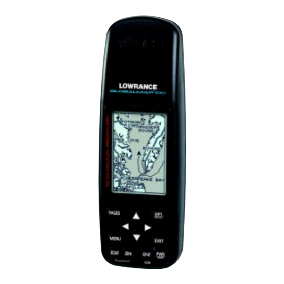
Lowrance GlobalMap 100 Installation And Operation Instructions Manual
Lowrance electronics installation and operation instructions gps receiver globalmap 100
Hide thumbs
Also See for GlobalMap 100:
- Installation and operation instructions manual (91 pages) ,
- Installation instructions manual (28 pages)
Table of Contents
Advertisement
Advertisement
Table of Contents

Related Manuals for Lowrance GlobalMap 100


Summary of Contents for Lowrance GlobalMap 100
- Page 1 ® GlobalMap 100 INSTALLATION AND OPERATION INSTRUCTIONS...
- Page 2 Copyright © 1996, 1997, 1998, 2000 Lowrance Electronics, Inc. All rights reserved. ® ® GlobalMap 100 and Lowrance are registered trademarks of Lowrance Electronics, Inc. WARNING! USE THIS UNIT ONLY AS AN AID TO NAVIGATION. A CAREFUL NAVI- GATOR NEVER RELIES ON ONLY ONE METHOD TO OBTAIN POSI- TION INFORMATION.
- Page 3 This device complies with Part 15 of the FCC Rules. Operation is subject to the following two conditions: (1) this device may not cause harmful interference, and (2) this device must accept any interference received, including interference that may cause undesired operation. Note: This equipment has been tested and found to comply with the limits for a Class B digital device, pursuant to Part 15 of the FCC Rules.
-
Page 4: Table Of Contents
INTRODUCTION ... 1 DGPS - What is it? ... 2 Don’t Get Lost ... 2 GETTING STARTED ... 2 Power ... 2 BATTERIES ... 2 Battery Installation ... 3 OPERATION ... 3 Keyboard ... 3 Menus ... 4 Turning Power On ... 4 Satellite Status Screen ... - Page 5 Project a Waypoint ... 32 Selecting a Waypoint ... 33 Waypoint Number ... 33 Waypoint List ... 33 Editing a Waypoint ... 33 Edit Position ... 33 Edit Name ... 34 Edit Icon ... 34 WAYPOINT NAVIGATION ... 34 Navigating to a cursor location ... 34 Navigating to a Waypoint using the Map ...
- Page 6 Notes:...
-
Page 7: Introduction
INTRODUCTION Welcome to the exciting world of GPS! Whether you’re a first-time user or a professional navigator, you’ll find the GlobalMap 100 is a full-featured GPS receiver at a price that was impossible just a few years ago. The ®... -
Page 8: Dgps - What Is It
GETTING STARTED Power The GlobalMap 100 operates from AA batteries or from 5 to 35 volts DC using an optional external power cable. If the power cable is used, the GlobalMap 100 automatically switches to it if the external power is greater than the battery voltage. -
Page 9: Battery Installation
External Antenna Although this GPS receiver is extremely sensitive, it can be used in loca- tions where the built-in antenna simply cannot receive signals from enough satellites. A second connector on the back of the unit is for an external antenna. -
Page 10: Menus
The GPS receiver is tracking satellites that are sur- rounded by a black box. If the satellite number is not surrounded by a box, then the receiver hasn’t locked onto that satellite and it isn’t being used to solve the position. -
Page 11: Finding Your Position
Finding Your Position Auto Search To lock onto the satellites, the GPS receiver needs to know it’s current position, local time, and date. (Elevation (altitude) is also used in the equa- tion, but it’s rarely required to determine a position.) It needs this data so that it can calculate which satellites should be in view. -
Page 12: Manual Initialization
Using the manual initialization method loads a position that’s close to yours into the GPS receiver. It should now have position, time, and date, thereby giving it the data it needs to determine which satellites are in view. Once the satellites are known, the receiver searches for only those satellites, making a lock faster than an auto search method. -
Page 13: Position/Navigation Screens
POSITION/NAVIGATION SCREENS This unit has four modes: status, map, navigation, and window groups. Use the PAGES and arrow keys to switch between the different screens. The four screens that show by default are shown below. STATUS NAVIGATION WINDOWS To change modes, simply press the PAGES key. A screen similar to the one at right appears. - Page 14 Nav Screen #1 This screen has a compass rose that shows not only your direction of travel, but also the direction to a re- called waypoint. The navigation screen looks like the one at right when you’re not navigating to a waypoint. Your position is shown by an arrow in the center of the screen.
-
Page 15: Course Deviation Indicator (Cdi)
Nav Screen #2 This navigation screen shows all navigation informa- tion in large digital numbers. To view this screen, press the PAGES key, then select the “NAV1” label. While it’s selected, press the right arrow key. The screen shown at right appears. Press the EXIT key to erase the menu. This screen is composed of eight digital boxes. -
Page 16: Map
The GlobalMap 100 has a ground map of the world built inside. This map has the majority of its detail in far southern Canada, the continental United States and Hawaiian islands, northern Mexico, the Bahamas, and Bermuda. The map screens show your course and track from a “birds-eye”... -
Page 17: Cursor
Cursor Pressing an arrow key turns on two dotted lines that intersect at the present position symbol. These lines are called a “cursor” and have a variety of uses. To turn the cursor on, simply press the arrow key in the direction you want the cursor to move. - Page 18 To correct this problem, a track-up mode rotates the map as you turn. Thus, what you see on the left side of the screen should always be to your left, and so on. A course-up mode keeps the map at the same orientation as the initial bearing to the waypoint.
-
Page 19: Autozoom
AUTOZOOM This receiver has an autozoom feature that eliminates much of the button pushing that competitive units force you to make. It works in conjunction with the navigation features. First, recall a waypoint. (See the waypoint section for more information on navigating to a waypoint.) Then, with the autozoom mode on, the unit zooms out until the entire course shows, from the present position to the destination waypoint (recalled waypoint). -
Page 20: Range Rings/Grid Lines
Range Rings/Grid Lines The map screen can be customized with rings that are 1/4 of the range and/or grids that divide the plotter into equal segments of latitude and longitude. To do this, press the MENU key, select “Map 1 Setup”, then “Map Options”. -
Page 21: Text Labels
Text Labels Select “Map Text” to turn all names on the map (such as Lake Tahoe or Mississippi River) off or on. The default is “on”. Press the left arrow key to turn them off. Locations Normally, text disappears as you zoom out. This declutters the screen, making it easier to see signifi- cant map detail. -
Page 22: Gray Fill
Gray Fill When this unit is first turned on, all water (lakes, oceans, rivers) is filled with gray to distinguish it from land, which is clear. (See below) To make the land fill with gray and water remain clear, select the “Gray Fill” label from the Earth Map menu, then press the left arrow key. -
Page 23: Update Options
Update Options By default, the plotter places a dot on the screen every 3 seconds to create the plot trail. You can change this time from once per second to once every thirty min- utes. The plot trail can also be updated by distance instead of by time. -
Page 24: Place Icon - Present Position
Place Icon - Present Position To place an icon at your present position, simply press the ENT key while the mapping screen is on. The screen shown at right appears. Use the arrow keys to high- light the desired icon. Now press the ENT key again. The mapping screen reappears with the icon showing at the position you were at when the ENT key was pressed. -
Page 25: Icon Options
Icon Options Icons can be erased from the plotter individually, all of a specific type, or all at once. They can also simply be turned off without erasing them. To make changes to the icons, press the MENU key, then select MAP SETUP, and finally select Icon Options. -
Page 26: Map Downloading
Mapping The GlobalMap 100 is sold with no accessories. The GlobalMap 100 Plus includes an IMS MapCreate CD and cables so that it can download maps from a personal computer to the unit. These accessories are available separately for units that were sold without them. - Page 27 “OK”. Now click on the “GPS” label, then “Initialize”. This starts the communication between the GPS unit and the computer. If the communications fail, try switching the baud rate on the GlobalMap 100 to a lower setting. Once the communications are established, click on the “Map Select”...
-
Page 28: Windows
WINDOWS The windows feature provides ten different data screens chosen for their broad range of navigation information and ease of use. To use the windows feature, press the PAGES key, then highlight the “GROUP A” label at the bottom of the screen. - Page 29 Group B This screen has a map in the track-up mode on the top half with bearing (BRG), distance to go (DIS), track (TRK) and the CDI on the lower half. (See page 10 for an explanation of the CDI.) Group C A half screen map in the track-up mode again appears at the top.
- Page 30 No correction available. The DGPS station’s ID number, frequency, bit rate, signal strength, signal to noise ratio (SNR), and time since the GPS receiver received the satel- lite corrections (AGE) all show at the bottom of this screen. Group H This is a time screen.
- Page 31 select “CLOCK ALM SETUP” and press the right arrow key. The screen shown below left appears. Now press the right arrow key. The screen below center appears. Using the arrow keys, enter the alarm’s time. Press CLOCK ALARM MENU the ENT key. The unit returns to the clock alarm menu. Highlight the “CLOCK ALM OFF ON”...
- Page 32 Group J There are three timers on this screen and an odometer (TRIP METER). The trip timer is described in group I. The trip meter measures the distance you’ve travelled since it was last reset. To reset the trip meter, press the MENU key, then select “TRIP METER RESET”...
-
Page 33: Reprogram Window Groups
counting until you stop it. When it reaches the alarm’s time setting, a tone sounds. Press the EXIT key to shut the alarm off. The countdown timer starts from a time that you enter and counts down to zero. (Note: When the countdown timer reaches zero, it begins count- ing up until you press the EXIT key. -
Page 34: Reprogram Boxes
If you finish selecting windows before filling the group with windows, press the ENT key. To leave the reprogramming menu without saving the changes, simply press the EXIT key. Reprogram Boxes The digital boxes on MAP 2 and 3 and both NAV screens can be reprogrammed, changing the informations shown by the boxes. -
Page 35: Reset Groups
WAYPOINTS This GPS receiver gives you the ability to create your own database of locations, called “waypoints’. You can save your present position, cursor position, or enter a coordinate and save it as a waypoint. For example, you may wish to store the location of your parked car as a waypoint be- fore starting on a hike. -
Page 36: Saving The Cursor Position As A Waypoint
Saving The Cursor Position as a Waypoint When the cursor is showing on the map and you press the WPT key twice, the cursor’s position is placed into the first available waypoint num- ber. In the example screen shown below, the cursor is placed at the desired location. -
Page 37: Saving A New Position
SA, atmospheric conditions, the number of satel- lites being tracked and their location relative to your position, and so on. However, even with SA turned on, this GPS receiver can show surpris- ingly accurate position information. If you wish to increase the accuracy of a saved position, use the waypoint averaging method. -
Page 38: Project A Waypoint
Project a Waypoint You can save a waypoint even if you don’t know it’s position or location on the map. This unit lets you project the location of a waypoint from a known waypoint us- ing only bearing and distance from the known way- point. -
Page 39: Selecting A Waypoint
SELECTING A WAYPOINT In order to edit or navigate to a waypoint, you must first select it. There are three ways to do this: by waypoint number, waypoint list, or search by name. All selection methods are on the main waypoint menu shown at right. Waypoint Number To select a waypoint by its number, simply highlight the “WPT”... -
Page 40: Edit Name
ENT key. The waypoint now has the new icon. WAYPOINT NAVIGATION The GlobalMap 100 makes it easy to navigate to any waypoint. All you have to do is select the waypoint (see page 31), then highlight the “GO TO WPT” label on the waypoint screen and press the right arrow key. The unit immediately shows navigation information to the waypoint on all navi- gation, map, and windows screens. -
Page 41: Navigating To A Waypoint Using The Map
on the list: “Go To Cursor”. Press the right arrow key. It now shows naviga- tion data to the cursor location (shown as “D” on the map). See the screens below. PRESS MENU KEY, NAVIGATING TO MOVE CURSOR TO THEN PRESS RIGHT CURSOR DESIRED LOCATION ARROW KEY... -
Page 42: Delete A Waypoint
The screen shown at right appears. The “From” label is highlighted at the top of the screen. Press the right ar- row key until the waypoint number that you want to move appears. In this example, we selected waypoint num- ber 1. -
Page 43: Routes
ROUTES You can connect several user waypoints together to form a route. When you recall the route, the unit shows navigation information to the first way- point in the route, then when you reach that waypoint, it switches to the next waypoint, and so on until you reach the last waypoint in the route. -
Page 44: Add From Map
SELECT FIRST WAYPOINT AND ADD TO ROUTE Add From Map You can add waypoints from the map, even create new ones. To do this, select “ADD FROM MAP” from the menu as shown below left. A screen similar to the one below center appears. Using the arrow keys, move the cursor to the desired waypoint or location. -
Page 45: Waypoint Statistics
returns to the route list with the waypoint removed from the list. (Note: This doesn’t delete the waypoint from the database, it simply removes it from the route.) Waypoint Statistics By default, this unit shows the distance and bearing from each waypoint in the route to the next. It will also show estimated time en route (ETE), estimated time of arrival (ETA), or the waypoint names (NAMES). -
Page 46: Waypoint Information
waypoints in the route. Follow these lines to get to each of the waypoints. When you enter the radius set by the arrival alarm, the unit automatically switches to the next waypoint on the list, showing navigation data to that waypoint, and so on until the last waypoint on the route list has been reached. -
Page 47: Delete A Route
The selected waypoint number appears at the top of this screen. Information about the waypoint shows at the bottom of the screen. When you’re finished with this screen, press the EXIT key to erase it. Delete a Route To erase a route, highlight the “ROUTE #” label on the route planning menu, then select the route you want to erase. -
Page 48: System Setup
SYSTEM SETUP Many features are listed under the “System Setup” la- bel on the main menu. These commands affect the ba- sic operation of the unit. To use them, press the MENU key, then “System Setup”. The screen at right appears. Sound To turn the speaker off, highlight the “SOUND”... -
Page 49: Units Of Measure
Global Positioning System. Currently, it relies on a system of ground- based transmitters that send correction signals to small DGPS receivers. DGPS gives you more accurate positions than is otherwise possible. All wiring connections to this GPS receiver are made through the power... -
Page 50: Nmea Output
DGPS” or “Magn DGPS” on the NMEA / DGPS menu (shown at the top of this page) and press the right arrow key to turn it on. (Note: If you have a Magnavox DGPS receiver connected, the GlobalMap 100 can’t send NMEA data.) With the exception of serial communications, typically no... - Page 51 TO GLOBALMAP 100 GLOBALMAP 100 WIRES WHITE WIRE RED WIRE TO +12V BLACK WIRE GROUND WIRES OTHER DEVICE’S WIRES OTHER DEVICE’S RECEIVE DATA WIRE TO GLOBALMAP 100 GLOBALMAP 100 GREEN WIRE WIRES WHITE WIRE RED WIRE TO +12V BLACK WIRE...
-
Page 52: Serial Communication Setup
If you have any other Magnavox or Starlink compatible DGPS receiver connected to the GlobalMap 100, you may need to change the settings. To do this, move the black box to the “Configure DGPS” label and press the right arrow key. A screen similar to the one at right ap- pears. -
Page 53: Reset Groups
GPS Setup and press the right arrow key. The screen shown at right appears. POWER SAVE This GPS receiver has an important power save fea- ture that significantly improves battery life. However, this feature does affect the receiver's performance. If you are using it under heavy cover, such as trees or around tall buildings, the receiver can lose its lock on the satellites easier when the power save feature is enabled. -
Page 54: Position Format
Position Format The GlobalMap 100 can show the position in degrees, minutes, and thou- sandths of a minute (36° 28.700') or degrees, minutes, seconds, and tenths of a second (36° 28' 40.9"). It can also show position in UTM (Universal Transverse Mercator) projection, British, Irish, Swedish, Swiss, Finnish, New Zealand, and Military Grid. -
Page 55: Pcf (Position Correction Factor)
To erase the menu without changing the datum, simply press the EXIT key. A list of the datums used by the GlobalMap 100 is in the back of this manual. PCF (Position Correction Factor) Another method used to make your display match a chart or map is called “PCF”... -
Page 56: Position Pinning
GlobalMap 100 and the one on our chart. After you’ve entered the latitude/longitude correction, press the ENT key to accept it. The GlobalMap 100 erases the PCF entry screen and returns to the navi- gation or mapping screens with the correction factor applied. -
Page 57: Map Fix
Map Fix Map Fix is used with charts or maps. This system asks for a reference position in latitude/longitude, which you take from a marked location on the map. It then shows the present position as distance on the map from that reference point. -
Page 58: Alarms
Arrival Alarm - If you set the arrival alarm’s distance to a small number, and you run a route (see the routes section), the GlobalMap 100 may not show navigation data to the next waypoint, once you arrive at the first one, since you may not be able to come close enough to the first waypoint to trip the arrival alarm. -
Page 59: Sunrise/Set Moonrise/Set Calculator
The DGPS message appears whenever the unit begins or stops using DGPS data to help determine your position. The default setting for these messages is “on”. To turn the message off, select the “Setup Alarms” menu from the main menu, then highlight “DGPS MSG”... -
Page 60: Simulator
The screen shown at right appears. If you simply press the right arrow key, turning the simu- lator on, the GlobalMap 100 will start from your present position and follow a track of 355° at 100 miles per hour. -
Page 61: Definition Of Terms/Abbreviations
DEFINITION OF TERMS/ABBREVIATIONS Due to space considerations, the digital displays use abbreviations for some names. They are as follows: ALT ... Altitude - Your height above sea level. BRG ... Bearing - The direction from your present position to a waypoint. -
Page 62: Datum List
DATUMS WGS 84 ... WGS 1984 DEFAULT Default ADINDAN ... Adindan MEAN Mean for Ethiopia, Sudan ADINDAN ... Adindan BURKINA Burkina Faso FASO ADINDAN ... Adindan CAMEROON Cameroon ADINDAN ... Adindan ETHIOPIA Ethiopia ADINDAN ... Adindan MALI Mali ADINDAN ... Adindan SENEGAL Senegal... - Page 63 CARTHAGE ... Carthage - Tunisia TUNISIA CH-1903 ... Switzerland CHATHAM ... Chatham Island Astro 1971 ISLAND ASTRO New Zealand (Chatham Island) NEW ZEALAND CHUA ASTRO ... Chua Astro PARAGUAY Paraguay CORREGO ... Corrego Alegre ALEGRE Brazil BRAZIL DABOLA ... Dabola GUINEA Guinea DJAKARTA ...
- Page 64 IRELAND ... Ireland 1965 1965 Ireland ISTS 061 ... ISTS 061 Astro 1968 ASTRO 1968 South Georgia Islands S GEORGIA ISTS 073 ... ISTS 073 Astro 1969 ASTRO 1969 Diego Garcia DIEGO GARCIA JOHNSTON ... Johnston Island 1961 ISLAND Johnston Island 1961 KANDAWALA ...
- Page 65 N AMERICAN ... North American 1927 1927 CANAL Canal Zone ZONE N AMERICAN ... North American 1927 1927 CUBA Cuba N AMERICAN ... North American 1927 1927 Greenland (Hayes Peninsula) GREENLAND N AMERICAN ... North American 1927 1927 MEXICO Mexico N AMERICAN ...
- Page 66 RT 90 ... Sweden SANTO (DOS) ... Santo (DOS) ’65 ESPIRITO 1965 Espirito Santo Island SANTO ISLAND SAO BRAZ ... Sao Braz AZORES Azores (Sao Miguel, Santa Maria Islands) SAPPER HILL ... Sapper Hill 1943 1943 EAST East Falkland Island FALKLND ISLE SCHWARZECK ...
- Page 67 LOWRANCE ELECTRONICS FULL ONE-YEAR WARRANTY “We", “our”, or “us” refers to LOWRANCE ELECTRONICS, INC., the manufacturer of this product. “You” or “your” refers to the first person who purchases this product as a con- sumer item for personal, family, or household use. We warrant this product against defects or malfunctions in materials and workmanship, and against failure to conform to this product’s written specifications, all for one year (1) from the date of original purchase by you.
- Page 68 LOWRANCE DATABASES LICENSE AGREEMENT THIS IS A LEGAL AGREEMENT BETWEEN THE END-USER WHO FIRST PURCHASES THIS PRODUCT AS A CONSUMER ITEM FOR PERSONAL, FAMILY, OR HOUSEHOLD USE (“YOU”) AND LOWRANCE ELECTRONICS, INC., THE MANUFACTURER OF THIS PRODUCT. (“WE”, “OUR”, OR “US”). USING THE PRODUCT ACCOMPANIED BY THIS LICENSE AGREEMENT CONSTITUTES ACCEPTANCE OF THESE TERMS AND CONDITIONS.
-
Page 69: Databases Limited Warranty
DATABASES LIMITED WARRANTY “We”, “our”, or “us” refers to Lowrance Electronics, Inc., the manufacturer of this product. “You” or “your” refers to the first person who purchases the product as a consumer item for personal, family, or household use. The Databases Limited Warranty applies to the one or more databases that your product may contain. - Page 70 Notes:...
-
Page 71: How To Obtain Service
How to Obtain Service (Canadian Customers Only) We back your investment in quality products with quick, expert service and genuine Lowrance replacement parts. If you need service or repairs, contact the Lowrance Factory Customer Service Department at the toll-free number listed below. A techni- cian may be able to solve the problem and save you the inconvenience of returning your unit. -
Page 72: Accessory Ordering Information
How to Obtain Service - U.S.A. Only We back your investment in quality products with quick, expert service ® and genuine Lowrance and you have questions, please contact the Factory Customer Service Department using our toll-free number listed below. You must send the unit to the factory for warranty service or repair.