Table of Contents
Advertisement
Advertisement
Table of Contents

Related Manuals for Lowrance GlobalNav 310


Summary of Contents for Lowrance GlobalNav 310
- Page 2 Copyright © 1997 Lowrance Electronics, Inc. All rights reserved. GlobalNav 310 ™ is a trademark of Lowrance Electronics, Inc. Lowrance ® is a registered trademark of Lowrance Electronics, Inc. WARNING! USE THIS UNIT ONLY AS AN AID TO NAVIGATION. A CAREFUL NAVIGATOR NEVER RELIES ON ONLY ONE METHOD TO OBTAIN POSITION INFORMATION.
-
Page 3: Table Of Contents
SELECT WAYPOINTS FOR ROUTE ... 31 FINISHING THE ROUTE ... 32 DELETE A WAYPOINT FROM ROUTE ... 32 GLOBALNAV 310 WAYPOINT DETAIL ... 32 FOLLOW A ROUTE ... 32 SKIP A WAYPOINT IN A ROUTE ... 34 DELETE A ROUTE ... 34... - Page 4 NAVIGATION ... 35 NAVIGATE TO A WAYPOINT ... 35 NAVIGATE TO A CURSOR LOCATION ... 35 NAVIGATING TO A WAYPOINT USING THE PLOTTER ... 36 CANCEL NAVIGATION ... 36 SYSTEM SETUP ... 37 SPEAKER ON/OFF ... 37 CONTRAST ADJUST ... 37 UNITS OF MEASURE...
-
Page 5: Introduction
The Government’s accuracy specification is 100 meters horizontally and 150 meters vertically 95% of the time. In other words, the position shown on your GlobalNav 310 could be up to 100 meters in any direction from your actual position, and the altitude could be plus or minus 150 meters from what’s shown on the screen, 95% of... -
Page 6: Installation
INSTALLATION INSTALLATION - Bracket You can install the GlobalNav 310 on the top of a dash or from an overhead with the supplied bracket. It can also be installed in the dash with an optional IDA-3 mounting kit. A swivel bracket is included that converts the GlobaNav 310's gimbal bracket to a swivel mount. - Page 7 Attach the GlobalNav 310 to the gimbal bracket using the supplied gimbal knobs and washers as shown below. GlobalNav 310 Gimbal Bracket Washer Gimbal Knob...
-
Page 8: Power Cable
POWER The GlobalNav 310 will operate from a 12-volt DC system. (9 to 15 volts DC.) You can connect the power cable to an accessory buss under the dash, however, to keep electrical noise interference to a minimum, we recommend you wire the power cable directly to the battery through the supplied 2-amp fuse. -
Page 9: Antenna
51 in this manual to drill the holes for the screws. The screws, supplied with the GlobalNav 310, are 4mm x 30mm. (about 1 1/8” long). Drill 4.75 mm (3/16”) holes for the mounting screws. If you route the cable through the mounting surface, you’ll need to drill a 25 mm (1”) hole for the cable. -
Page 10: Magnet Mount
Now attach the antenna to the mounting surface, using 4mm screws and the supplied lock washers. Route the cable to the GlobalNav 310 and the antenna installation is finished. -
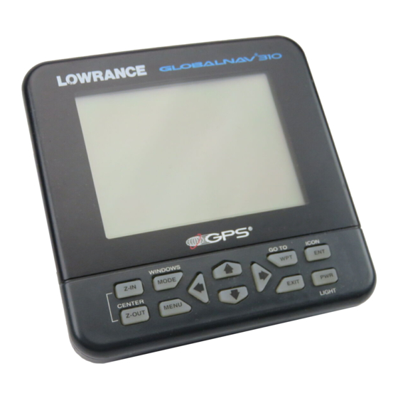
Page 11: Keyboard
The ENT and EXIT keys let you enter or erase selections. The PWR key turns the GlobalNav 310 on and off. Note: To prevent an accidental power shutdown, you must hold the PWR... -
Page 12: Operation
Finding Your Position Cold Start When the GlobalNav 310 is turned on for the very first time, it doesn’t know where it is, nor what the local time or date is. If you tell it your position, time, and date, the unit will take much less time to lock-on to the satellites and give you a fix or position. -
Page 13: Initialization
The next time you use the unit, it should take much less time to lock on. To use your GlobalNav 310, first make certain you have a clear view of the sky, free from any obstructions such as trees, carport, or a covered boat dock. - Page 14 This is the GPS initialization screen. The position, altitude, time, and date the GlobalNav 310 is currently using to find the satellites is shown at the bottom of this screen. Changing these values to your local position and time will speed the position lock.
-
Page 15: Position/Navigation Displays
Once the GlobalNav 310 finds and locks on to three satellites, it stops flashing the numbers on the display. (Note: Altitude will still flash until the unit locks on to the fourth satellite. -
Page 16: Navigation Screens
NAV-1 PLOT-1 GROUP A as "GRP" (groups). For example, Group A is the first windows group on the MODE menu.) Press the right arrow key to see more screens on each mode. When the desired screen appears, press the EXIT key to clear the menu. - Page 17 348°. The line extending behind the ar- row in the center shows your track his- tory, or path you’ve travelled. Your speed over ground or Ground Speed (GS) shows in the digital box to the right of the circle. The screen looks like this when you’re not navigating to a waypoint.
-
Page 18: Plotter Screens
Nav Screen #2 The navigation screen shows navigation information in large digital numbers. To view this screen, press the MODE key, then press the up arrow key until the black box surrounds the “NAV 1” label. Now press the right arrow key. A screen similar to the one at right appears. -
Page 19: Plotter Cursor
The cursor is also used to place and erase icons and waypoints. Press the EXIT key to erase the cursor. PLOTTER OPTIONS The GlobalNav 310 lets you customize the plotter using the “plotter options” menu. To use this menu, first press the MENU key, then use the up or down ar- row keys to highlight the “Plotter Opts”... -
Page 20: Plot Trail
“ClearPlot Trail” menu, then press the right arrow key. A message box appears, asking you if you really want to erase the plot trail. Follow the directions on this message box. The GlobalNav 310 returns to the plotter screen after the message box clears. -
Page 21: Plotter Update Rate
In the track-up view at right, the present position moves straight towards the top of the display. As you can see, the an- chor icon is now shown in its proper ori- entation - to our right. A "N" shows to help you see which direction is north when the track-up mode is on. -
Page 22: Grid Lines
The grid lines appear as vertical and horizontal dashed lines. ICONS The GlobalNav 310 has fifteen symbols or “icons” available. These icons can be placed anywhere on the plotter screens. These can be used to mark fishing spots, boat ramps, rest stops, or whatever. You can place an icon at your present position, or at the cursor location. -
Page 23: Erase Icons
press the ENT key. The plotter screen reappears with the icon at the cursor's location. Press the EXIT key to erase the cursor. On the screen shown at right, the large fish icon was selected and placed at the cursor location. Erase Icons To erase an icon from the screen, first press the MENU key, then select the... -
Page 24: Windows
EXIT key to erase the mode menu. Special Windows Although most of the windows used in the GlobalNav 310 are self-ex- planatory, there are several windows that have special features or can be used in unique ways. The following section describes these windows. -
Page 25: Course Deviation Indicator (Cdi)
“ALARMS/CDI” menu. Using the CDI with a map helps you vi- sualize your position in relation to the course. The CDI is on several of the 310’s windows and can be programmed to show on any window group. -
Page 26: Clock
Press the EXIT key to turn the alarm off. Note: The GlobalNav 310 must be on in order for the alarms to work. In other words, if you set the alarm to go off at 7:00 a.m., then the GlobalNav... -
Page 27: Timers
Timers The GlobalNav 310 has two timers built in. One is a countdown timer and the other is a count-up timer. The countdown timer counts down from the time you put in to zero. The count-up timer starts at zero and counts up to the time you entered. -
Page 28: Waypoints
NAV screens. WAYPOINTS The GlobalNav 310 gives you the capability of creating your own data- base of locations, called “waypoints”.. You can save your present posi- tion, cursor position, or enter a latitude/longitude and save it as a way- point. -
Page 29: Saving Cursor Position
Saving The Cursor Position as a Waypoint When the cursor is showing on the plotter and you press the WPT key twice, the GlobalNav 310 puts the cursor’s position into the first available waypoint number. A message appears on the display telling you the way- point number it just used. -
Page 30: Edit Waypoint Lat/Lon
Remember, the method of saving your present position and the cursor’s position is identical. Edit Lat/Lon The GlobalNav 310 lets you enter any latitude/longitude using the keyboard and save it under any waypoint number, from 1 to 250. You can also change any waypoint’s position using this method. -
Page 31: Edit Waypoint Name
Edit Name The GlobalNav 310 also lets you assign a name to each waypoint. The name can have up to eight characters. To name a waypoint, first select the way- point number that you wish to name. -
Page 32: Distance Between Wayponts
For example, moving waypoint number 2 to waypoint number 10 depos- its the name “WPT 2” in waypoint 10’s name field. DISTANCE BETWEEN WAYPOINTS The GlobalNav 310 can easily give you the distance between two user waypoints. To do this, first press the WPT key, highlight the “Wpt Options”... -
Page 33: Waypoint Options
WAYPOINT OPTIONS You can customize the look of the waypoints on the plotter, or even turn them off. To do this, first press the MENU key, then highlight the “WPT/Icon Opts” label. Press the right arrow key. The screen shown at right appears. To keep the waypoints from showing on the plotter, simply press the right arrow key when the “Waypoints”... -
Page 34: Routes
ROUTES You can connect several user waypoints together to form a route. When you recall the route, the GlobalNav 310 will show you navigation informa- tion to the first waypoint in the route, then when you reach that waypoint, it switches to the next waypoint, and so on until you reach the last way- point in the route. -
Page 35: Select Waypoints For Route
This menu lets you go to the waypoint selection menu, delete a waypoint from the route, or see details about any way- point in the route. Since we want to add a waypoint to the route, press the right arrow key on the “Insert From WPTS” label. -
Page 36: Finishing The Route
Finishing the Route When you’ve selected all of the waypoints for the route, simply press the EXIT key until you return to the navigation, plotter, or windows screen. Your route is saved in memory. Delete a Waypoint To delete a waypoint from a route, first select the route from the “Route Plan- ning”... - Page 37 When you enter the radius set by the arrival alarm, the GlobalNav 310 automatically switches to the next waypoint on the list, showing navigation data to that waypoint, and so on until the last way- point on the route list has been reached.
-
Page 38: Skip A Waypoint In A Route
Skip Waypoint The GlobalNav 310 lets you skip a way- point in a route without stopping the route. To do this, first press the MENU key, then highlight the “Routes” menu and press the right arrow key, then highlight the “Skip WPT” label and press the right arrow key. -
Page 39: Navigation
Next, press the MENU key. A new menu appears on the list: “Go To Cursor”. Press the right arrow key. The GlobalNav 310 shows nav data to the cursor loca- tion (shown as “D” on the plotter). See the screen at the top of the next page. -
Page 40: Navigating To A Waypoint Using The Plotter
CANCEL NAVIGATION The GlobalNav 310 continues to navigate to a recalled waypoint, the last waypoint in a route, or the cursor posi- tion until you stop it. -
Page 41: System Setup
Press the EXIT key to erase this screen. Units of Measure The GlobalNav 310 can show its data in many different formats. For ex- ample, distance can be displayed in statute miles (MI), nautical miles (NM), or kilometers (KM). -
Page 42: Position Format
Measure menu, (shown above) then press the right arrow key. A screen simi- lar to the one at right appears. The GlobalNav 310 can show the posi- tion in degrees, minutes, and thou- sandths of a minute (36 28.700') or de- grees, minutes, seconds, and tenths of a second (36 28' 40.9". -
Page 43: Nmea/Dgps
NMEA / DGPS The GlobalNav 310 transmits data through the data port in the back of the unit using NMEA 0183 format, version 1.5 or 2.0. This data is used by other electronic devices such as marine autopilots for position and steer- ing information. -
Page 44: Nmea Output
All wiring connections to the GlobalNav 310 are made to it’s power cable. See the sample wiring diagrams on the next page for general wiring pro- cedures. Read your other product’s owner’s manual for more wiring infor- mation. Once the cables are wired, turn the... -
Page 45: Dgps Receiver
TO GLOBALNAV 310 GLOBALNAV 310’S WIRES WHITE WIRE RED WIRE TO +12V BLACK WIRE GROUND WIRES OTHER DEVICE’S WIRES OTHER DEVICE’S RECEIVE DATA WIRE TO GLOBALNAV 310 GLOBALNAV 310’S GREEN WIRE WIRES WHITE WIRE RED WIRE TO +12V BLACK WIRE... -
Page 46: Serial Communication Setup
These menus select the beacon receiver’s frequency and bit rate (in bits per second). If you are using a Starlink receiver, turning the auto mode on causes the GlobalNav 310 to auto-detect the frequency and bit rate. To change one of these settings, simply highlight the menu item you wish to change, then press the right or left arrow key until the desired number appears. -
Page 47: System Info
Execute GPS Cold Start When the GlobalNav 310 is turned on for the first time “out of the box”, it automatically sends a “cold-star t” message to the GPS receiver. You can also send a cold start message to the receiver at any time. -
Page 48: Datum
All datums are named. The GPS system is based on the WGS-84 datum, which covers the entire world. Other datums may also cover the entire world, or just a small portion. By default, the GlobalNav 310 shows your position on the map using the WGS-84 datum. However, it can show your position using one of 189 different da- tums. -
Page 49: Pcf
.047 minutes north latitude. Using the PCF feature, you can make the GlobalNav 310 match the chart you’re using. If you move, the unit will continuously add the change to all posi- tion, navigation, and mapping displays. -
Page 50: Position Pinning
After you’ve entered the latitude/longitude correction, press the ENT key to accept it. The GlobalNav 310 erases the PCF entry screen and returns to the navigation or mapping screens with the correction factor applied. POSITION PINING When using a GPS receiver at extremely low speeds, it can have trouble determining your course over ground, or direction you’re travelling. -
Page 51: Messages
Arrival Alarm - If you set the arrival alarm’s distance to zero (0), and you run a route (see the routes section), the GlobalNav 310 may not show navigation data to the next waypoint, once you arrive at the first one. -
Page 52: Reprogram Window Groups
In this ex- ample, we selected the digital clock.The GlobalNav 310 will add this window to the selected group. It then shows the selected window’s position, as shown at right. -
Page 53: Reset Window Groups
RESET GROUPS To restore all windows groups to their factory settings, first press the MENU key, then highlight the “System Setup” label and press the right arrow key. Now highlight the “Reset Groups” label on this menu. Press the right arrow key. A message appears, asking if you really want to do this. -
Page 54: Simulator
If you simply press the right arrow key, turning the simulator on, the GlobalNav 310 will start from your present position and follow a track of 355° at 100 miles per hour. To change either the track or speed, highlight the one you want to change, then press the right or left arrow key. -
Page 55: Definition Of Terms/Abbreviations
keys to increase or decrease the speed. Use the right and left arrow keys to change the track. Press the EXIT key to erase these menus. When you’re finished changing the track and speed, press the EXIT key to erase the menus. To turn the simulator off, press the MENU key, then move the black box to the “Simulator Setup”... -
Page 56: Window Groups
WINDOWS The following is a listing of windows groups A through O. GROUP “A” GROUP “C” GROUP “E” GROUP “G” GROUP “B” GROUP “D” GROUP “F” GROUP “H”... - Page 57 GROUP “I” GROUP “K” GROUP “M” GROUP “O” GROUP “J” GROUP “L” GROUP “N”...
-
Page 58: Ups Return Service
Lowrance's UPS Return Service - U.S.A. Only Lowrance Electronics and United Parcel Service (UPS) are proud to of- fer all of our customers free shipping for all units sent to us for repair or service. If you have to send this unit to the factory, and you are in the continental United States, use the enclosed UPS shipping label for easy, free shipping to our factory customer service department. -
Page 59: Accessory Ordering Information
KEEP THIS LABEL! YOU WILL NEED IT IF YOU EVER NEED TO RETURN YOUR UNIT TO THE FACTORY FOR REPAIR. Accessory Ordering Information To order accessories such as power cables, please contact: 1) Your local marine dealer. Most quality dealers that handle marine elec- tronic equipment should be able to assist you with these items. -
Page 60: Warranty Statement
LOWRANCE ELECTRONICS FULL ONE-YEAR WARRANTY “We", “our”, or “us” refers to LOWRANCE ELECTRONICS,INC., the manufacturer of this product. “You” or “your” refers to the first person who purchases this product as a consumer item for personal, family, or household use. We warrant this product against defects or malfunctions in materials and workmanship, and against failure to conform to this product’s written specifications, all for one year (1) from the date of original purchase by you. - Page 61 THIS PAGE INTENTIONALLY LEFT BLANK...
-
Page 62: Antenna Module Template
4.75MM (3/16”) 4 PLACES 25MM (1”) (If Necessary) -
Page 63: How To Obtain Service - International
How to Obtain Service (Canadian Customers Only) We back your investment in quality products with quick, expert service and genuine Low- rance replacement parts. If you need service or repairs, contact the Lowrance Factory Customer Service Department at the toll-free number listed below. A technician may be able to solve the problem and save you the inconvenience of returning your unit. -
Page 64: How To Obtain Service - U.s.a. Only
How to Obtain Service - U.S.A. Only We back your investment in quality products with quick, expert service ® and genuine Lowrance replacement parts. If you're in the United States and you have questions, please contact the Factory Customer Service Department using our toll-free number listed below.