Table of Contents
Advertisement
Advertisement
Table of Contents

Related Manuals for Garmin Monterra


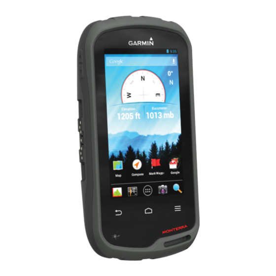
Summary of Contents for Garmin Monterra
- Page 1 Monterra ™ Owner’s Manual October 2013 190-01601-00_0A Printed in Taiwan...
- Page 2 Garmin ® , the Garmin logo, BlueChart ® , City Navigator ® , and TracBack ® are trademarks of Garmin Ltd. or its subsidiaries, registered in the USA and other countries.
-
Page 3: Table Of Contents
Clearing the Current Track ............ 4 Pairing Your ANT+™ Sensors ........... 9 Deleting a Track ..............4 Enabling Airplane Mode ............. 9 Garmin Adventures ..............4 Profiles ..................9 Sending Files to BaseCamp ..........4 Selecting a Profile ..............9 Creating an Adventure ............ - Page 4 Long-Term Storage ............. 11 Device Care ................11 Cleaning the Device ............11 Cleaning the Touchscreen ..........11 Water Immersion ..............11 Specifications ................11 Data Management ..............11 File Types ................11 Installing a Memory Card ............ 11 Connecting the Device to Your Computer ......12 Transferring Files to Your Device ........
-
Page 5: Introduction
Do not attempt to use the device to charge a battery that was Camera not provided by Garmin ® . Attempting to charge a battery that Microphone was not provided by Garmin can damage the device and void the warranty. -
Page 6: Waypoints, Routes, And Tracks
The first time you turn on the device, you must set up basic • To check for an update manually, select Settings > device settings. You can also set up accounts. About Monterra > System updates. Turn on the device. The device checks for available updates. This may take Follow the on-screen instructions. -
Page 7: Editing A Waypoint
For more information, Select . go to http://buy.garmin.com or contact your Garmin dealer. Viewing the Active Route Finding a Location by Name While navigating a route, swipe down from the top of the You can search for map POIs and saved items, such as screen. -
Page 8: Tracks
• If you selected Auto for the Record Method, select an system documentation to learn how to map the drive. option to record tracks more or less often. Open the Garmin or memory card drive or volume. NOTE: Using the Most Often interval provides the most Select an option: track detail, but fills up the device memory quicker. -
Page 9: Navigating To A Destination
Navigating to a Destination Select Where To?. Select a category. Select a destination. Select Go. The map opens with your route marked with a magenta line. Navigate using the map (page 5) or compass (page Stopping Navigation From the map or compass, select >... -
Page 10: Resetting The Trip Computer
If necessary, select an album. chirp™ Select a photo or video. A chirp is a small Garmin accessory that is programmed and left Videos are indicated by in a geocache. You can use your device to find a chirp in a Swipe left or right to view additional photos and videos in the geocache. -
Page 11: Finding A Geocache With A Chirp Device
Finding a Geocache with a chirp Device Pull up the weather cap from the headphone jack, and connect wired headphones. When you enable chirp searching, the device alerts you when it detects nearby chirp devices. This is useful when searching for The headphone wire acts as an antenna to receive the geocaches that contain a chirp device. -
Page 12: Rotating The Screen
Swipe left or right to view additional applications and Customizing the Data Fields widgets. Before you can change the map data fields, you must enable them (page Hold an application or widget, and drag it to the desired location on the home screen. Select a page. -
Page 13: Heading Settings
GPS compass when you are traveling at a higher rate of example, connecting a tempe temperature sensor with your speed for a period of time. Garmin device. Calibrate Compass: Allows you to calibrate the compass if you Bring the device within range (3 m) of the sensor. -
Page 14: Editing A Profile Name
Customize your home screen, settings, and data fields. Changing the Lock Screen Security You can require a security pattern, password, or PIN to unlock Editing a Profile Name the lock screen. You can also disable the lock screen. Select Settings > Profiles. Select Settings >... -
Page 15: Installing A Memory Card
• JPEG photo files. Long-Term Storage • GPI custom POI files from the Garmin POI Loader. Go to When you do not plan to use the device for several months, www.garmin.com/products/poiloader. remove the batteries. Stored data is not lost when batteries are •... -
Page 16: Connecting The Device To Your Computer
Getting More Information NOTE: Some computers with multiple network drives may You can find more information about this product on the Garmin not display device drives properly. See your operating website. system documentation to learn how to map the drive. -
Page 17: Index
Index trip planner. See routes troubleshooting 12 language, keyboard 10 locations editing 2 accessories 9, 12 unit ID 12 saving 2 accounts 10 units of measure 8 locking, screen 2, 8, 10 addresses, finding 3 updates, software 2 adventures 4 updating software 12 airplane mode 9 maps 2, 5 alarms, proximity 7, 9 disconnecting 12 data fields 8 altimeter 5, 9 mass storage mode 11... - Page 18 1200 East 151st Street Olathe, Kansas 66062, USA Garmin (Europe) Ltd. Liberty House, Hounsdown Business Park Southampton, Hampshire, SO40 9LR UK Garmin Corporation No. 68, Zhangshu 2nd Road, Xizhi Dist. New Taipei City, 221, Taiwan (R.O.C.) © 2013 Garmin Ltd. or its subsidiaries...