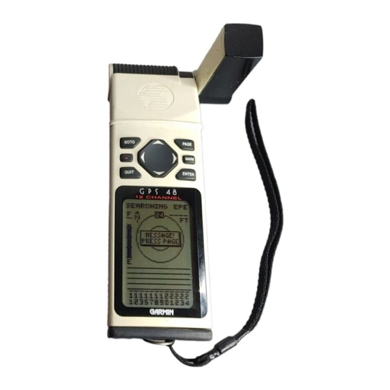
Garmin Personal Navigator GPS 48 Owner's Manual & Reference
Garmin personal navigator owner's manual gps 48
Hide thumbs
Also See for Personal Navigator GPS 48:
- Declaration of conformity (1 page) ,
- Supplementary manual (2 pages) ,
- Specifications (2 pages)
Table of Contents
Advertisement
Advertisement
Table of Contents

Related Manuals for Garmin Personal Navigator GPS 48


Summary of Contents for Garmin Personal Navigator GPS 48
- Page 1 Personal Navigator O w n e r ’ s M a n u a l & R e f e r e n c e...
- Page 2 GARMIN products. GARMIN, Personal Navigator, AutoLocate, TracBack, and PhaseTrac12 are all trademarks of GARMIN Corporation and may not be used without the express per- mission of GARMIN Corporation. December 1999 - Part Number 190-00141-00 Rev. B - Printed in Taiwan...
- Page 3 See your GARMIN dealer for accessories including our PC kit, swivel mounts, external antennas, and power/data cables. We hope the GPS 48 will meet all of your navigation needs and know it will become a valuable part of your outdoor gear.
- Page 4 AID (NAVAID), any NAVAID can be misused or misinterpreted and, therefore, become unsafe. Use the GPS 48 at your own risk. To reduce the risk of unsafe opera- tion, carefully review and understand all aspects of this Operator’ s Manual and thoroughly practice operation using the simulator mode prior to actual use.
-
Page 5: Table Of Contents
INTRODUCTION Table of Contents SECTION ONE Introduction Glossary ..........2-3 Navigation Basics &... -
Page 6: Glossary
INTRODUCTION Glossary The GPS 48 is a powerful navigation tool that can guide you anywhere in the world. To better understand its operation and capabilities, it may be helpful to review the basic terms and concepts briefly explained below. Other navigation and GPS definitions used in the manual are defined in the appropriate reference sections of the manual. - Page 7 Estimated Time Enroute (ETE) The time left to your destination at your present speed. Grid Coordinate system that projects the earth on a flat surface, using square zones for position measurements. UTM/UPS and Maidenhead formats are grid systems. Ground Speed (SPD) The velocity you are traveling relative to a ground position.
-
Page 8: Navigation Basics & Key Pad Usage & Data Entry
000º, east as 090º, south as 180º, and west as 270º. The diagram and compass rose below provide a graphic illustration of the navigation terms used by the GPS 48. More information on basic navigation and GPS are available at your local library or bookstore. -
Page 9: Keypad Usage
Turns the unit on and off and activates screen backlighting. Scrolls through the main data pages in sequence and returns display from a submenu page to a primary page. Captures a position and dis- plays the mark position page. Displays GOTO page with the waypoint highlighted for GOTO operation. -
Page 10: Initializing For First Time Use
•Select Country––allows you to initialize the receiver by selecting your present position from a list of countries in the GPS 48’ s internal database. This method usually provides a position fix in a few minutes. •Autolocate ––allows the GPS 48 to initialize... -
Page 11: Initialization Troubleshooting
5. Press to finish. The GPS 48 now begins searching for the appropri- ate satellites for your location and should acquire a position within 3-5 minutes. You can verify that you have acquired a position by watching the Satellite Page transition to the Position Page (provided you haven’t... -
Page 12: Primary Pages
Position Page Primary Pages Before we start the tour, let’ s briefly look at the five primary information pages used for the GPS 48. Switch between pages by pressing either the Satellite Page The Satellite Page shows satellite positions and signal strength. -
Page 13: Primary Pages
Navigation Page A navigation page gives you steering guidance when going to a waypoint. The GPS 48 has two navi- gation page choices: the Compass Page and the Highway Page. The Compass Page is the default and briefly explained here. The Highway Page is covered on pages 28 and 31. -
Page 14: Power On & Marking A Position
Now that you’ve seen the primary pages, let’ s get started by taking a simple tour to show you the basics about using your GPS 48. The tour assumes that your unit has been turned on, initialized, and that none of the factory settings (units of measure, selectable fields, etc.) have been changed. -
Page 15: Position Page, Map Basics, & Going To A Waypoint
“breadcrumb” display of your track right on the screen. The GOTO waypoint page allows you to select a destination from a list of all available waypoints in the GPS 48’s memory. GETTING STARTED Map Page & Going to a Waypoint... -
Page 16: Compass Page & Cancelling A Goto
Destination Waypoint Graphic Highway The GPS 48’ s Highway Page provides graphic steering guidance to a destination waypoint, with emphasis on the straight-line desired course, the distance and direc- tion you are off course. As you head toward your destination, the middle of the screen provides visual guidance to your waypoint on a moving graphic “highway.”... -
Page 17: Clearing The Map Display, Screen Contrast, & Power Off
Clearing a Cluttered Map Display After you’ve used the GPS 48 for a few trips, you may find that your map display has become a bit messy from keeping track of your every move. For practice, let’ s clean up the screen by clearing the track log (the plot points left on the Map Page) we’ve just created during the Getting... -
Page 18: Satellite Page
Field Battery Indicator The GPS 48’ s Satellite Page displays the status of vari- ous receiver functions. The status information will help you understand what the GPS 48 is doing at any given time, and will tell you whether or not the receiver has calculated a position fix. -
Page 19: Receiver Status
The status will be shown as one of the following conditions: Searching— the GPS 48 is looking for any avail- able satellites in view. AutoLocate— the GPS 48 is initializing and col- lecting new almanac data. -
Page 20: Battery Level Indicator, Backlighting, And Emergency Erase
Note: A bulb icon will appear on the Satellite Page when backlighting is turned on. Emergency Erase Function You may erase the GPS 48’ s memory in four quick steps. This will cause all stored data to be deleted, including: routes, waypoints, and the track log. -
Page 21: Position Page & User Selectable Fields
Position Page The second page in the GPS 48’ s primary page sequence is the Position Page. This page shows you where you are, what direction you’re heading, and how fast you’re going, and it’ s most useful when you are travel- ing without an active destination waypoint. -
Page 22: Maximum Speed
When the GPS 48 is acquiring satellites or navigat- ing in the 2D mode, the last known altitude is used to compute your position. In cases where the GPS 48 has 2D coverage, entering your exact altitude will enable the receiver to determine a more accurate fix. -
Page 23: Map Page & Marine Database
Map Page Zoom Scale Bearing to Waypoint Track Over Ground The Map Page shows your position and surroundings, and provides you with a target cursor that lets you pan ahead to determine the distance and bearing to a map position, mark new waypoints and goto waypoints while you navigate. -
Page 24: Marine Database
(see page 26). The nautical navaids contained in the GPS 48 marine database include racons, radio beacons, fog horns, day- beacons (red triangles, green squares and white dia- monds), lit and unlit navaids. - Page 25 Marine Database (cont) Lit and unlit navaids are designated by the primary color. The navaid symbol will have the first letter in the primary color displayed in the symbol. Information about the navaid is contained in the navaid label. The navaid label can be activated two ways, either by reaching the label zoom scale set in navaid setup (see page 27) or by panning the map cur- sor to the navaid (see page 22).
-
Page 26: Map Page, Zooming, Panning & Configuring
REFERENCE Zooming Panning & Configuring A crosshair will appear when you activate the pan function. The distance and direction of the crosshair from your current position will be shown in the upper corners of the Map Page. On-Screen Pointing The crosshair will “snap” to displayed waypoints, which allows you to quick- ly review or go to the... - Page 27 From the waypoint definition page, you can also define how each individual waypoint is displayed on the map. The GPS 48 displays waypoints as a name with a corresponding symbol (e.g., “nearest fuel” and a gas pump symbol), a symbol only (e.g., a fish symbol), or a 16-character comment and corresponding symbol (e.g.,...
-
Page 28: Map Page, Track Log, City, & Navaid Setup
REFERENCE Setup Windows The ‘OPT’ field gives access to the map setup pages, right from the Map Page. The Map Page’s default screen orientation is track up. “Track Up” means that your current direction of travel is always up (or towards the top of) the screen. - Page 29 1. Highlight ‘YES’ or ‘NO’ for the specific map item, and press Track Setup Page The track setup page lets you manage the GPS 48’ s track log data. You can also select whether to record a track log and define how it is recorded.
-
Page 30: Track Log
REFERENCE Clearing the Track Log Clear the track log any time your screen gets clut- tered or to make more room to store points to be used for a TracBack. You can configure when the city locations display on the map in the City Setup Page. - Page 31 Navaid Setup Page The navaid setup page lets you select the zoom scale where navaids become visible on the map. The setup page is divided into two columns, range and zoom, with label setup at the bottom of the page. The ‘RANGE’ field represents the visible range of the navaid, the ‘ZOOM’...
-
Page 32: Using The Highway & Compass
ENTER twice. Selecting a User Defined Navigation Page Once you have selected a GOTO, Tracback, MOB or route the GPS 48 will provide navigation using one of two user defined navigation pages. Compass Page Compass Page (default) provides a direc- •The... - Page 33 Selecting a User Defined Navigation Page (cont) Graphic Compass Track Over Ground The ‘ETE’ field, located in the middle-bottom of both pages, is a user-selectable field that allows you to display a variety of navigation values for your trip. To access the user-selectable field: 1.
-
Page 34: Compass Page
(SPD), and a user-selectable field for ETE, ETA, CTS, XTK, VMG, or TRN. When you are one minute away from your destina- tion (based on your current speed and track over ground), the GPS 48 will alert you with a flashing on- screen message box. Destination Waypoint... - Page 35 Destination Waypoint Graphic Highway The GPS 48’ s Highway Page provides graphic steer- ing guidance to a destination waypoint, with a greater emphasis on the straight-line desired course and the distance and direction you are off course. The bearing and distance to a waypoint - along with your current track and speed - are displayed at the top of the screen.
-
Page 36: Marking A Position & Position Averaging Function
‘SAVE?’ and press ENTER. Marking a Position The GPS 48 allows you to mark and store up to 500 position as waypoints. A waypoint can be entered by taking an instant electronic fix, by manually entering coordinates (pg. 35), or by using the bearing and dis- tance to a known position (pg. -
Page 37: Waypoint Pages & Managing Waypoints
Waypoint Pages The GPS 48 has three waypoint pages that let you quickly manage up to 500 waypoints. These pages— nearest waypoints, waypoint list, and waypoint defini- tion—can be accessed through the Menu Page. To select a waypoint page: 1. Access the Menu Page, and highlight a waypoint page option. -
Page 38: Proximity Waypoints
Note: This feature is handy for deleting temporary waypoints created by the TracBack function. Proximity Waypoints The GPS 48’ s proximity waypoint function warns you when you are getting too close to hazardous way- points. This function allows you to create up to nine proximity waypoints and designate an alarm circle for each waypoint. -
Page 39: Waypoint Definition Page
Waypoint Comment Distance from Reference Waypoint REFERENCE Waypoint Definition Page The GPS 48’s advanced waypoint planning fea- tures allow you to create new waypoints and prac- tice navigation without ever setting foot outside. If you create a new way- point by entering coordi-... -
Page 40: Waypoint Symbols
6. Press to confirm the ‘DONE?’ prompt. Waypoint Symbols The GPS 48 allows you to select one of 16 symbols for each waypoint for easy recognition on the map dis- play. From the symbol page, you may also select how the waypoint appears on the map. -
Page 41: Renaming And Deleting Waypoints
2. Press the left side of the keypad to clear the name field. 3. Scroll through the waypoints. Note: The GPS 48’ s waypoint scanning feature will offer the first waypoint that matches the character or characters you have entered up to that point. If you... -
Page 42: Selecting A Goto Destination & Man Overboard
MOB waypoint. Selecting a GOTO Destination The GPS 48 provides four ways to navigate to a des- tination: GOTO, MOB, TracBack, and route navigation. The most basic method of selecting a destination is the GOTO function, which lets you choose any stored way- point as the destination and quickly sets a direct course from your present position. -
Page 43: Tracback Navigation
, highlight ‘TRACBACK?’, and press Once the TracBack function has been activated, the GPS 48 will take the track log currently stored in memo- ry and divide it into segments called legs. Up to 30 temporary waypoints will be created to mark the most significant features of the track log in order to duplicate your exact path as closely as possible. -
Page 44: Trackback Navigation
REFERENCE Tips on TrackBack Navigation The track log will be divided into segments with temporary waypoints to create a route back to the beginning of the track log. The TracBack function allows you to navigate your track log back to the oldest track point in memory. -
Page 45: Creating & Using Routes
Route Navigation The last form of navigating to a destination with the GPS 48 is by creating a user-defined route. The route navigation feature lets you plan and navigate a course from one place to another using a set of pre- defined waypoints. -
Page 46: Route Definition
Track of Leg Copy Field Function Prompts The GPS 48 lets you create and store up to 20 routes of 30 waypoints each. The bottom of the route definition page features several ‘function’ fields which let you copy, clear, invert, or activate the displayed route. -
Page 47: Creating And Navigating Routes
Creating and Navigating Routes To create a route from the route definition page: 1. Highlight the ‘ROUTE:’ field, and press 2. Enter a route number, and press routes will be available.) 3. Press to begin entry of a route comment. 4. -
Page 48: Active Route
REFERENCE Active Route Page Active Route Page Whenever you have an active route, the active route page will appear in primary page sequence after Compass/Highway Page. To copy a route, select an open storage route and press the ENTER key. If you select a route that is already used, you’ll be alerted with a ‘Route Full’... -
Page 49: Editing Routes
On-Route GOTOs At the beginning of this section, we mentioned that the GPS 48 will automatically select the route leg closest to your position as the active leg. This will give you steering guidance to the desired track of the active leg. -
Page 50: Menu Page & Distance/Sun Calculation
ENTER. Menu Page The GPS 48’ s Menu Page provides access to addi- tional pages (submenus) that are used to select and cus- tomize operation and navigation setup. These eight pages are divided into categories by function. We’ve already gone over the waypoint and route management pages in their respective sections. -
Page 51: Time Format
1. Highlight the ‘HOURS’ field, and press 2. Select 12- or 24-hour display, and press REFERENCE Date and Time Setup The GPS 48’s two operat- ing modes are accessed through the system setup submenu. To display the correct local time, you must enter... -
Page 52: Screen Contrast
2. Select the desired setting, and press 3. To turn lighting on and off, press the Tone Setting The GPS 48 allows you to choose a tone for mes- sages only, messages and keystrokes, or no tone setting at all. -
Page 53: Navigation Setup
CDI scale, units, and heading, and speed filter information. Position Formats The default position format for the GPS 48 is lati- tude and longitude in degrees and minutes (hdddºmm.mmm’). You may also select degrees, min- utes and seconds (hdddºmm’ s s.s’’); degrees only (hddd.dddddº);... -
Page 54: Units Of Measure
1. Highlight the ‘CDI SCALE’ field, and press 2. Select the desired setting, and press Units of Measure The GPS 48 lets you select statute (default), nauti- cal, or metric units of measure for all “speed” and “dis- tance” fields. -
Page 55: Speed Filter
Magnetic Heading Reference (cont) To select a heading reference: 1. Highlight the ‘HEADING’ field, and press 2. Select the desired heading preference, and press To enter a user-defined magnetic heading: 1. Select ‘User Mag’ and press 2. Enter the degrees and direction of magnetic variation, and press To select heading units for display: 1. -
Page 56: Interface Setup & Dgps Interface
Interface Setup The GPS 48’ s interface page lets you specify the for- mats for connecting external devices. There are six options: GRMN/GRMN, None/None, RTCM/None, RTCM/NMEA, NMEA/NMEA, and None/NMEA. Each option lists the input format first, followed by the output format. -
Page 57: Dgps Interface
DGPS operation. You may also monitor the DGPS status from the status field on the interface page. The GPS 48 will display one of three alert messages concerning DGPS operation: No DGPS Position— there is not enough data available to compute a DGPS position. -
Page 58: Alarms Setup
Alarms Setup The alarms setup page is used to set the three alarms available on the GPS 48: the anchor drag alarm, arrival alarm, and CDI alarm. The anchor drag alarm will alert you if your boat has moved outside a range measured from a central point (your position). -
Page 59: Find City
Language Setup The GPS 48 offers nine different language selections: English, Danish, French, German, Italian, Spanish, Swedish, Portuguese and Norwegian. To select a language: 1. From the Setup menu highlight ‘LANGUAGE’ and press 2. Highlight the desired language and press... -
Page 60: Navigation Simulator
Navigation Simulator The GPS 48’ s simulator mode lets you practice all aspects of its operation without active satellite acquisi- tion. You can plan and practice trips, enter new way- points and routes, and save them for use during normal operation. -
Page 61: Appendix A--Specifications & Wiring
Internal Backup: NOTE: Alkaline batteries lose a significant amount of their capacity as temperature decreas- es. If you’re using the GPS 48 in below freezing temperatures, use lithium batteries for longer battery life. Extensive use of screen backlighting will significantly reduce battery life. - Page 62 APPENDIX A Specifications & Wiring Three optional cables are available to connect the GPS 48 to an external power source or interface with another unit or PC: • Cigarette Lighter Adapter— Allows connection to a 12-volt DC cigarette lighter plug. Part No. 010-10085-00.
-
Page 63: Battery Installation
Battery life will vary due to a variety of factors, including temperatue and use of screen bacdklighting. Lithium batter- ies will provide longer life in colder conditions. The GPS 48 also features an internal 10-year lithium battery which retains your data while changing the AA... - Page 64 Appendix A Loran TD Position Format changes. Since the GPS 48 does not rely on the loran signal for navigation, it can refer- ence a different GRI chain and/or secondary stations and still navigate to the location stored in memory.
-
Page 65: Appendix B-Messages And Time Offsets
Try another location with a clearer view of the sky. Power Down and Re-init—The GPS 48 is not able to calculate a position due to abnormal satellite conditions. Turn the unit off and verify the last position shown by other means. Try the unit again later, possibly in a different location. -
Page 66: Time Offsets
Time Offsets RTCM Input has Failed—DGPS data being received has been lost. You are no longer receiv- ing the beacon signal. Searching the Sky—The GPS 48 is in searching the sky for almanac data or the unit is in AutoLocate mode. -
Page 67: Appendix C-Map Datums
The following list shows the map datums available for the GPS 48. Menu abbreviations are listed first, followed by the corresponding map datum name and area. The default map datum for the GPS 48 is WGS 84. Adindan Adindan- Ethiopia, Mali,... - Page 68 APPENDIX C Map Datums Mahe 1971 Marco Astro Massawa Merchich Midway Ast ‘61 Minna NAD27 Alaska NAD27 Bahamas NAD27 Canada NAD27 Canal Zone North Am. 1927- Canal Zone NAD27 Caribbn NAD27 Central NAD27 CONUS NAD27 Cuba NAD27 Grnland NAD27 Mexico NAD27 San Sal NAD83 Nhrwn Masirah...
-
Page 69: Appendix D-Navaid Descriptions
The following list shows the abbreviations for lit and unlit navaid labels followed by a brief description of the abbreviation. Lit Navaid Abbreviations Fixed – continuous and steady light Single Flashing – flash repeated on given time period, not to exceed 30 per minute FL(2) Group Flashing –... -
Page 70: Appendix E-Index
APPENDIX E Index Acquisition Time ..57 Activating a Route ..43 Active Route Page ..44 Acquiring a position ..6 Alarm Setup ..54 Alkaline batteries . - Page 71 Language Setup ..55 Loran TD Positiion Format 60 Mag. Heading Reference . .50 Man Overboard Function .38 Map Cursor ...23 Map Datums ..49, 63 Map Orientation .
- Page 72 APPENDIX E Index Satellite Page ..8, 14 Scanning Waypoints ..37 Screen Backlighting . .13, 48 Screen Contrast ..13, 48 Signal Strength Bars ..14 Simulator .
- Page 73 GARMIN Corporation warrants this product to be free from defects in materials and manufacture for one year from the date of purchase. GARMIN will, at its sole option, repair or replace any components that fail in normal use. Such repairs or replacement will be made at no charge to the customer for parts or labor.
- Page 74 ® © 1999 GARMIN Corporation 1200 E. 151st Street, Olathe, KS 66062 USA GARMIN (Europe) Ltd. - Unit 5, The Quadrangle, Abbey Park, Romsey, UK SO51 9AQ UK GARMIN (Asia) Corp., No. 68, Jangshu 2nd Rd., Shijr, Taipei County, Taiwan, R.O.C.