Garmin GMI 10 Quick Start Manual
Hide thumbs
Also See for GMI 10:
- Installation instructions manual (8 pages) ,
- Quick start manual (20 pages) ,
- Instructions (2 pages)
Table of Contents
Advertisement
Advertisement
Table of Contents

Related Manuals for Garmin GMI 10


Summary of Contents for Garmin GMI 10
- Page 1 GMI 10 quick start manual...
-
Page 2: Manual Conventions
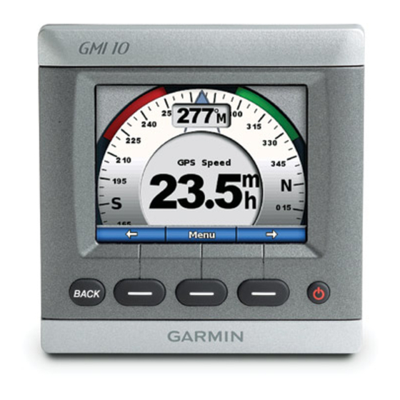
Introduction Manual Conventions In this manual, when you are The GMI 10 allows you to quickly instructed to select an item, use the view important information about soft keys ( ) along the bottom your boat provided by connected of the screen to select each item. -
Page 3: Unit Overview
12). Soft Keys—used to navigate the menus and select items on the GMI 10. Typically, the left and right soft keys cycle data on the instrument screen and navigate menu screens, and the center soft key selects highlighted items and opens the Menu. -
Page 4: Viewing Information
Using the GMI 10 Viewing Information Instrument screens are organized by Use the GMI 10 to view numerical category. The categories available data provided by connected are: sensors. Many data types can also Surface—speed, heading, odometer be displayed as an analog gauge... - Page 5 Custom—create custom instrument Cycling Through screens. Choose the number Instrument Screens in a and type of data fields on each Category custom screen. You can create and When viewing a category, use cycle through up to five custom the soft keys under the left and instrument screens.
- Page 6 Changing Instrument Some instrument screens have additional options available. Screen Options Data provided on an instrument To change additional options screen is represented either on an instrument screen: numerically or as an analog gauge. From the instrument screen, In many cases, a numerical value select Menu.
- Page 7 Creating a Custom Instrument Screen You can create and cycle through up to five custom instrument screens. To create the first custom instrument screen: 1. From the instrument screen, select Menu> Setup > Set Select the number of fields Instrument Type > Custom. 2. Select the number of fields you want to show on the custom instrument screen (1–4). 3. Select the data type you would like to show in each field. For a list of all data types, see...
- Page 8 To add additional custom To change an existing custom instrument screens: instrument screen: 1. From the custom instrument 1. From the custom instrument screen, select Menu > Add screen you want to change, Custom Page. (If you have select Menu > Change Appearance. more than one custom instrument screen, this option • Select Change Page Layout will appear as Add/Remove to change the number of Custom Page.) fields and data types in the 2. Select the number of fields you fields. want to show on the custom •...
- Page 9 Configuring the Customizing System Options GMI 10 To customize system options on You can configure various options the GMI 10, from the instrument on the GMI 10. Menu Setup screen, select > > System. From the instrument screen, select Menu >...
- Page 10 User Mag Var—allows you to coordinate system in which the set the magnetic variation value. map is structured. Beeper—set when the GMI 10 CAUTION: Do not change makes audible sounds. the position format or map datum unless you are using a Auto Power—select if the unit...
-
Page 11: Setting Alarms
Setting Alarms • DST (Daylight Saving Time)— indicate whether you want To set alarms on the GMI 10, from daylight saving time Off, On, Menu the instrument screen, select or Auto. The auto setting turns Setup > Alarms. > daylight saving time on or off, Shallow Water—set an alarm to... -
Page 12: Changing The Display
POWER reaches the specified level. button from the instrument screen. Changing the Display Options To change the display options on the GMI 10, from the instrument Menu Setup screen select > > Display. Color Mode—switch between Night color modes. - Page 13 Device Options While viewing the NMEA 2000 You can view information about device information, select Config. your NMEA 2000 devices and change available device-specific options on the GMI 10. From the instrument screen, select Menu > Setup NMEA 2000 Devices.
-
Page 14: Data Field Options
Appendix Data Field Options This table lists all available types of data you can show in a custom data field on a custom instrument screen (page When you create a custom page, data types supported by the sensors installed on your NMEA 2000 network appear in black. If you do not have the appropriate sensor for a data type, it appears in red. - Page 15 Sensor Needed Fuel Total Fuel Flow Rate Fuel Sensor Total Fuel Level Fuel Sensor Cruising Range Fuel Sensor Fuel Economy Fuel Sensor Fuel Level Fuel Sensor Tank 1 Fuel Sensor Tank 2 Fuel Sensor Navigation Course Made Good GPS Antenna Distance Made Good GPS Antenna Waypoint Name Garmin Chartplotter Bearing to Waypoint Garmin Chartplotter Distance to Waypoint Garmin Chartplotter Off Course Garmin Chartplotter Desired COG Garmin Chartplotter Heading Heading Sensor Course Over Ground GPS Antenna GPS Speed GPS Antenna Position GPS Antenna GMI 10 Quick Start Manual...
- Page 16 Category Data Type Sensor Needed Turn Garmin Chartplotter Trip Odometer GPS Antenna Trip Odometer GPS Antenna Average GPS Speed GPS Antenna Maximum GPS Speed GPS Antenna Weather Barometer Atmospheric sensor Air Temperature Atmospheric sensor Humidity Atmospheric sensor Wind Speed Wind Sensor Wind Direction Wind Sensor Sailing Apparent Wind Speed Wind Sensor Apparent Wind Angle Wind Sensor True Wind Speed Wind Sensor True Wind Angle Wind Sensor Wind VMG (Velocity Made Wind Sensor Good) Waypoint VMG...
- Page 17 Category Data Type Sensor Needed Temperature Temperature Sensor Speed Water Speed Sensor System Time GPS Antenna Date GPS Antenna Unit Voltage None GMI 10 Quick Start Manual...
-
Page 18: Alarms And Messages
Boat is not Moving Fast Enough to Calibrate—water speed calibration – the boat is moving too slow to calibrate. Connection with NMEA 2000 device lost—the GMI 10 has lost connection with a NMEA 2000 device. Deep Water—alarm – the boat has entered water deeper than the specified depth. - Page 19 NMEA 2000 Device Requires Calibration—a NMEA 2000 device requiring calibration has been detected. Shallow Water—alarm – the boat has entered water shallower than the specified depth. Simulating Operation—the unit is in demo mode. Surface Temperature—alarm – the water is approaching the specified temperature.
- Page 20 © 2007 Garmin Ltd. or its subsidiaries Garmin International, Inc. 1200 East 151 Street, Olathe, Kansas 66062, USA Garmin (Europe) Ltd. Liberty House, Hounsdown Business Park, Southampton, Hampshire, SO40 9RB UK Garmin Corporation No. 68, Jangshu 2 Road, Shijr, Taipei County, Taiwan www.garmin.com Part Number 190-00892-01 Rev. A...