
Related Manuals for Mio DigiWalker C310


Summary of Contents for Mio DigiWalker C310
-
Page 1: User Manual
User Manual MioMap™ v3.2 Navigation software for Mio DigiWalker C310 US English August, 2006 (v1.00) -
Page 2: Copyright Note
This manual nor any parts thereof may not be reproduced or transmitted in any form either electronically or mechanically, including photocopying and recording, without the express written consent of Mio Technology Limited. © 2006 Mio Technology Limited Whereis® map data is © 2006 Telstra Corporation Limited and its licensors Data Source ©... - Page 3 Thank you for choosing MioMap as your door-to-door in-car navigator. Read the Quick Start Guide first and start using MioMap right away. This document is the detailed description of the software. Although MioMap can easily be discovered by experience, it is still recommended that you read through this manual to clearly understand the exact function of each button and icon.
-
Page 4: Table Of Contents
Screens with map ... 24 4.3.1 Turn preview (No. 1) ... 26 4.3.2 Zoom in and out (No. 2 & 3)... 26 4.3.3 Tilt up and down (No. 4 & 5) ... 27 4.3.4 Lock to GPS position and heading (No. 6)... 27... - Page 5 Map scale (No. 8) ... 28 4.3.7 Menu (No. 9)... 28 4.3.8 Map orientation and Overview (No. 10) ... 28 4.3.9 GPS position quality (No. 11)... 29 4.3.10 Battery status (No. 12) ... 30 4.3.11 Sound muting (No. 13)... 30 4.3.12 Track Log recording/playback indicator (No.
- Page 6 4.7.1.1 Fixed cameras... 52 4.7.1.2 Mobile cameras ... 53 4.7.1.3 Built-in cameras ... 53 4.7.1.4 Section control cameras... 53 4.7.2 Controlled traffic direction ... 54 4.7.3 Speed limit checked... 54 4.7.4 Add a new camera or edit an existing one ... 54 4.7.5 Change the settings of the camera warning...
- Page 7 6.3.1.3 Economical... 74 6.3.2 Vehicle ... 74 6.3.3 Road types to include/exclude ... 75 6.3.3.1 Unpaved Roads ... 75 6.3.3.2 Motorways... 75 6.3.3.3 Ferries ... 75 6.3.3.4 U-turns ... 75 6.3.3.5 Permit needed... 76 6.3.3.6 Toll Roads ... 76 6.3.3.7 Cross-border Planning ... 76 Language &...
-
Page 8: Warnings And Safety Information
MioMap is a navigation system that helps you find your way to your selected destination. It will determine your exact location with the help of an attached GPS device. The position information obtained from the GPS receiver will not be transmitted anywhere, so others will not be able to track you by the help of this program. -
Page 9: General Information
2 General information MioMap is a navigation system optimized for in-car use. It provides door-to-door navigation for both single and multi-point routes using adaptable route parameters. MioMap is capable of planning routes throughout the whole map region installed on the memory card. Unlike some other products, MioMap does not require that you change maps or switch to a poorly detailed general map to navigate between map segments or countries. -
Page 10: Operating Miomap (Controls)
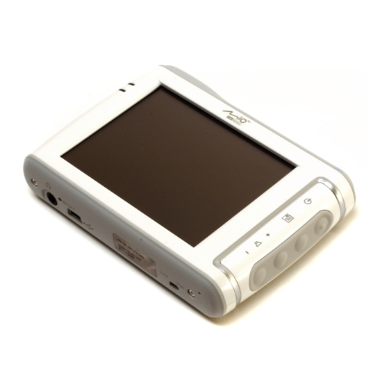
3.1.1 Power on/off Use this button to turn the power of the Mio DigiWalker C310 on or off any time. If the device power is turned off while MioMap is running, when you turn the device back on, MioMap will continue the navigation as soon as the built-in GPS determines the location again. -
Page 11: Main Menu
While the device is switched off, the GPS will not work, no position will be calculated, track log will not be saved, and navigation will stop. 3.1.2 Main menu If pressed while having the Cockpit, Map or Route Information screen (Page 36) displayed, this button will open the Main menu screen (Page 15). -
Page 12: List Selectors
3.2.2 List selectors When the values in the list need to be named, only the current value is shown (sometimes together with a short description) in a horizontal stripe with arrows at both ends. The arrows are buttons. Tap to move left in the list or tap to move right. -
Page 13: Switches In The Quick Menu
3.2.5 Switches in the Quick menu The switches of the Quick menu (Page 40) behave as normal switches but they look different in order to fit in with the other menu buttons. Tap the button to toggle between the two states. Remember that the sign on the button will not indicate the current state but the state you can switch it to. -
Page 14: Qwerty-Type Keyboards
Note: If you have chosen a program language that uses Latin letters, only the ABC keyboard appears. If you choose the Greek language, an additional keyboard appears with Greek letters. Similarly Hebraic and Cyrillic letters are available when Hebrew or Russian is chosen in Setup / Languages (Page 76). If you are used to computer keyboards, you may consider trying one of the QWERTY-type keypads. -
Page 15: Discovering The Program Through The Screens
4 Discovering the program through the screens The best way to discover MioMap is to explore each screen in detail, and to find out how to move from one to another. Read this chapter for a guided tour. 4.1 Main menu MioMap starts by displaying the Main menu. -
Page 16: The Map
4.2 The map The most important and most frequently used screens of MioMap are the two screens with the map (Map screen and Cockpit screen). They are similar in look and in possible controls but are optimized for different uses. The map they display is common. -
Page 17: Zoom Levels
Note: You may find that 2D mode is more useful in North-up Map mode when looking for a certain part of the map or an object to select as destination. On the other hand, 3D mode in Track-up Cockpit mode with Smart Zoom makes navigation very comfortable. -
Page 18: Streets And Roads
You can change between day and night views manually in the Quick Menu (Page 42) or let MioMap do it automatically (Page 68) for you. Note: The automatic day/night mode is based upon the current date and GPS position by which MioMap calculates the exact sunrise and sunset times on the particular day at the particular location. -
Page 19: Other Objects
Streets and roads have names or numbers for identification. Of course, this information can be displayed on the map. MioMap uses two different ways to show street labels. The conventional way is the same as a roadmap – it displays the name of the street aligned with the street. -
Page 20: Current Position And Lock-On-Road
(e.g. on the right in Germany and on the left in the U.K.) on two-way roads. You always see this corrected position on the map. The position given by the GPS is not displayed, but this is the information recorded in the track log. When recorded track logs are shown on the map, the line is not corrected. -
Page 21: Visible Pois (Points Of Interest)
Note: When your GPS position is available, and Lock-to-Position (Page 27) is active, the cursor is the current GPS position, the Green arrow. When you select another point by tapping the map, or using the Find menu (Page 57), the new Cursor is shown on the display with the red dot and the radiating red circles. -
Page 22: Speed Cameras
A different type of special POIs are Contacts. When MioMap is started, it will attempt to recognize the addresses in your Mio DigiWalker C310’s Contact database. All contacts with the address recognized will be shown as My POIs in a group named Contacts. -
Page 23: Animated Turn Guidance
4.2.11.2 Animated turn guidance Animated arrows represent all route events other than the above-mentioned special points. These arrows show the direction in which you need to continue your journey. 4.2.11.3 The route line The line representing the planned route is displayed in orange with both daylight and night colors. -
Page 24: Screens With Map
The way they show the map is the same but their look and controls are optimized for different purposes. The Map screen is to be used mainly without a GPS, to browse the map, create user POI items, or to plan your route based on map points. The Map screen is designed to give you the maximum map area. - Page 25 Display (Cockpit only) Turn preview* Indicates that Lock to GPS position and heading is inactive Selected map point (Cursor) (Map only) Map scale Map orientation and Overview GPS position quality Battery status Sound on or muted Track Log recording or playback...
-
Page 26: Turn Preview (No. 1)
turn**** Current speed limit***** * On Map screen only when a route is active ** Contents differ when a route is active *** Appears only when a route is active **** Appears only when a route is active and the next turn is near ***** Appears only if speed limit is known for the current road 4.3.1 Turn preview (No. -
Page 27: Tilt Up And Down (No. 4 & 5)
30 seconds. 4.3.4 Lock to GPS position and heading (No. 6) This semi-transparent icon is displayed if GPS position is available, and the map has been moved. It also appears when you scale or tilt the map while Smart Zoom is enabled. -
Page 28: Cursor (No. 7)
POI near it, mark it with a pin, or save it as a POI. Note: When GPS position is available, the Lock button will appear indicating that you have disabled Lock-to-Position. Tapping the Lock button will re-enable the position lock and move the cursor back to the current GPS position. -
Page 29: Gps Position Quality (No. 11)
Tap the icon again to return to Track-up (automatic rotation) mode. 4.3.9 GPS position quality (No. 11) Similarly to the icon found on the GPS Data screen (Page 35), the map screens also inform you about the GPS signal: •... -
Page 30: Battery Status (No. 12)
2D (no altitude available), and position error may be significant, yet MioMap is ready to navigate. • A black dish and two arcs represent a 3D GPS position. MioMap is ready to navigate. 4.3.10 Battery status (No. -
Page 31: Track Log Recording/Playback Indicator (No. 14)
• Start: use the Cursor as the departure point for your route. This menu point is available only in Map mode and when there is no active route. In Cockpit mode the departure point of the route is always the GPS position or if it is not available, the last known GPS position. - Page 32 • Route To: use the Cursor as the destination of your route. This button is to start a new route. The previous route (if it exists) will be deleted and replaced. If a multi- point route is active, MioMap will ask you whether you really want to delete it together with all its via points.
-
Page 33: Current Street (No. 16)
• POI: opens the list of POIs near the selected point. These are the POIs shown in the Popup Info window. If you want to add a new POI at the cursor, you can do so by tapping New in the bottom left corner. This menu point replaces Add POI and it is only available in the Map screen and if there is at least one POI item near the Cursor. -
Page 34: Distance To Next Turn (No. 18)
Tap the small satellite dish icon on the Map or Cockpit screen to open this window. The GPS Data screen is a collection of information received from the GPS device and it also serves as the entry point to the following screens:... -
Page 35: Gps Data Displayed
GPS. Should any of these appear, this means a faulty operation of your device. 4.4.3 GPS data quality indicator In the top left corner there is a satellite dish to show the quality of the GPS position. Different colors represent different signal quality:... -
Page 36: Time Synchronization
Below the PNA time you have hour and minute controls to manually correct the time with or without a valid GPS time. It also gives you the chance to correct the time after synchronization if your PNA does not support time zones or daylight saving time. -
Page 37: Route Data Displayed (For Destination And Via Points)
(Page 47). Without an active route one of the buttons is inactive and route data cannot be displayed. As a reminder, you can open this screen two ways: tapping the Info button in the Route menu (Page 52), or tapping one of the Route Data fields on the Cockpit screen. -
Page 38: Distance Left
that belongs to a via point, the route is colored only up to that via point. The rest of the line remains gray. 4.5.1.2 Distance Left This value can also be displayed in one of the Route data fields on the Cockpit screen as ‘Distance to destination’. -
Page 39: Warning Icons
4.5.2 Warning icons The following 5 squares are normally gray. Some of them turn red and show a graphical symbol in case warning(s) are attached to the planned route. These are warnings, so icons always show information for the whole route, even if the data fields display values from your current position to a via point only. -
Page 40: Fit To Screen
• Next page – displayed when more than 5 warnings apply for the recommended route. 4.5.3 Fit to screen Tap this button to display an overview of the whole recommended route. You will jump to the Map screen with a 2D North-up view so that you can check where the route takes you. -
Page 41: 3D Map (Switch)
4.6.2.1 2D / 3D Map (switch) This button switches between the top-down and the perspective views of the map screen. The states of this button are: In 3D mode the map shows a perspective view. You can use the tilt buttons (Page 27) to change the angle of the view if they are enabled with the switch right from this one (Page 41). -
Page 42: Daylight & Night Modes (Switch)
4.6.2.3 Daylight & Night Modes (switch) This button switches between the daylight and night color schemes of MioMap. The states of this button are: Turn on or off the night colors manually to override the automatic color scheme switching. Note: Using this option turns off the Automatic Night Colors feature. You need to re- enable it at the General settings screen (Page 67) to have the colors change automatically again. - Page 43 Note: If there are valid entries in the Contacts application of your Mio DigiWalker C310, the ones MioMap can recognize the address in will be imported as My POIs, added to a new group named Contacts. Each time MioMap starts, it reloads the points from the Contacts application database.
- Page 44 When the My POI Groups are displayed, you have the following options: • Show/Hide: similarly to built-in POIs, you have the possibility to show or hide all POIs of the selected category on the map. Groups with a blue icon are displayed; groups with a gray icon are hidden.
-
Page 45: Popup Information (Switch)
Here you have the following options: • OK: if you tap this button, the map screen returns with the selected POI in the middle. • Edit: you can edit the attributes (name, icon and group) of the selected POI. • Delete: you can delete any of your previously saved POIs. MioMap will ask you to confirm this action. -
Page 46: Manage Track Logs
• Record: this will initiate track log recording. A new line appears in the list, and GPS position data will be saved until you stop the recording or exit MioMap. A red icon (Page 31) is shown on the map screens to let you know that a recording is in progress. -
Page 47: Route Tab
This menu contains options to manage different settings in the program. 4.6.3.1 Recalculate This menu point is only available if an active route exists and GPS position is present. It brings up a menu with four options. Using one of these functions you can modify the current route. -
Page 48: Delete
recalculation is disabled. However you may consider using it when you travel on a road parallel to that recommended by the route. In this case MioMap may not recalculate the route for some time, but you can force recalculation here. This is also the button you will most frequently use when the window appears automatically, provided that the manual route recalculation is set (Page 71). -
Page 49: Itinerary
This function has a special role if you have used the Avoid feature during your journey. When you arrive at your destination, the route line disappears on the map and navigation stops. The route is now practically deleted, but if you plan a new route, the roads, maneuvers and areas excluded from your route will also be avoided when planning the new route. -
Page 50: Fly Over
Tap this button to show a list of possibilities for modifying the route. They let you recalculate the route avoiding the highlighted event and sometimes also some of the subsequent ones. • Maneuver: this option avoids the highlighted action. For example if you find a turn too difficult during rush hour traffic, MioMap will recalculate the route excluding that turn. -
Page 51: Edit
Tap Edit to see the list of all points used in the route. The first item in the list is the departure point of the route without a valid GPS position, the last reached via point if you open the list during navigation, or the point where MioMap most recently recalculated the route. -
Page 52: Info
4.6.3.6 Info This button opens the Route Information screen described here: Page 36. This screen shows information about the current route and has a few additional options to check and modify your active route. 4.6.4 Main button The Main button at the bottom right corner leads to the Main menu screen described here: Page 15. -
Page 53: Mobile Cameras
These cameras are displayed with the following symbol: 4.7.1.2 Mobile cameras Some cameras are operated from vehicles. The database contains some typical places of these mobile cameras. They are not always operational at the given location, and the speed limit is not specified for them. The warning is similar to fixed cameras, but as there is no speed limit given, only the proximity is announced. -
Page 54: Controlled Traffic Direction
Note: In the rare case MioMap cannot register the moment you pass the second camera (e.g. it is placed at the exit of a tunnel where GPS position is not yet available) the warning will continue. Just tap the camera symbol displayed on the left to stop the warning. -
Page 55: Change The Settings Of The Camera Warning
4.7.5 Change the settings of the camera warning You can turn on and off the camera warning, and fine-tune its settings in General settings (Page 69 and Page 69). -
Page 56: Find
5 Find One of the most frequently used functions of MioMap is selecting the destination. Once you have the destination, you can start navigating. Getting to this point should be as fast as possible. MioMap provides you with a versatile search engine designed to find your chosen destination after only a few taps on the screen. -
Page 57: Using The Find Menu
automatically. When you open it manually, it will remain until you close it or switch to another screen. Tip: If you want the selected point shown in the center of the map, close and reopen the menu or wait until it closes and open it again. By opening the Cursor menu manually, the map will be moved to have the selected location in the center. -
Page 58: Selecting The City, State And Country To Search In
Tip: If during navigation you need to know the name of the city or the country you are currently in, just start Find/Address and read the first line of the list. This function leads to a reliable result only if GPS position is available, and you have not disabled Lock-to-Position by moving the map. - Page 59 You can accomplish this by using an alphabetic input screen (either an ABC- or a QWERTY-type). You only need to enter the first few letters, as the program only searches among the settlements that exist in the given state or country. If the name of the settlement is of more than one word, the searched pattern can be any or the combination of those.
- Page 60 Once you have selected the city, you can continue by entering the street name as described here: Page 61. Changing the state (Australia, USA, etc.) Some of the maps contain state information. If the settlement you are looking for is in a different state, tap Other City then Change State from the list of recently used cities, then select the appropriate state.
-
Page 61: Selecting A Street Or The Center Of The Settlement
5.3.1.2 Selecting a street or the center of the settlement Once the settlement (or state in Australia) is selected, you can continue by specifying the street you are looking for. Selecting the center of the settlement If you wish to navigate to the settlement displayed in the top center of the screen, just tap Done before entering any letters. -
Page 62: How To Select An Intersection Instead Of A House Number
Enter the number, tap Done, and MioMap will show you the selected location on the map (or will start navigating immediately if you have selected Find Address at the Main menu screen). Note: House numbers may not be available on the map of your region. Ask your local dealer for details. -
Page 63: Find In History
5.3.3 Find Coordinates MioMap also lets you enter your destination by map coordinates. The coordinates need to be in latitude/longitude format and, based on the WGS84 earth model (the one used by most GPS devices). -
Page 64: Find A Poi
When you enter this page, the coordinates of the current GPS position (or the selected map point, the Cursor, if Lock-to-Position is inactive) are shown at the top of the display. The coordinates are always shown in ‘decimal degrees’ format, but you can enter the coordinates in any of the three latitude/longitude formats (decimal degrees;... - Page 65 • GPS Position: the search will be carried out around the current location given by the GPS if it is available. If no GPS position is available, the last known GPS position (gray arrow on the map) will be used.
-
Page 66: Find One Of The Favorites (Home/Work)
Search results are ordered by their distance from the given reference point (nearest first). Note: In the case of POI items that you have created, you can also see the results in alphabetical order. Push the button with the label ABC that appears between Search and the page number. -
Page 67: Settings
6 Settings MioMap provides several settings in order to let you customize the functions of the program. The Settings screen can be accessed directly from the Main menu screen (Page 15) and from the map screens by using the battery icon (Page 30), while some of its sub-screens are accessible from other parts of the program. -
Page 68: Automatic Night Colors
GPS. Once you set a permanent color scheme in the Quick menu (Page 42), this automatic mode turns off. -
Page 69: Alternative Speeding Tolerance
6.1.4.3 Alternative speeding tolerance If the speed limit of the current road reaches the value set at Alternative speed limit, this setting will replace the basic one set at the top of this screen. The slider and the selector work exactly as the basic ones described here: Page 68. Example: to let you better understand how this feature works, here is an example. -
Page 70: Audible Warning
6.1.6.1 Audible Warning You can disable the audible warning; have a simple warning (when you are warned only if you exceed the speed limit when approaching a camera); or a complex sound with repeated beeps as you approach the camera. In case of section control cameras, you will also hear these beeps while you are between the two cameras (these cameras work in pairs). -
Page 71: Set Favorite Destinations
6.1.7 Set Favorite Destinations You can select two of your most frequent destinations to be your favorites (Page 66). You can start navigating to either of them by only two taps on the screen. The original names of these points are Home and Work. You can rename them and specify their locations. -
Page 72: Disabled
Your options are: • Recalculate:MioMap will recalculate the route with the previous settings. The result is the same as if Automatic recalculation was selected. • Drop Next Via Point / Delete Route: MioMap will remove the next via point from the list and recalculate the route without it. -
Page 73: Voice Guidance Volume/Switch
This works in tandem with the Mute button (Page 30) on the map screens. Switching one of them will change the status of the other. 6.2.2 Voice guidance volume/switch The switch on the left can turn on or mute MioMap's audible guidance (voice instructions and speed camera warning). -
Page 74: Route Parameter Settings
Note: The Mute function (Page 30) accessible from the map screens overrides the settings on this screen. When MioMap is muted, all sounds disappear. These settings will not be changed; only the output will be muted temporarily. 6.3 Route parameter settings This is a very important page. -
Page 75: Road Types To Include/Exclude
Furthermore, when Bus or Truck is chosen, the program assumes that high speeds cannot be achieved, and this information is taken into account when calculating the route, the estimated time enroute (ETE), and the estimated time of arrival (ETA). Available values: •... -
Page 76: Permit Needed
Turning back on dual carriageways is not considered as a u-turn. Note: Via points are handled as stopovers with regards to u-turns. It means disabling u-turns on this page will avoid u-turns during the entire route if possible, but when reaching a via point, the following part of the route may be planned starting in the opposite direction. -
Page 77: Voice Language
6.4.2 Voice language This button shows the current language of the voice guidance. By tapping the button you can select from a list of available languages and speakers. Tap any of these to hear a sample voice prompt. Just tap OK when you have selected the new spoken language. -
Page 78: In Cockpit Mode (And Track-Up Orientation)
Page 33. 6.5.2 Backlight settings Here you can set how the display backlight behaves when using MioMap. These settings are independent of the settings of the other applications of Mio DigiWalker C310. 6.5.2.1 Power management At the top of the screen you can set how the backlight will behave when the screen has not been touched for a while. -
Page 79: Brightness
Everything that was saved (pins, My POIs, Favorites, track logs etc.) or modified (Settings, History lists) since MioMap was installed is stored in a user database located in the internal memory of the Mio DigiWalker C310. Here you have options to save, restore or reset the database or parts of it. -
Page 80: Restore Data
6.5.3.2 Restore Data If you have accidentally deleted things, or you have created a number of temporary items and you do not wish to delete them one by one, you can tap this button to restore the state of MioMap to the latest backup. By tapping this button you will lose all of the changes made since the time of the latest backup. -
Page 81: Textured Polygons
Note: You can only disable street names and POI icons if MioMap follows your position. As soon as you move the map and Lock-to-Position (Page 27) is disabled, street names and icons become visible again. Tap Lock to re-enable Lock-to- Position and have the labels and icons disappear again. -
Page 82: Keep Position On Road (Lock-On-Road)
Lock-on-Road to make MioMap always show your exact position. Note: By turning off Lock-on-Road you also turn off the GPS position error filtering. The position shown on the map will be subject to all position errors and position fluctuations. -
Page 83: Troubleshooting Guide
I cannot find the Green arrow that would show my location. Navigation does not start. Check the GPS status icon on any of the map screens (Page 29) or the GPS Data screen (Page 34). It is likely that the GPS cannot determine your position. Move the GPS out of cover to get a position fix. - Page 84 The ‘Route To’ button is for starting a new route only. For a single route you tap this when the destination is selected. Multi-point routes can be created after you have established a single route. Add points to the single route by using the ‘Add Via’ and ‘Continue’...
-
Page 85: Glossary
GPS Data screen (Page 35) and both map screens (Page 29). Note that 2D and 3D GPS receptions have nothing to do with the 2D and 3D display modes of the map. That is a way of representing the map on the screen independently from the GPS reception. - Page 86 3D mode with a low viewing angle, and the sun is near the horizon. Elevation: When the GPS receiver can see at least four GPS satellites, it can determine its current position in three dimensions. In this case the elevation is calculated together with the latitude/longitude position.
- Page 87 GPS provides in every second or every few seconds (depending on your GPS settings). When you start the recording, position data are saved in the database until you stop recording it. This set of sequential GPS positions is called track log.
-
Page 88: End User License Agreement
You use this product at your own responsibility and risk. Mio Technology Limited shall not assume any responsibility for damages arising from this product during driving or transportation or any violation of traffic regulations...