Furuno DUAL GPS GP-150-DUAL Operator's Manual
Dual differential gps navigation system
Hide thumbs
Also See for DUAL GPS GP-150-DUAL:
- Operator's manual (2 pages) ,
- Operator's manual (127 pages)
Table of Contents
Advertisement
Advertisement
Table of Contents
Troubleshooting

Related Manuals for Furuno DUAL GPS GP-150-DUAL


Summary of Contents for Furuno DUAL GPS GP-150-DUAL
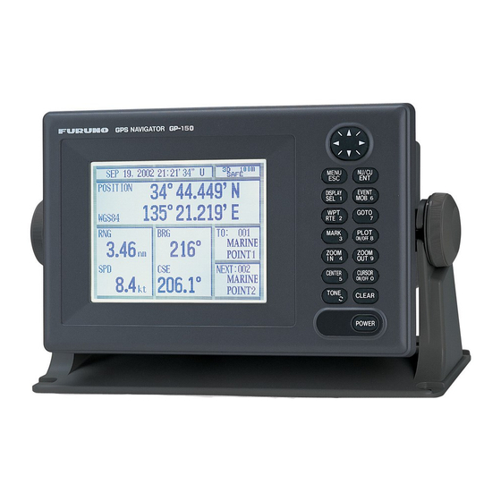
- Page 1 OPERATOR'S MANUAL Dual GPS GP-150-DUAL MODEL www.furuno.co.jp...
- Page 2 : +81-(0)798-65-4200 All rights reserved. Printed in China Pub. No. OME-44410-E (HIMA ) GP-150-DUAL The paper used in this manual is elemental chlorine free. ・FURUNO Authorized Distributor/Dealer A : FEB E : FEB . 26, 2010 *00016042712* *00016042712* *00016042712* *00016042712*...
-
Page 3: Important Notices
(http://www.eiae.org/) for the correct method of disposal. How to discard a used battery Some FURUNO products have a battery(ies). To see if your product has a battery(ies), see the chapter on Maintenance. Follow the instructions below if a battery(ies) is used. -
Page 4: Safety Instructions
SAFETY INSTRUCTIONS WARNING Do not open the cover of the equipment. This equipment uses high voltage electricity which can shock, burn or cause death. Only qualified person- nel should work inside the equipment. Do not dissasemble or modify the equipment. Fire, electrical shock or serious injury can result. -
Page 5: Table Of Contents
TABLE OF CONTENTS FOREWORD... v SYSTEM CONFIGURATION... vi EQUIPMENT LISTS... vii 1. OPERATIONAL OVERVIEW 1.1 Control Description...1-1 1.2 Turning On and Off the Power ...1-2 1.3 Adjusting Display Contrast and Brilliance...1-3 1.4 Display Mode...1-3 1.5 Transmitting Data ...1-6 1.6 The Interface Unit ...1-8 2. - Page 6 TABLE OF CONTENTS What is WAAS?... AP-12 List of Terms/Symbols ... AP-13 SPECIFICATIONS OF GP-150-DUAL . SP-1 PACKING LISTS... A-1 OUTLINE DRAWINGS... D-1 INTERCONNECTION DIAGRAM ... S-1 INDEX ... IN-1...
-
Page 7: Foreword
Owners Congratulations on your choice of the FURUNO GP-150-DUAL dual differential GPS navigation system. We are confident you will see why the FURUNO name has become synonymous with quality and reliability. For 60 years FURUNO Electric Company has enjoyed an enviable reputation for innovative and dependable marine electronics equipment. -
Page 8: System Configuration
SYSTEM CONFIGURATION ANTENNA GPA-017S/018S/019S DISPLAY UNIT GP-150-DUAL Position, waypoint, etc. (RS-422/Current loop) CATEGORY OF UNITS Unit ANTENNA UNIT Exposed to weather DISPLAY UNIT Protected from weather * When an antenna unit is commonly used, GPS/BEACON Antenna Distributor MD-GB2 is required. ANTENNA GPA-017S/018S/019S GPS/BEACON... -
Page 9: Equipment Lists
EQUIPMENT LISTS Standards Name Type GPA-017S Antenna Unit GPA-018S GPA-019S GP-150-E-N Display Unit GP-150-E-A Installation CP20-01900 Materials CP20-01950 Accessories FP20-01100 Spare Parts SP20-00500 Options Name Flush Mount Kit S OP20-24 Flush Mount Kit F OP20-25 CP20-01700 CP20-02700 Antenna Cable Set CP20-01710 CP20-02710 Antenna Cable Assy. - Page 10 (Continued from the previous page) OP20-32-1 OP20-32 Beacon Receiver Set OP20-33 OP20-34 Rectifier PR-62 DGPS Beacon Receiver GR-80 Whip Antenna FAW-1.2 IF-2500 Interface Unit IF-2503 Printer PP-505-FP Data Switch Box MD-200 viii 000-041-018 With GPA-018S 000-041-019 With whip antenna and OP20-32-1 000-041-596 With GPS-019S 000-041-598...
-
Page 11: Operational Overview
1. OPERATIONAL OVERVIEW 1.1 Control Description Opens/closes menu; quits current operation. Selects display mode. Registers waypoints and routes. Inscribes mark on the display. Enlarges display. Centers ship’s position/cursor position. Adjusts display contrast and brilliance; changes latitude/longitude coordinate. MENU NU/CU DISPLAY EVENT GOTO PLOT... -
Page 12: Turning On And Off The Power
When the satellite signal is being received normally, one of the indications shown in Table 1-1 appears depending on equipment setting and GPS receiver state. Table 1-1 GPS receiver indication Indication = OK Note 1: When PDOP value exceeds 6 in the 3D mode, the position fixing method is automatically changed to 2D. -
Page 13: Adjusting Display Contrast And Brilliance
Adjusting Display Contrast and Brilliance 1) Press the TONE key. The display shown in Figure 1-3 appears. Tone: 17 (0~31) Brilliance: 7 (0~7) MENU Escape Figure 1-3 Screen for adjustment of display tone and brilliance 2) To adjust tone, press setting and setting range (0-31) are shown to the right of "... -
Page 14: Highway Display
1. OPERATIONAL OVERVIEW Plotter 1 display Cursor position data, when cursor is on Blinking asterisk (*) indicates data is Course Own ship's being refreshed. track Alarm Own ship range mark 34˚ 23.456´ N 135˚ 45.678´ E [01] Waypoint TM W84 2.00 NM Course Grid... -
Page 15: Navigation Display
Navigation display 1) No autopilot Cross track Bearing from own error meter ship to destination waypoint Bearing Destination scale Velocity To waypoint no. Destination 63˚ 123˚ 0.1NM 23:45' 17H 45M distance Estimated Time of Time To Go Arrival (15th23:45) (3days17hrs45min) Cross track error indication Cross track... -
Page 16: Transmitting Data
1. OPERATIONAL OVERVIEW Data display Refer to Chapter 6 for user-defined window setting. The ZOOM icon can be displayed by pressing the CURSOR ON/OFF key. Position in latitude and longitude or LOPs Fixing date and time* Zoom icon SEP 12, 2009 23:59'59" U 12˚... - Page 17 4) Press to select All and press the NU/CU ENT key. The following message appears. Press the NU/CU ENT key to transmit, or MENU ESC to escape. Are you sure to transmit ? ENT: Yes MENU: No Figure 1-15 The following message appears while data is being transmitted.
-
Page 18: The Interface Unit
1. OPERATIONAL OVERVIEW The Interface Unit The Interface Unit IF-2500 outputs data received from the navigators to external equipment. Operational status is shown by the LEDs on the unit. For further details, see the chapter on installation. For how to select data to output, see paragraph 8.4 Outputting Data. -
Page 19: Display And Track
2. DISPLAY AND TRACK Enlarging/Shrinking the Display You may enlarge/shrink the display on the Plotter 1, Plotter 2 and Highway displays, with the ZOOM IN and ZOOM OUT keys. The horizontal range is available among 0.25, 0.5, 1, 2, 4, 8, 16, 32, 64, 128 and 192 nautical miles (Plotter 2 and Highway displays). -
Page 20: Shifting The Display
2. DISPLAY AND TRACK Cursor turned off Ship's position (in latitude and longitude or LOPs), speed and course appear on the display. Own ship Own ship position mark in latitude and longitude 34˚ 23.456´ N 135˚ 45.678´ E TM W84 2.00NM Speed Figure 2-2 Data displayed... -
Page 21: Erasing Track
When plotting is stopped "Stopping track plot" appears at the center of the display for about three seconds and " appears at the left side of the display. (" does not appear on the Navigation and Data displays.) Hold icon (appears while recording of track is stopped) 34˚... -
Page 22: Track Plotting Interval
2. DISPLAY AND TRACK Are you sure to erase ? ENT: Yes MENU: No Figure 2-6 Prompt for erasure of track 5) Press the NU/CU ENT key. Track Plotting Interval The plotting interval determines both how the track will be reconstructed on the display and track storage time. -
Page 23: Apportioning The Memory
Apportioning the Memory The memory holds 2,000 points of track and marks and may be apportioned as you like. The default memory setting stores 1,000 points each of track and marks. Note: All data are erased when the memory apportion setting is changed, even when the previous value is reentered. - Page 24 2. DISPLAY AND TRACK Magnetic variation The location of the magnetic north pole is different from the geographical north pole. This causes a difference between the true and magnetic north direction. This difference is called magnetic variation, and varies with respect to the observation point on the earth.
-
Page 25: Marks
3. MARKS Entering Marks Marks can be inscribed on the Plotter 1 and Plotter 2 displays, in one of 12 mark shapes. Further, marks can be connected with lines. Note: When the mark memory becomes full no marks can be entered. When this occurs, the buzzer sounds and the message shown below appears on the display for three seconds. -
Page 26: Mark Shape
3. MARKS Mark Shape 13 mark shapes are available. Select mark shape as follows: 1) Press MENU ESC and 2 to display the TRACK/MARK SETUP menu. TRACK/MARK SETUP Track REC Time (01’00") Mark Shape Mark Line Event Mark : Select ENT: Enter MENU: Escape Figure 3-4 TRACK/MARK SETUP menu... -
Page 27: Event Mark Shape
Saved event position 34° 40.123’ N 135° 21.123’ E Figure 3-7 To erase event marks, see "3.2 Erasing Marks". Event Mark Shape Event marks are available in 10 shapes. Event mark shape is mutually changed when the navigators are sharing data. Select event mark shape as follows. - Page 28 3. MARKS This page is intentionally left blank.
-
Page 29: Navigation Planning
4. NAVIGATION PLANNING Entering Waypoints In navigation terminology a waypoint is a particular location on a voyage whether it be a starting, intermediate or destination waypoint. The GP-150-DUAL can store 999 waypoints, numbered from 001-999. Waypoints can be registered four ways: •... - Page 30 4. NAVIGATION PLANNING 6) Press to select waypoint mark shape. The following display appears. : Cursor ENT: Enter MENU: Escape Figure 4-4 Screen for selecting waypoint mark shape 7) Press to select mark shape. 8) Press the NU/CU ENT key. The display shown in Figure 4-5 appears.
-
Page 31: Waypoint List
Entering waypoints by MOB position/event position The MOB position or an event position can be registered as a waypoint. Event marks are numbered from 01 to 99; 01 is the latest event mark. Note: You cannot register a MOB position or event position when there are no MOB positions or event positions saved. -
Page 32: Editing Waypoints
4. NAVIGATION PLANNING Edit = Waypoint : 001 _ _° _ _._ _ _’ N _ _ _°_ _._ _ _’ W Mark : CMNT: : Cursor : Column ENT: Enter MENU: Escape Figure 4-11 6) Enter latitude and longitude. To enter 34°12.345' N 135°23.456' E, for example, press;... -
Page 33: Entering Routes
Erasing waypoints through the waypoint list 1) Press WPT RTE and 4. 2) Press to select waypoint to erase. 3) Press the CLEAR key. The message shown in Figure 4-13 appears if the waypoint is currently selected as destination, is part of a route, or is in the route currently selected as destination. -
Page 34: Erasing Route Waypoints
4. NAVIGATION PLANNING ROUTE : 01 (In Use , REVERSE) Skip Distance Trial Speed : AUTO MAN (012.0kn) 34° 12.345’ N 130° 23.456’ E MARINE POINT AUG 12’ 95 12 : 35U 36° 12.345’ N 135° 23.456’ E A POINT AUG 13’... -
Page 35: Replacing Route Waypoints
Replacing Route Waypoints Route waypoints are mutually replaced when the navigators are sharing data. 1) Press WPT RTE and 5 to display the route list. 2) Press to select route. 3) Press to display route editing screen. 4) On the route editing screen, place the cursor on waypoint number to replace. - Page 36 4. NAVIGATION PLANNING This page is intentionally left blank.
-
Page 37: Setting Destination
5. SETTING DESTINATION Setting Destination There are four ways by which you can set destination: • By cursor • By MOB position or event position • By waypoint, and • By route. The same destination is set on both navigators when they are sharing data. Note: Previous destination is cancelled whenever a destination is set. - Page 38 5. SETTING DESTINATION Figure 5-4 Single destination set by cursor Setting multiple destinations 1) Press GOTO and 1. 2) Place the cursor on the location desired for a waypoint. 3) Press the NU/CU ENT key. 4) Repeat steps 2 and 3 to enter other points. Waypoints are connected with a line.
- Page 39 Setting destination by MOB position or event position Note: This operation cannot be performed when there is no MOB position or event position. The buzzer sounds and the message shown in Figure 5-8 appears to alert you when there is no MOB position or event position.
-
Page 40: Setting Route As Destination
5. SETTING DESTINATION Setting destination by selecting wpt. 3) Press . Each press of the key alternately enables manual entry of waypoint number and selection of waypoint number by cursor (through the waypoint window). 4) Press to select waypoint. 5) Press the NU/CU ENT key. Own ship position becomes starting point and a dashed line runs between it and the waypoint selected. -
Page 41: Cancelling Destination
Skipping route waypoints You may skip route waypoints by displaying "DI" (DIsable) next to the route waypoint in the route list. Using Figure 5-14 as an example, your ship is currently heading toward waypoint 04 but is to switch course and head to waypoint 03. -
Page 42: Erasing Route Waypoints (Flags)
5. SETTING DESTINATION Erasing Route Waypoints (flags) Flags are erased at both GPS navigators when they are sharing data. 1) Place the cursor on the flag to erase. 2) Press the CLEAR key. The message shown in Figure 5-17 appears if the waypoint is currently selected as destination, is part of a registered route, or is part of the route currently being... -
Page 43: Finding Range And Bearing Between Two Points
Finding Range and Bearing Between Two Points Selecting course sailing method The range and bearing to a destination can be calculated two ways: Great Circle or Rhumb Line. However, cross track error is calculated in rhumb line only. Great Circle: The great circle courseline is the shortest course between two points on the surface of the earth. - Page 44 5. SETTING DESTINATION AUTO uses ship's average speed to calculate time-to-go. 6) If you selected MAN, enter speed. 7) Press the NU/CU ENT key. The range, bearing and time-to-go between two points appear on the display. If data entered is wrong or insufficient the buzzer sounds and the message "Incomplete Data"...
-
Page 45: Setting Up Various Displays
6. SETTING UP VARIOUS DISPLAYS The Data Display The user may select what data to display in four locations on the data display. JAN 12, 2009 23:59'59" U Position 12 23.456' N 123 23.456' E 223.4 31.23 12.3 123.4 User-defined User-defined display data #1 display data #4... -
Page 46: Position Format
6. SETTING UP VARIOUS DISPLAYS Position Format Position can be displayed in latitude and longitude, Loran C LOPs, or Decca LOPs, and the default format is latitude and longitude. Displaying position in latitude and longitude 1) Press MENU ESC, 9 and 8 to display the LOP SETUP menu. - Page 47 Entering waypoints using LOPs 1) Press WPT RTE and 4. 2) Press to display LOPs. Waypoint List (LOP, LC) 001 36365.2 59102.3 MARINE POINT AUG12’ 95 12 : 35U 002 36512.3 59134.5 ___ A POINT AUG13’ 003 _ _ _ _ _ , _ _ _ _ _ _ , _ ___ _ _ _ _ _ _ _ _ _ _ _ _ 004 _ _ _ _ _ , _...
-
Page 48: Demo Display
6. SETTING UP VARIOUS DISPLAYS Demo Display The demo display provides simulated operation of this unit. Own ship tracks, at the speed selected, a figure eight course, starting from position entered. All controls are operative; you may change course, enter marks, etc. -
Page 49: Alarms
7. ALARMS Overview There are seven alarm conditions which generate both aural and visual alarms. When an alarm setting is violated, the buzzer sounds and the name of the alarm being violated appears on the display. The alarm icon also appears on the Plotter 1, Plotter 2 and Highway displays. -
Page 50: Cross Track Error (Xte) Alarm
7. ALARMS Anchor watch alarm The anchor watch alarm sounds to warn you that own ship is moving when it should be at rest. Alarm Own ship’s setting position Destination waypoint Figure 7-4 How the anchor watch alarm works Before setting the anchor watch alarm, set present position as destination waypoint, referring to chapter 5. -
Page 51: Speed Alarm
Speed Alarm The speed alarm sounds when ship's speed is lower or higher (or within) the alarm range set. 1) Press MENU ESC and 4. 2) Press to select Ship Speed. 3) Press to select In or Over. In: Alarm sounds when speed is within range set. -
Page 52: Water Temperature Alarm
7. ALARMS Water Temperature Alarm The water temperature alarm sounds when the water temperature is higher or lower (or within) the preset temperature. This alarm requires a water temperature signal from external equipment. 1) Press MENU ESC and 4. 2) On page 2/2 of the ALARM SETTINGS menu, press to select Water TEMP. -
Page 53: Menu Settings
16 ft. Disable Satellite Every GPS satellite is broadcasting abnormal satellite number(s) in the Almanac. Using this information, the GPS receiver automatically eliminates any malfunctioning satellite from the GPS satellite schedule. However, the Almanac sometimes may not contain this information. - Page 54 ECDIS, turn on the power while holding down the 0 key. POSN Offset You may apply an offset to position generated by the internal GPS receiver, to compensate for difference between GPS position and chart position. Time DIFF The GPS system uses UTC time.
- Page 55 GPS position smoothing 1) Press MENU ESC, 9 and 6. 2) Press to select Posn. 3) Enter smoothing factor in three digits (0000-9999). 4) Press the NU/CU ENT key. 5) Press the MENU ESC key. GPS speed smoothing 1) Press MENU ESC, 9 and 6. 2) Press to select Spd.
-
Page 56: Units Of Measurement
8. MENU SETTINGS Time difference 1) Press MENU ESC, 9 and 6. 2) Press to select Time Diff on page 2/2. 3) Key in time difference (-14:00 to +14:00). 4) Press to change from plus to minus or vice versa. 5) Press the MENU ESC key. -
Page 57: Size And Brilliance Of Markers
Size and Brilliance of Markers The DISPLAY SETUP menu lets you select the size and brilliance of various markers. Grid tone The grid can be displayed in light or dark tone, or turned off. 1) Press MENU ESC and 1. The DISPLAY SETUP menu appears. -
Page 58: Outputting Data
8. MENU SETTINGS Enlarging characters The size of the indications of position or user-defined display areas can be enlarged on the Data display. 1) On the Data display, with no enlarged characters, press the CURSOR ON/OFF key to turn on the zoom icon. 2) Operate the cursor keys to select data to enlarge in the window. - Page 59 2) Press to select Data Fmt. 3) Press to select NMEA 0183 (V1.5 or V2.0) or IEC 61162-1. 4) Press the NU/CU ENT key. Talker ID appears in reverse video. 5) Press to select GP, LC or DE. 6) Press the NU/CU ENT key. 7) Enter Tx interval for each output data sentence in line 1.
-
Page 60: Receiving Data From Personal Computer
8. MENU SETTINGS DATA 4 I/O SETUP <Out> To Previous Page Data FMT V1.5 V2.0 Talker ID Output Data (00-90 sec) 1. AAM:00 APA:00 APB:04 2. BWR:00 BWW:00 GGA:00 GLL:01 3. RMB:01 RMC:00 VTG:01 4. WNR:00 WPL:00 XTE:00 5. GNS:00 GBS:01 Rnn:00 ENT : Enter MENU : Escape Figure 8-10 DATA 4 I/O SETUP menu (2/2) - Page 61 Stopping loading of data 1) Press the MENU ESC key. The message shown in Figure 8-16 appears. Are you sure to stop ? ENT: Yes MENU:No Figure 8-16 2) To quit loading, press the NU/CU ENT key. The cursor shifts to Stop. 3) To start loading, select Start.
-
Page 62: Waas/Dgps Setting
8. MENU SETTINGS 11) Press the NU/CU ENT key. The message shown in Figure 8-22 appears while data is being saved. Now saving Waypoint/Route data ! MENU:Stop Figure 8-22 12) Save data at the computer. 13) Press the MENU ESC key. When data is saved, the cursor shifts to Stop. - Page 63 List 1) Press to select List to show the STATION NEAREST list. Station Nearest User Setup FREQ 1 320.5kHz 0.6NM 202 * 2 320.5kHz 22.3NM 3 316.0kHz 70.3NM 4 320.0kHz 87.2NM 5 288.0kHz 93.7NM : Select ENT : Enter MENU : Escape *: User-programmed station Figure 8-25 2) Press...
-
Page 64: Gps Monitor Display
8. MENU SETTINGS Edit=DGPS station: 17 20. 5 kHz FREQ Rate 200 bps 34 44’N 135 21’W Position : Column : Cursor ENT : Enter MENU : Escape Figure 8-28 7) Edit data, and then press the NU/CU ENT key. 8) After displaying the message “Are you sure to change?”, press the NU/CU ENT key. - Page 65 Number, bearing and elevation angle of all satellites in view of the GPS receiver appear. Satellites being used in fixing position are circled with a solid line; satellites not being used in fixing position are circled with a dashed line.
- Page 66 8. MENU SETTINGS This page is intentionally left blank. 8-14...
-
Page 67: Maintenance & Troubleshooting
9. MAINTENANCE & TROUBLESHOOTING Clearing the Memory The GP-150-DUAL has two memories: GPS memory and plotter memory. Clearing the plotter memory The plotter memory holds plotted track and mark data. When you clear the plotter memory, all tracks and marks are cleared and all corresponding defaults settings are restored. -
Page 68: Preventive Maintenance
Figure 9-5 GPS error message This message may appear when there is an interfering object between the satellite and GPS receiver (for example, mast) or the antenna cable is disconnected. Press the CLEAR key to silence the buzzer. If the CLEAR key is not pressed, several beeps sound every three minutes. - Page 69 DOP error When PDOP value exceeds 6 in the 3D mode, or HDOP value exceeds 4 in the 2D mode, this error occurs and the following message appears. DOP Error Final GPS Time/Position Aug 25, 2006 02:09’43" U 34 45.459 ’N 134 45.459’E Press CLEAR to Close window.
-
Page 70: Troubleshooting
9. MAINTENANCE & TROUBLESHOOTING Troubleshooting The table which follows provides troubleshooting procedures which you can follow to restore normal operation. If normal operation cannot be restored, ask your dealer for advice. If… you cannot turn on the power position cannot be fixed position is wrong position sometimes cannot be fixed... -
Page 71: Diagnostic Tests
Diagnostic Tests Memory and I/O port test 1) Press MENU ESC and 8 to display the SELF TESTS menu. SELF TESTS 1. Memory, I/O Port Test 2. Keyboard Test 3. Test Pattern 4. Automatic Testing 08501820XX DGPS Program No. 48505640XX GPS Program No. -
Page 72: Interface Unit If-2500
9. MAINTENANCE & TROUBLESHOOTING Display test 1) Press MENU ESC, 8 and 3 to display the test pattern screens. 2) To change the test pattern, press the NU/CU ENT key. Each time the key is pressed one of the patterns shown in Figure 9-12 appears. -
Page 73: Installation
10. INSTALLATION 10.1 General The figure below shows the system configuration of the GP-150-DUAL. For MD-GB2 connection, see the interconnection diagram attached at back of this manual. GPS ANTENNA GPA-017S GPA-018S GPA-019S TNC-J-3 TNC-P-3 NJ-TP-3DXV-1 N-J-3 N-P-8DFB N-P-8DFB N-J-3 NJ-TP-3DXV-1 12-24 VDC 12-24 VDC 1) #: MJ-A2SPF004-030 *3m*... -
Page 74: Display Unit
10. INSTALLATION 10.2 Display Unit The display unit can be installed using either of four methods as shown below. Refer to the outline drawing page D-1, D-2, and D-3. • Locate the unit away from exhaust pipes and vents. • The mounting location should be well ventilated. •... - Page 75 Flush mounting type S An optional flush mount kit type S is required. (Name: Flush Mount Kit S, Type: OP20-24, Code No.: 004-393-000) Name Wing bolt M4X30 YBSC2 Hex. bolt M6X12 SUS304 Wing nut M4 YBCS2 Spring washer M6 SUS304 Flush mount metal 20-013-1111 1.
-
Page 76: Antenna Unit
10. INSTALLATION 10.3 Antenna Unit Mounting Install the antenna unit referring to the installation diagram on page D-4. When selecting a mounting location for the antenna unit, keep in mind the following points. • Select a location out of the radar beam. The radar beam will obstruct or prevent reception of the GPS satellite signal. -
Page 77: Index
Taping antenna unit GPA-018S After inserting the whip antenna to the antenna base of GPA-018S, tape the antenna base and whip antenna with self-vulcanizing tape and vinyl tape to reinforce the whip antenna. 1. Wrap the antenna junction point with butyl rubber tape No. 15 (NITTO SINKO COOP.) or the equivalent. - Page 78 10. INSTALLATION Extending antenna cable length The standard cable is 15m long. 30m and 50m long extension cable sets are optionally available. Extension cable line-up Fabricate the end of antenna cable and attach the coaxial connector. Details are shown on the next page. Antenna Unit GPA-019S GPA-018S GPA-017S...
- Page 79 How to attach the N-P-8DFB connector Outer Sheath Armor Inner Sheath Shield Cover with heat-shrink tubing and heat. Clamp Gasket (reddish brown) Trim shield here. Insulator Trim aluminum tape foil here. Clamp Nut Solder through the hole. Remove outer sheath and armor by the dimensions shown left.
-
Page 80: Wiring
10. INSTALLATION 10.4 Wiring The figure below shows the connection of cables on rear of display unit. Antenna Unit GPA-019S GPA-018S GPA-017S 20cm Grounding The display unit contains several CPUs. While they are operating, they radiate noise, which can interfere with other radio equipment. Ground the unit as follows to prevent it. -
Page 81: Initial Settings
10.5 Initial Settings The GP-150-DUAL can output navigation information to external equipment through the Interface Unit IF-2500. For example, it can output position data to a radar or echo sounder for display on their screen. Before selecting data to output, confirm what data the external equipment requires. - Page 82 10. INSTALLATION GNS: GNSS fix data GPS: GPS satellite fault detection RMB: Recommended minimum navigation information. Cross-track error, direction to steer, origin and destination waypoint latitude and longitude, range and bearing of destination waypoint, destination closing velocity, arrival alarm. RMC: Recommended minimum specific GPS/TRANSIT data.
- Page 83 … h: Target status not used … i: Reference target not used … j: Checksum FURUNO proprietary sentences AGFPA: Autopilot information from FURUNO autopilot Port Input DATA1 NMEA 0183 Ver. 1.5/2.0 AGFPA, DBT, DPT, MTW, TTL DATA3 External MOB...
- Page 84 10. INSTALLATION General data 1) Input of lighthouse/buoy information: Floppy disk stored lighthouse/buoy information is supplied from PC connected to DATA4 port. 2) Input of waypoint data: Connect YEOMAN to DATA4 port 3) Input and output of waypoint/route data TX Rate of operation The TX rate or operation is the percentage of data output in one second, and it appears on the screen.
- Page 85 DATA1 output setting 1) Press MENU ESC, 9 and 3 keys to show the DATA1, 3 OUTPUT SETUP menu. DATA 1, 3 OUTPUT SETUP Data FMT Talker ID Output Data 1. AAM:00 APA:00 2. BWC:00 BWW:00 GGA:01 GLL:01 3. RMB:01 RMC:00 VTG:01 WCV:00 4.
-
Page 86: Data 3 Output Setting
10. INSTALLATION DATA 3 output setting The DATA 3 can output NMEA 0183 (V1.5/V2.0) /IEC 61162-1 data or log pulse depending on jumper block setting on the NAV board. For NMEA 0183 (V1.5/V2.0) /IEC 61162-1, the same signal of DATA 1 is output from DATA 3. Selection of NMEA0183 or log pulse Output data NP board... - Page 87 Setting DATA 4 to Data Output 1) Press MENU ESC, 9 and 5 to show the DATA4 I/O SETUP menu. 2) Press to select DATA 4. Level. 3) Press 4) Press the CU/NU ENT key. 5) Press or to select Out. 6) Press to go to the next page to show the DATA I/O SETUP <Out>...
- Page 88 10. INSTALLATION Setting DATA 4 to "COM" (general data) Waypoint data can be received from a personal computer, through the DATA 4 port. Note that the data transmitting operation should be done after receiving data using DATA 4 port. For details, see page 1-6. 1) Press MENU ESC, 9 and 5.
- Page 89 Setting DATA 4 to DGPS An external DGPS receiver can be connected to the DATA 4 port. Follow the procedure below to setup the GP-150-DUAL according to the specifications of the DGPS receiver. 1) Press MENU ESC, 9 and 5. 2) Press to select Level.
-
Page 90: Interface Unit If-2500
10. INSTALLATION 10.6 Interface Unit IF-2500 Specifications Input port 2 ports for NMEA 0183 data Output port 6 ports for either of NMEA 0183 or RS-422 data 3 ports for alarm signal Power supply 10 to 35 VDC Power consumption Color 2.5G5/1.5 Newtone no. - Page 91 Solder a ground wire to the shield. Dress the shield and the outer sheath with heat shrink tube, leaving 30 mm of shield and outer sheath exposed. Heat the heat shrink tube. Remove the insulation of NH connector (supplied) 3 mm. Heat the heat shrink tube.
- Page 92 10. INSTALLATION Grounding To prevent electrical shock and mutual interference, run a ground wire between the earth terminal on the unit and ship’s superstructure. Cabling schedules The signal cable should be a twisted-pair, double-screened cable. Ground the signal cable at the cable clamp. Connections Power supply J1 (24 VDC)
- Page 93 Output signal (contact closure signal) J10 (Arrival alarm) Pin no. Designation Alarm out 1 (H) Alarm out 1 (C) Selection of output data format The output data format is selectable by changing a jumper block; A for RS-422 and B for NMEA. For example, to select NMEA for J4, change the jumper block from A to B on J401 and J402.
-
Page 94: Gps/Beacon Antenna Distributor Md-Gb2
Connector type Ambient temperature Humidity Waterproofing Note: Furuno GPS Receivers are designed, considering 10dB antenna cable loss. Because this distributor loses 4dB, shorten antenna cables so that loss is 6dB or less. Refer to the following formula for calculation of loss. -
Page 95: Appendix
APPENDIX Menu Tree Main menu MENU 1. DISPLAY SETUP Grid (Dark, Light, Off) Course Bar (Dark, Light, Off) Time Mark (Dark, Light, Off) Waypoint Size (Large, Small) Cursor Size (Large, Small) Set/Drift AVR (Off, 10min, 20min, 30min, 1hr, 2hrs, 3hrs, 5hrs, 6 hrs) 2. - Page 96 APPENDEX 9. SYSTEM SETTINGS 1. PLOTTER SETUP 2. UNIT SETUP 3. DATA1, 3 OUTPUT SETUP 4. DATA TRANSFER 5. DATA4 I/O SETUP AP-2 Memory Apportion (TRK: 1000/2000 Pt) Bearing REF (True, MAG) MAG Variation (AUTO, MAN) (07˚W) (00˚E) Calculation (RL, GC) SOG, COG, RNG, BRG, User defined WAT TEMP, WAT DEPTH, XTE,...
- Page 97 6. GPS SETUP Fix Mode (2D, 2/3D) ANT Height (000 - 999 ft) Disable Satellite (1 - 32) GPS Smoothing Speed Average (0000 - 9999 sec) RAIM Function (Off, On) RAIM Accuracy (1 - 999) Geodetic Datum (WGS84, NAD27, Other) POSN Offset (0.000'N, 0.000'W) Time DIFF (+00:00) POSN (38˚00.000'N, 123˚00.000'W)
-
Page 98: World Time Standards
APPENDEX World Time Standards AP-4... -
Page 99: Geodetic Chart List
Geodetic Chart List 001: WGS84 002: WGS72 003: TOKYO : Mean Value (Japan, Korea & Okinawa) 004: NORTH AMERICAN 1927 : Mean Value (CONUS) 005: EUROPEAN 1950 : Mean Value 006: AUSTRALIAN GEODETIC 1984 : Australia & Tasmania 007: ADINDAN : Mean Value (Ethiopia &... -
Page 100: Loran C Chains
APPENDEX Loran C Chains c i f c i f c i f c i f Ø t l y AP-6... -
Page 101: Decca Chains
Decca Chains Chain Chain Chain code South Baltic Vestlandet Southwest British Northumbrian Holland North British Lofoten North Baltic North West Trondelag English North Bothnian Southern Spanish North Scottish Gulf of Finland Danish Irish Finnmark French South Bothnian Hebridean Frisian Islands Helgeland Skagerrak North Persian Gulf... -
Page 102: Parts List
This equipment contains complex modules in which fault diagnosis and repair down to component level are not practical (IMO A.694(17)/8.3.1). Only some discrete components are used. FURUNO Electric Co., Ltd. believes identifying these components is of no value for shipboard maintenance; therefore, they are not listed in the manual. Major modules can be located on the parts location photos on the next page. -
Page 103: Parts Location
Parts Location Display unit PNL Board (20P8148) EW50379FDW APPENDEX GR-7000A (Option) (08S0334) GN-8096 (20S0395) NP Board (20P8192) AP-9... -
Page 104: Interface Documentation
APPENDEX Interface Documentation "DATA1" Port IEC 61162-1/NMEA 0183 Ver. 1.5 Output • Output Schematic Diagram (Talker) DATA 1 TD-A TD-B • Output Drive Capability Max. 10mA NMEA 0183 Input 20P8192 DATA 1 MJ-A6SRMD RD-H RD-C AP-10 20P8192 MJ-A6SRMD R123 R182 CR15 1SS272 SN75ALS172... - Page 105 • Load Requirements Isolation: opto coupler Ω Input Impedance: 470 ± Max. Voltage: Threshold: 3mA (In case of FURUNO device talker connection) "DATA3" Port 20P8192 DATA3 MJ-A6SRMD TD-A TD-B • Output Drive Capability Max. 10mA FL15 FL14 APPENDEX SN75ALS172 AP-11...
-
Page 106: What Is Waas?
APPENDEX What is WAAS? WAAS, available in North America is a provider in the worldwide SBAS (Satellite Based Augmentation System) navigation system. CBAS provides GPS signal corrections to SBAS users, for even better position accuracy, typically better than three meters. There are three more SBAS providers, MSAS (Multi-Functional Satellite Augmentation System) for Japan, EGNOS (Euro Geostationary Navigation Overlay Service) for Europe and GAGAN (GPS And GEO Augmented Navigation) for India. -
Page 107: List Of Terms/Symbols
List of Terms/Symbols The following table shows the terms used in the GP-150-DUAL. Term/Symbol ◎, - - - - - , MOB ┼ 2D, 3D ALARM ARRV AUTO ℃ CMNT CURS deg, ° DGPS DISP DIST DPTH DRIFT ℉ FREQ Meaning Own Ship Marks/Lines... - Page 108 APPENDEX Term/Symbol EVENT hr(s) LORAN MENU min, ' OFFSET PORT POSN RAIM RCVR ROUTE s, " AP-14 Meaning Forward Global Positioning System Great Circle Event Heading hours Input/output Identification January July January kilo Heltz kilo metre knot Latitude Loran-C Longitude Line Of Position Loran metre(s)
- Page 109 Term/Symbol STBD TEMP TEST TIME TRIAL Pt, Pts Meaning Speed Starboard/Starboard Side Station Steer Speed Through the Water True Temperature Test Time Trial Track Point(s) Time To Go Universal Time, Coordinated Variation Water Waypoint Cross Track Error APPENDEX AP-15...
- Page 110 SPECIFICATIONS OF GPS NAVIGATOR GPS RECEIVER Receiving frequency Tracking code Number of channel Position fixing method Accuracy GPS: DGPS: WAAS: Ship’s speed accuracy Course accuracy Position fixing time Tracking velocity 1.10 Position update interval 1 s 1.11 RAIM indicators 1.12 Beacon receiver (internal kit, option)
- Page 111 INTERFACE Number of ports 3.1.1 Data format 3.1.2 OUT: POWER SUPPLY Display unit Rectifier (PR-62, option) 100/110-115/220/230 VAC, 1 phase, 50/60Hz ENVIRONMENTAL CONDITION Ambient temperature Antenna unit Display unit Relative humidity Degree of protection Antenna unit Display unit Vibration COATING COLOR Antenna unit Display unit IEC61162-1 (JUL-2000), NMEA0183 Ver1.5/2.0...
- Page 120 Dー4...
- Page 121 Mar,27'07 R.Esumi...
- Page 122 Feb. 19, '03...
- Page 123 Feb. 19, '03...
- Page 125 Jan.13'04...
- Page 126 空中線部 ANTENNA UNIT GPA-017S GPA-018S GPA-019S IV-2sq. TNC-J-3 TNC-J-3 TNC-P-3 TNCP-NJ NJ-TP-3DXV または *2 *4 8D-FB-CV,MAX.10m,φ14.3 受信演算部 N-P-8DFB DISPLAY UNIT GP-150-DUAL MJ-A6SPF0003 GPS ANT DATA2 TNC-P-3 -050C,5m,φ6 MJ-A6SPF TD-A シロ TD-B クロ RD-H キ RD-C ミドリ GRN NJ-TP-3DXV MJ-A6SPF0003 DATA1 -050C,5m,φ6 MJ-A6SPF FUSE...
- Page 127 INDEX Alarms 7-1-7-4 anchor watch 7-2 arrival 7-1 clearing aural and visual alarms 7-1 cross track error (XTE) 7-2 depth 7-4 disabling 7-1 speed 7-3 trip 7-3 water temperature 7-4 Altitude unit 8-4 Anchor watch alarm 7-2 Apportioning the memory 2-5 Arrival alarm 7-1 Bearing reference 2-5 Brilliance adjustment 1-3...
- Page 128 INDEX Fix mode 8-2 Geodetic chart list AP-5 Geodetic datum 8-2 GPS memory clearing 9-1 GPS menu description 8-1 disabling satellites 8-2 fix mode 8-2 geodetic datum 8-2 GPS position smoothing 8-3 GPS speed smoothing 8-1 position offset 8-2 speed averaging 8-1 time difference 8-2 GPS monitor display 8-11 GPS position smoothing 8-3...
- Page 129 Time difference 8-4 Time mark tone 8-5 Track erasing 2-3 plotting interval 2-4 starting/stopping plotting 2-2 Transmitting data 1-6 Trip alarm 7-3 Troubleshooting 9-4-9-6 automatic testing (all tests) 9-6 display test 9-6 keyboard test 9-5 memory and I/O port test 9-5 True bearing 2-5 Water temperature alarm 7-4 Water temperature unit 8-4...
-
Page 130: Declaration Of Conformity
EN 61108-1: 2003 (IEC 61108-1 Ed. 2: 2003-07) EN 61162-1: 2000 (IEC 61162-1 Ed. 2: 2000-07) IEC 62288 Ed. 1: 2008-07 06212001 issued by Telefication b.v. (0560), The On behalf of Furuno Electric Co., Ltd. Hiroaki Komatsu Manager, International Rules and Regulations...